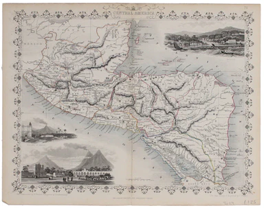
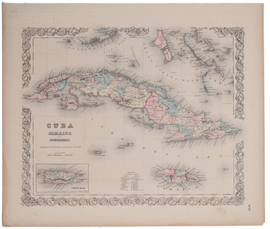
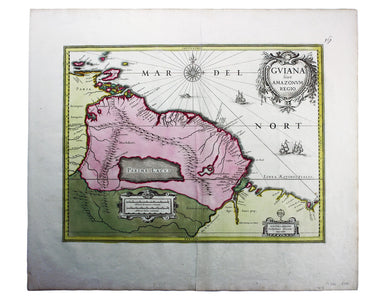
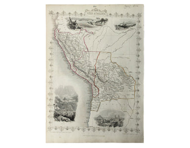
Tallis' Map of Central America
This map of Central America was engraved by John Rapkin for John Tallis' popular ‘Illustrated Atlas’. It includes black and white vignettes of Beli...
View full detailsThis map of Central America was engraved by John Rapkin for John Tallis' popular ‘Illustrated Atlas’. It includes black and white vignettes of Beli...
View full detailsThis is one of the most detailed mid-19th Century American atlas maps of Cuba and the region, set within Colton’s distinctive style of border, by o...
View full detailsThe 'Revoltas da Armada', the Brazilian naval mutinies of 1893-1894, were linked with the Federalist Rebellion against the recently-formed First Br...
View full detailsOur map of the Americas was prepared for the Homann firm by Johann Matthias Hase, professor of mathematics in Wittenberg, on his stereographic hori...
View full detailsTerra Firma et Novum Regnum Granatense et Popayan This regional map covers Colombia and neighbouring parts of present day Panama, Ecuador, Costa Ri...
View full detailsThis is a late issue of Blaeu’s map of Guiana, with full-body colour typical of the later seventeenth-century. Seventeenth and eighteenth century m...
View full detailsL’Amerique Meridionale qui fait l’autre partie des Indes Occidentales This map of South America features figures in indigenous costume and a vignet...
View full detailsThis map of Peru and Bolivia was engraved by John Rapkin for the ‘Illustrated Atlas’. It has vignettes including a view of Potosi engraved by James...
View full detailsThe Falkland Islands, surveyed by Captains Robert Fitz Roy R.N., William Robinson R.N. and Bartholomew James Sulivan R.N. This map of the Falkland...
View full detailsKarte von der Insel St Lucia This map of the Caribbean island of St Lucia was published in the Dutch edition of Prévost's Histoire Générale des Voy...
View full detailsThis pictorial map of Panama is US military mailer, designed to be folded and posted home. The verso has a detailed map of the canal zone, with sta...
View full details