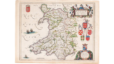
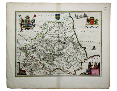
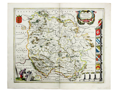
Blaeu's Map of Wales
Wallia Principatus vulgo Wales This beautiful map of Wales features coats of arms of the historic Kingdom of Gwynedd (used by the Princes of Wales)...
View full detailsWallia Principatus vulgo Wales This beautiful map of Wales features coats of arms of the historic Kingdom of Gwynedd (used by the Princes of Wales)...
View full detailsThis map of Liddesdale, in the Scottish borders, is from Golden Age Dutch cartographer Blaeu’s Scottish atlas. First published in 1654, the atlas w...
View full detailsBlaeu and the rival Golden Age Dutch cartographic publishing house of Janssonius raced to bring out atlases of the British Isles in the 1630s and e...
View full detailsThis map of Monmouthshire and the Severn Estuary is from ‘the rarest edition of Blaeu’s Large Atlases’: only ten of the proposed eleven volumes wer...
View full detailsBlaeu and the rival Golden Age Dutch cartographic publishing house of Janssonius raced to bring out atlases of the British Isles in the 1630s and e...
View full detailsBlaeu’s map of Herefordshire. Blaeu and the rival Golden Age Dutch cartographic publishing house of Janssonius raced to bring out atlases of the Br...
View full detailsCeretica sive Cardiganensis Comitatus; Anglis Cardigan Shire Blaeu and the rival Golden Age Dutch cartographic publishing house of Janssonius raced...
View full details