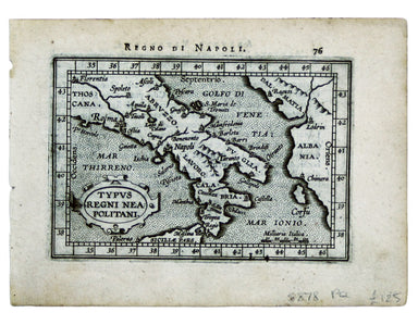
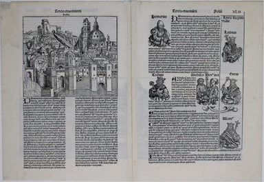
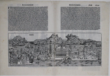
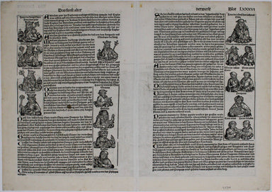
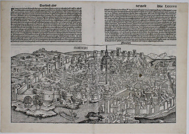
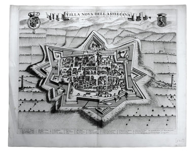
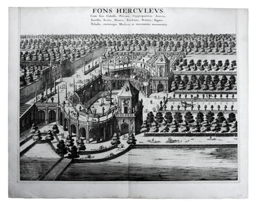
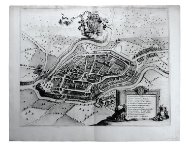
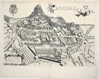
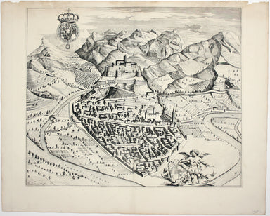
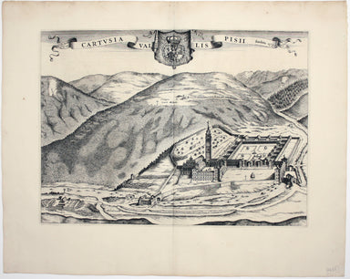
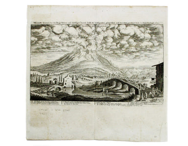
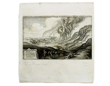
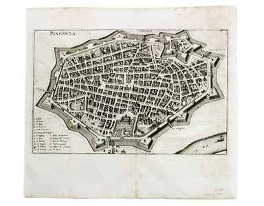
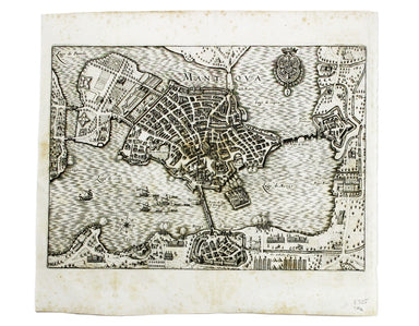
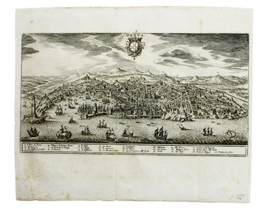
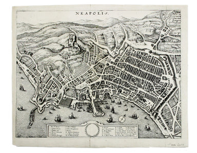
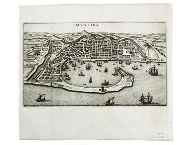
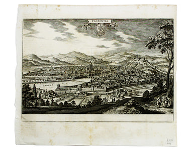
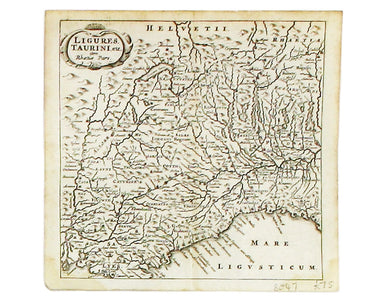
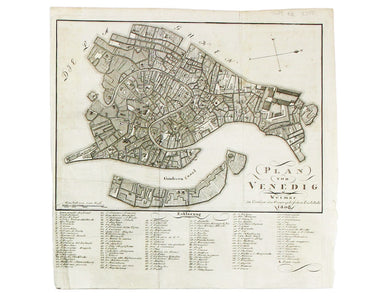
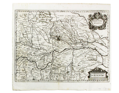
The Nuremberg Chronicle Map of Venice
This is one of the earliest obtainable views of Venice, derived from a larger woodcut by Dutch artist Erhard Reuwich, which was published in the fi...
View full detailsThis is one of the earliest obtainable views of Venice, derived from a larger woodcut by Dutch artist Erhard Reuwich, which was published in the fi...
View full detailsThis is one of the earliest obtainable views of Florence, derived from a lost engraving by Francesco Rosselli. The woodcuts were created in the wor...
View full detailsPlan Des Antiquitez De Rome, Représentées Et Distinguées Suivant La Situation De Chacun De Ses Anciens Monuments / Roma Vetus This map of Rome is a...
View full detailsPierre Mortier acquired the copper printing-plates for Blaeu's great town books of Italy, which were originally published from the 1660s onwards, a...
View full detailsCarmagnola, just south of Turin in Piedmont, was fought over and extensively remodelled in the mid seventeenth-century; it was briefly recaptured b...
View full detailsExigua & celeberrima Verruca […] This is a map of Verrua Savoia, north east of Turin in Piedmont. Blaeu’s townbook of Savoy and Piedmont was fi...
View full detailsVilla Nova dell’ Astegiana This is a map of Villanova d’Asti, in Piedmont. Blaeu’s townbook of Savoy and Piedmont was first published by the Blaeu ...
View full detailsFons Herculeus: Cum Suis Colosso, Cryptoporticu, Antris, Sacellis, Scalis, Dioetis, Tricliniis, Statuis, Signis, Tabulis, Coeterisque Musivis, ac m...
View full detailsRumiliacum vulgo Rumilly Blaeu’s townbook of Savoy and Piedmont was first published by the Blaeu heirs in 1682, but the plates were purchased and r...
View full detailsThis map of Demonte in Piedmont was engraved by Juvenal Boetto. Blaeu’s townbook of Savoy and Piedmont was first published by the Blaeu heirs in 16...
View full detailsThis map of Sicily is from the second series of maps engraved by Philip Galle for the Epitome, the pocket atlas version of Ortelius’ Theatrum. Cond...
View full detailsTypus Regni Neapolitani This map of the Kingdom of Naples is from the second series of maps engraved by Philip Galle for the Epitome, the pocket at...
View full detailsCamaldulensium, nondum omnino absoluta ad Lancei oppidum eremus This is the Camaldolese hermitage near Lanzo Torinese in Piedmont (which is visible...
View full detailsThis is a map of Revello, near Cuneo in Piedmont. Blaeu’s townbook of Savoy and Piedmont was first published by the Blaeu heirs in 1682, but the pl...
View full detailsThis is a map of Ormea, near Cuneo in Piedmont. Blaeu’s townbook of Savoy and Piedmont was first published by the Blaeu heirs in 1682, but the plat...
View full detailsCartusia Vallis Pisii, fundata 1173 This is the Charterhouse of Pesio, a Carthusian foundation near Cuneo in Piedmont. Blaeu’s townbook of Savoy an...
View full detailsThis view shows the major eruption of Vesuvius in December 1631, published by Merian and his heirs in various works, including the Itinerarium Ital...
View full detailsThis is a view of the Solfatara volcanic crater, mythological home of Vulcan in the Phlegraean Fields at Pozzuoli, near Naples. It was published by...
View full detailsThis plan of of Ostia was published by Merian and his heirs in various works, including the Itinerarium Italiae of 1640, the Archontologia cosmica ...
View full detailsThis plan of Piacenza was published by Merian and his heirs in various works, including the Itinerarium Italiae of 1640, the Archontologia cosmica ...
View full detailsThis plan of Mantua was published by Merian and his heirs in various works, including the Itinerarium Italiae of 1640 and editions of the Theatrum ...
View full detailsThis plan of Genoa was published by Merian and his heirs in various works, including the Itinerarium Italiae of 1640 and editions of the Theatrum E...
View full detailsThis plan of Palmanova (a Venetian town founded in 1593, sheltered behind innovative fortifications taking the form of a nine-pointed star) was pub...
View full detailsThis plan of Loreto (site of the Basilica della Santa Casa) was published by Merian and his heirs in various works, including the Itinerarium Itali...
View full detailsThis plan of Pavia (the ancient Ticinum) was published by Merian and his heirs in various works, including the Itinerarium Italiae of 1640 and edit...
View full detailsThis plan of Naples was published by Merian and his heirs in various works, including the Itinerarium Italiae of 1640 and editions of the Theatrum ...
View full detailsThis plan of Messina was published by Merian and his heirs in various works, including the Itinerarium Italiae of 1640 and editions of the Theatrum...
View full detailsThis plan of Florence was published by Merian and his heirs in various works, including the Itinerarium Italiae of 1640 and editions of the Theatru...
View full detailsLa Savoia divisa nelle sue Principali Provincie da Giacomo Cantelli da Vignola [….] This is a map of Savoy from Mercurio Geografico, an unusual and...
View full detailsThis map of Gallipoli in Apulia was published by Merian and his heirs in various works, including the Itinerarium Italiae of 1640, the Archontologi...
View full detailsRome Ancienne This plan of ancient Rome is from Mallet’s Description de l’Univers, first published in Paris in 1683 and reprinted with German text ...
View full detailsLigures, Taurini etc, item Rhaetiae pars Clüver is regarded as one of the founders of historical geography; his Introductionis in universam geograp...
View full detailsCondition & Materials Copper engraving, 23 x 24.5 cm, black and white as issued, blank verso. Stadtplan of Napoleonic Venice.
Condition & Materials Copper engraving, 27.5 x 37 cm, black and white, blank verso. Map showing the Duchy of Mantua.
Two English printers dipped a toe in the vernacular atlas market at approximately the same time with pocket editions of the Ortelius atlas: ‘These ...
View full detailsPianta del Nuovo Aquedotto che conduce l’acqua a Civita Vechia fabricato in parte sopra le ruuine dell’ antico construtto da Traiano Imperatore Thi...
View full detailsTavola Esatta dell’antico Latio e Nova Campagna di Roma, situata sotto il quinto Clima […] Prepared by papal cartographer Innocenzo Mattaei circa 1...
View full detailsBusca, near Cuneo in Piedmont. Blaeu’s townbook of Savoy and Piedmont was first published by the Blaeu heirs in 1682, but the plates were purchased...
View full details