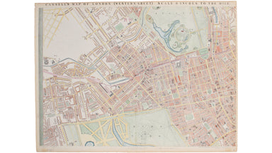
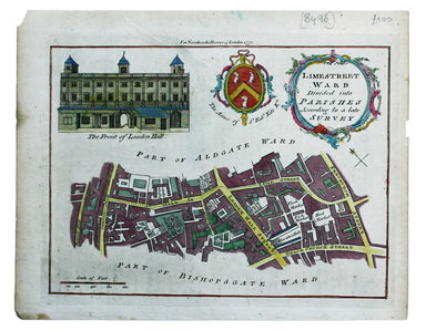
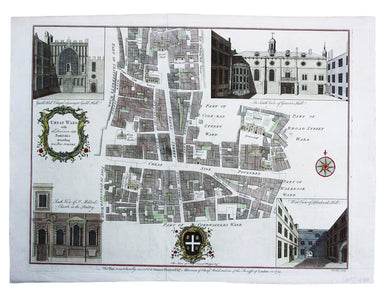
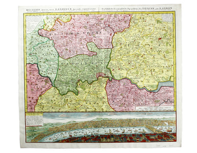
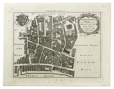
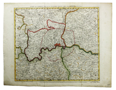
Western Sheet of Cassell’s Map of London
Cassell's 'immense map' of London was prepared for the Weekly Dispatch and published in nine parts between January 1861 and April 1862. This exampl...
View full detailsCassell's 'immense map' of London was prepared for the Weekly Dispatch and published in nine parts between January 1861 and April 1862. This exampl...
View full detailsLimestreet Ward divided into Parishes according to a late Survey Possibly engraved by Thomas Bowen and first published in the London Magazine, this...
View full detailsCheap Ward with its Divisions into Parishes according to a New Survey This ward plan of Cheap was published in the greatly expanded second edition ...
View full detailsRegionis, quae est circa Londinum […] This map follows Thomas Bowles’ ‘A New and Correct Map of Thirty Miles round London’ published c. 1740. The f...
View full detailsCondition & Materials Copper engraving, 19 x 25 cm, recent hand-colour, blank verso; a plan of Tower Ward published in Noorthouck’s History of ...
View full detailsA New and Correct Map of the Countries Twenty Miles round London Condition & Materials Copper engraving, 34 x 39 cm, recent hand-colour, blank ...
View full details