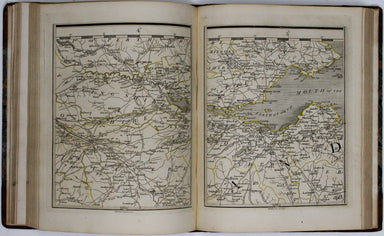
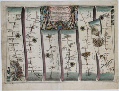
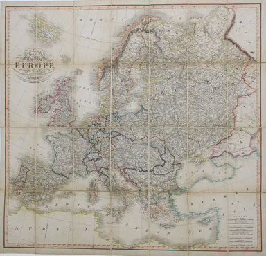
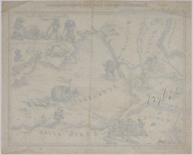
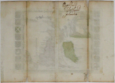
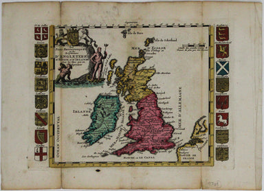
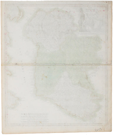
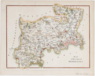
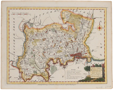
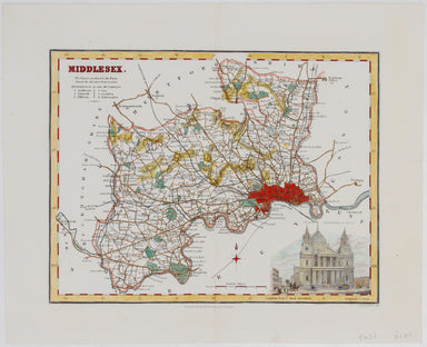
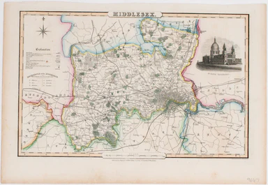
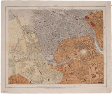

Tallis' Map of Natal
This map of Natal was engraved by John Rapkin for John Tallis' popular ‘Illustrated Atlas’; it includes vignettes of Port Natal engraved by William...
View full detailsThis map of Natal was engraved by John Rapkin for John Tallis' popular ‘Illustrated Atlas’; it includes vignettes of Port Natal engraved by William...
View full detailsThis map of Central America was engraved by John Rapkin for John Tallis' popular ‘Illustrated Atlas’; it includes black and white vignettes of Beli...
View full detailsThis map of Nova Scotia was engraved by John Rapkin for John Tallis' popular ‘Illustrated Atlas’; it includes black and white vignettes of Halifax,...
View full detailsThe map of the Eastern Hemisphere tracks the overland route to India (subject of a separate map in the series) and on to Australia. The mapmaker Jo...
View full detailsThis map of Africa was regularly updated to reflect the advances (and uncertainties) of European exploration, but this particular example appears t...
View full detailsEngraved by John Rapkin for John Tallis' ‘Illustrated Atlas’, this map of the world shows tracks for all three of Cook’s voyages and includes a vig...
View full detailsThibet, Mongolia, and Mandchouria Steel engraving, 26 x 33 cm, original outline colour, blank verso; engraved by John Rapkin for the ‘Illustrated A...
View full detailsThis map of Western Africa shows caravan routes leading into the Sahara; the course of the Niger – still partially uncertain, but reaching a point...
View full detailsThis map of Glasgow is of the town plans published in Tallis’ hugely popular ‘Illustrated Atlas’ which was published serially from the mid 1840s o...
View full detailsThis map of Edinburgh is one of the town plans in Tallis’ hugely popular ‘Illustrated Atlas’ which was published serially from the mid 1840s onwar...
View full detailsVan Diemen’s Island or Tasmania Steel engraving, 35 x 25 cm, original outline colour, blank verso; map of Tasmania engraved by John Rapkin for the ...
View full detailsWith vignettes including a view of Potosi Steel engraving, 34.5 x 25 cm, original hand-colour in outline, numbered in an old hand in upper margin, ...
View full detailsEast Canada and New Brunswick Steel engraving, 26.5 x 32.5 cm, original outline colour, blank verso; map of East Canada and New Brunswick engraved ...
View full detailsMap of West Canada with vignettes of Kingston, Ontario, and Niagara Falls Steel engraving, 25.5 x 33 cm, original outline colour, blank verso; map ...
View full detailsOverland Route to India Steel engraving, 34.5 x 25 cm, original outline colour, map of the overland route to India engraved by John Rapkin with vig...
View full detailsBritish America Steel engraving, 25.5 x 33 cms, original outline colour; map of British America engraved by John Rapkin with black and white vignet...
View full detailsNorthern India, including the Presidency of Calcutta Engraved by John Rapkin for the ‘Illustrated Atlas’ with vignettes, this map of Northern India...
View full detailsThis map of the Black Sea has been updated to show the 300 miles of submarine telegraph cable laid between Varna and Balaclava by Robert Stirling ...
View full detailsGermany Steel engraving, 35 x 25 cm, original outline colour, blank verso; a map of Germany engraved by John Rapkin for the Illustrated Atlas. Vign...
View full detailsBelgium Steel engraving, 26 x 34 cm, imprint trimmed, original outline colour, blank verso; a map of Belgium engraved by John Rapkin for the Illust...
View full detailsThe Crimea Steel engraving, 26 x 33 cm, original outline colour, slight toning, blank verso; a map of Crimea engraved by John Rapkin for the Illust...
View full detailsBaltic Sea Steel engraving, 25.5 x 34 cm, original outline colour, blank verso; a map of the Baltic Sea engraved by John Rapkin for the Illustrated...
View full detailsSpain and Portugal Steel engraving, 26 x 31 cm, original outline colour, blank verso; engraved by John Rapkin for the Illustrated Atlas; a map of S...
View full detailsHungary Steel engraving, 34.5 x 25 cm, original hand-colour in outline, blank verso; map of Hungary engraved by John Rapkin for the ‘Illustrated At...
View full details