

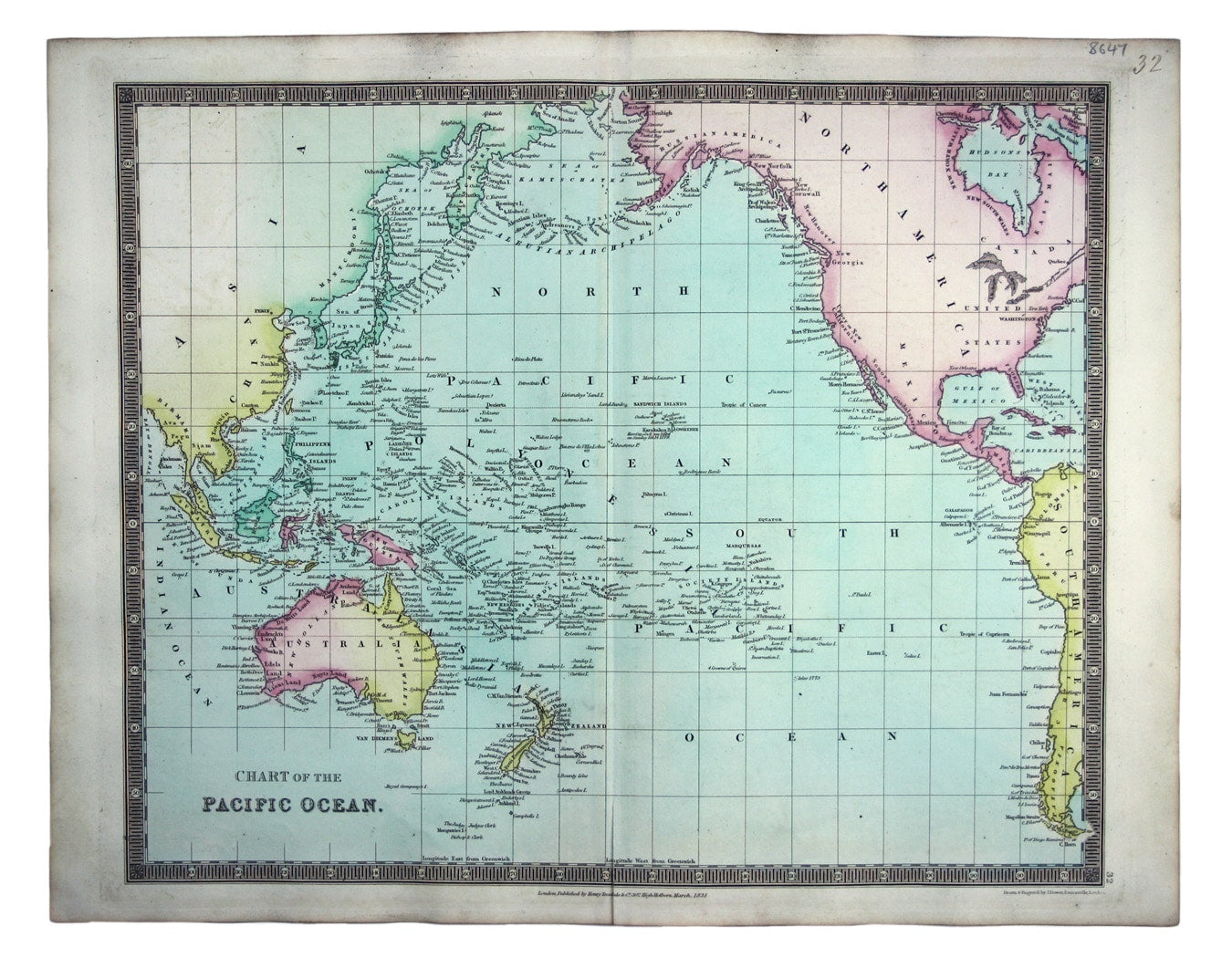
Teesdale's Chart of the Pacific Ocean
SKU: 8647
Title:
Teesdale's Chart of the Pacific Ocean
Date of publication:
Printed Measurement:
Colour:
Mapmaker:
Engraver:
This chart of the Pacific Ocean features two regions named New South Wales. Cook’s New South Wales in Australia remains familiar, but the other, on the shores of Hudson Bay, was named in the early 17th century; like some of the other nomenclature including New Georgia and New Hanover on the west coast of Canada, it has fallen out of use.
The site of Cook’s death on Hawaii (‘Owhyhee’) is noted. Read more
Our map was published in a first edition of Teesdale’s ‘New General Atlas of the World’.
Condition & Materials
Steel engraving, 35.5 x 43 cm, engraved by John Dower, original hand colour, numbered in an old hand, blank verso. Read less