

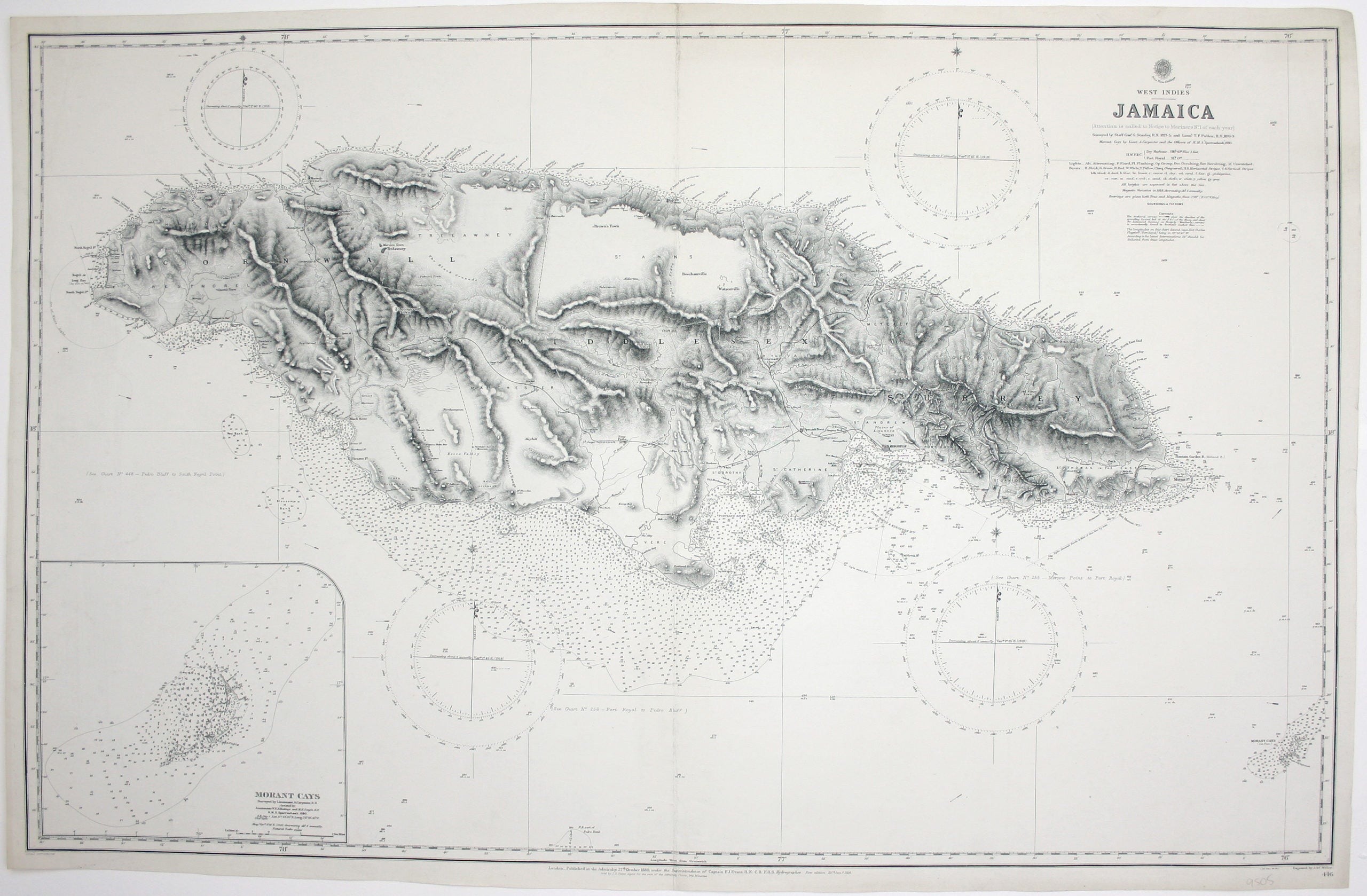
Admiralty Chart of Jamaica
SKU: 9505
Title:
Admiralty Chart of Jamaica
Date of publication:
Printed Measurement:
Publisher:
Colour:
Engraver:
This chart of Jamaica shows soundings etc, with interior detail of relief, roads and settlements, and an inset of Morant Cays.
First published in 1880, our example was revised in January 1914. Pullen was an experienced surveying officer, noted for survey work in New Guinea and on the Zanzibar coast. He succumbed to malaria while leading a surveying expedition on the west African coast in 1889 (reported in RGS Proceedings, 1890). Read more
Condition & Materials
Engraved British chart, sheet size 66.5 x 102.5 cm, black and white, engraved by John and Charles Walker, centrefold, blank verso with old ink stamp. Read less