

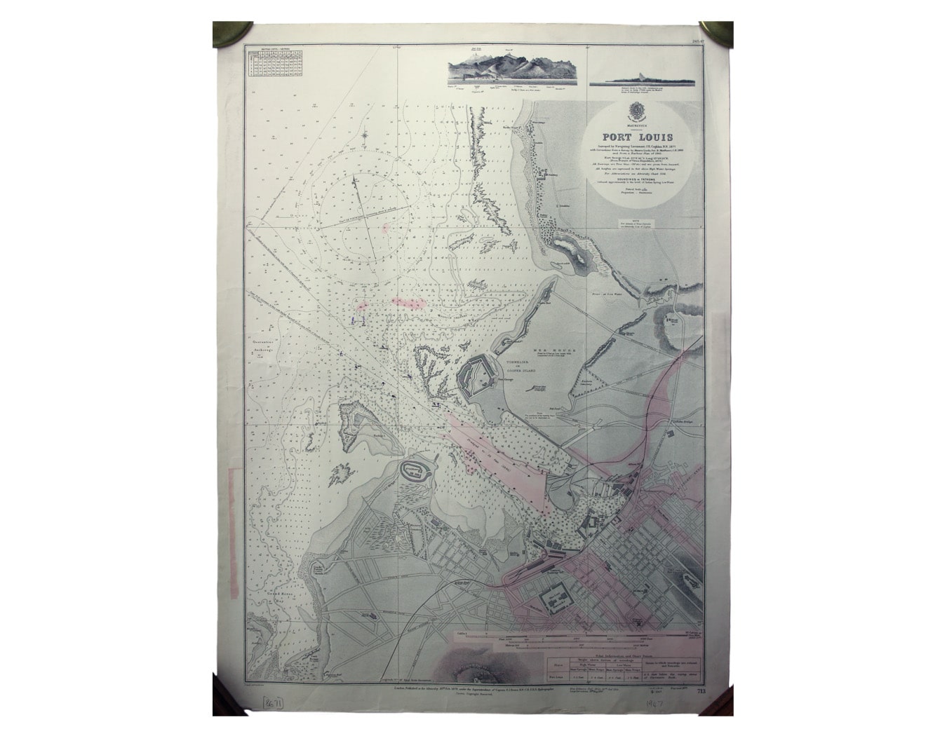

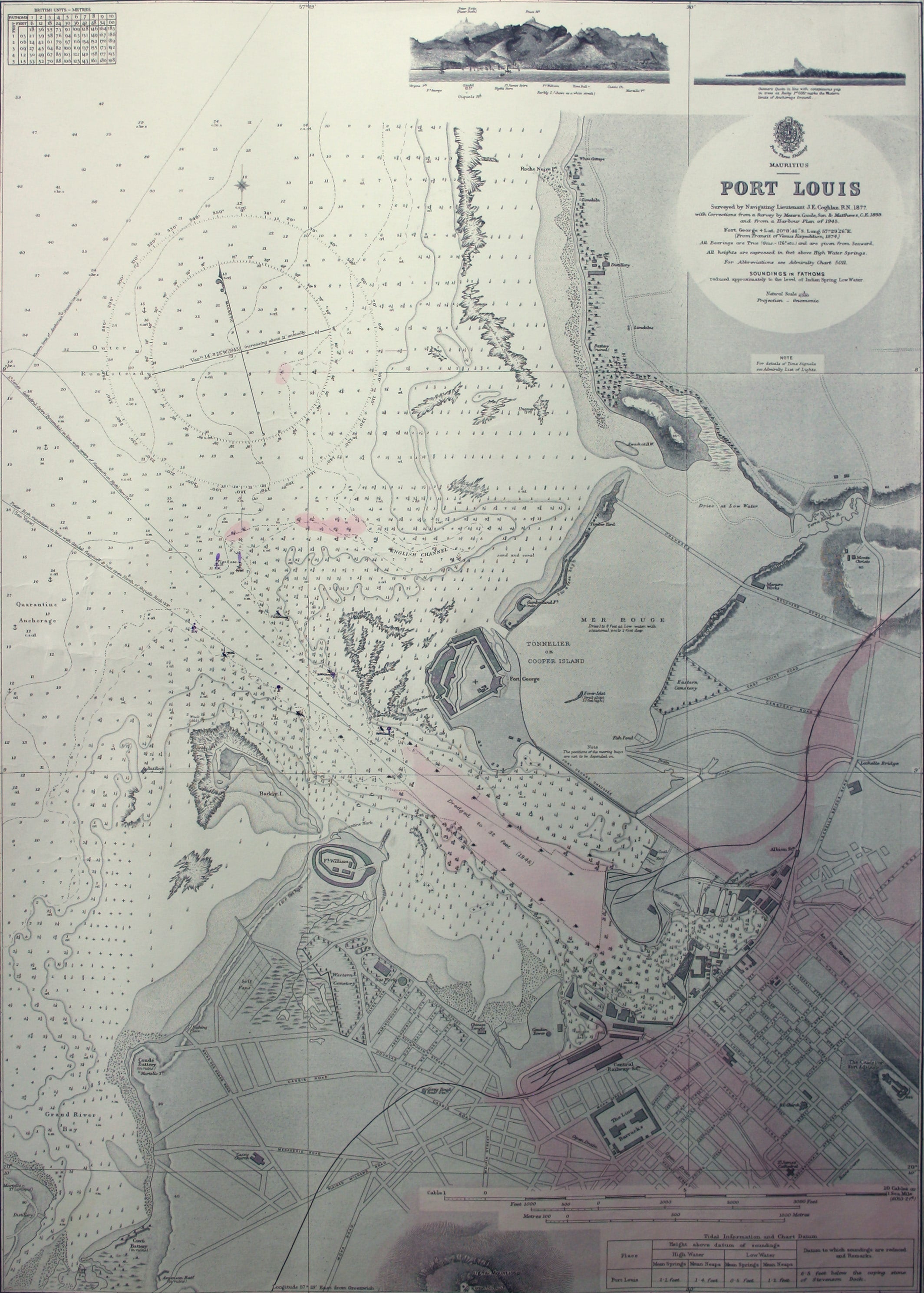
British Admiralty Chart of Port Louis, Mauritius
SKU: 8671
Title:
British Admiralty Chart of Port Louis, Mauritius
Date of publication:
Printed Measurement:
Colour:
Mapmaker:
Port Louis is the capital and principal port of Mauritius, which remained a British colony until 1968.
Condition & Materials Read more
Engraved British chart of Port Louis, 102 x 68.5 cm, black and white with some hand colour, centrefold, trace of pink paper label in right hand margin, blank verso; shows soundings etc, with interior detail of relief, roads and settlements. Surveyed in 1878, with corrections to 1947. Read less