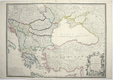
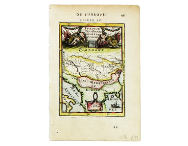
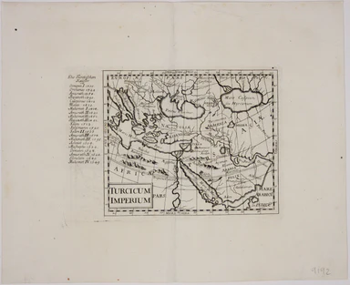
Bertius’ Miniature Map of the Turkish Empire
£200.00
Turcicum Imperium
In stock
Copper engraving, 9.5 x 13.5 cm, black and white, French text on verso. A miniature map of the Turkish Empire, from the French text edition of Tabularum geographicarum contractarum libri, a geographical work which is normally catalogued under the name of its author, Bertius.
The maps are generally reduced from the cartography in the folio Mercator-Hondius atlas, and were mostly engraved by Jodocus Hondius, eldest son of the printer, who also bears the same name. Geoffrey King calls them ‘undoubtedly the finest set of miniature maps ever printed’. (Miniature Antique Maps p. 96). Koeman, Atlantes Neerlandici, Lan 11A. Tibbetts, Arabia in early maps, 70.
Title | Bertius’ Miniature Turkish Empire |
---|---|
Mapmaker(s) | BERTIUS, Petrus |
Engraver(s) | HONDIUS II, Jodocus |
Place of publication | Amsterdam |
Date of publication | 1618 |
Printed Area Measurements | 9.5 x 13.5 cm |
Colour | black and white |