

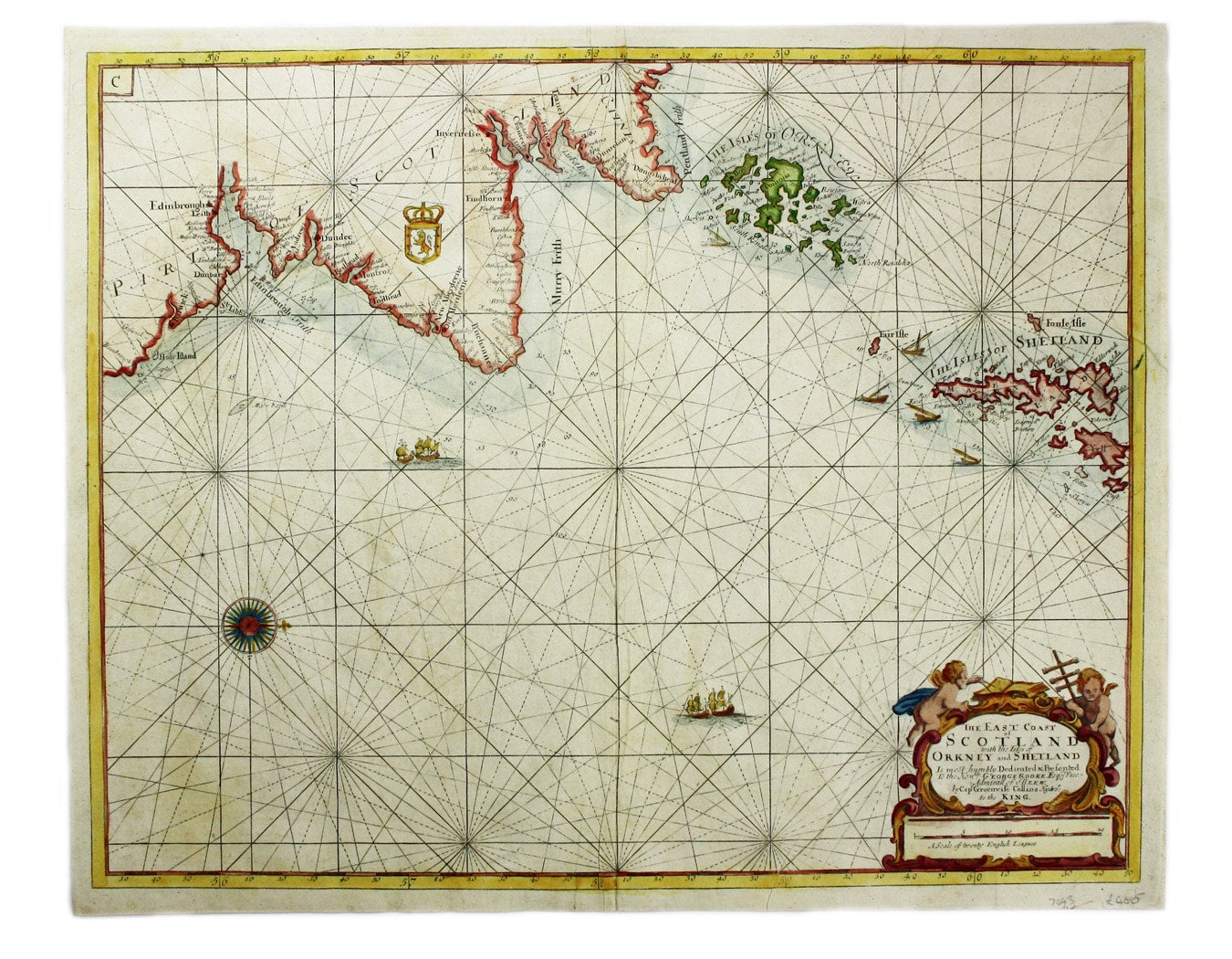

Collins’ Map of the East Coast of Scotland
SKU: 7543
Title:
Collins’ Map of the East Coast of Scotland
Date of publication:
Printed Measurement:
Colour:
Mapmaker:
The East Coast of Scotland with the Isles of Orkney and Shetland
This sea chart is from ‘Great Britain’s Coasting Pilot’, the first English Sea Atlas based upon a systematic personal survey. Read more
The charts were first published in atlas form in 1693 and issued for a full century afterwards with some additions and corrections. This example is probably from an edition printed by Mount & Page.
Condition & Materials
Copper engraving, 44.5 x 57 cm, recent hand-colour, single wormhole at centrefold, blank verso. Read less