

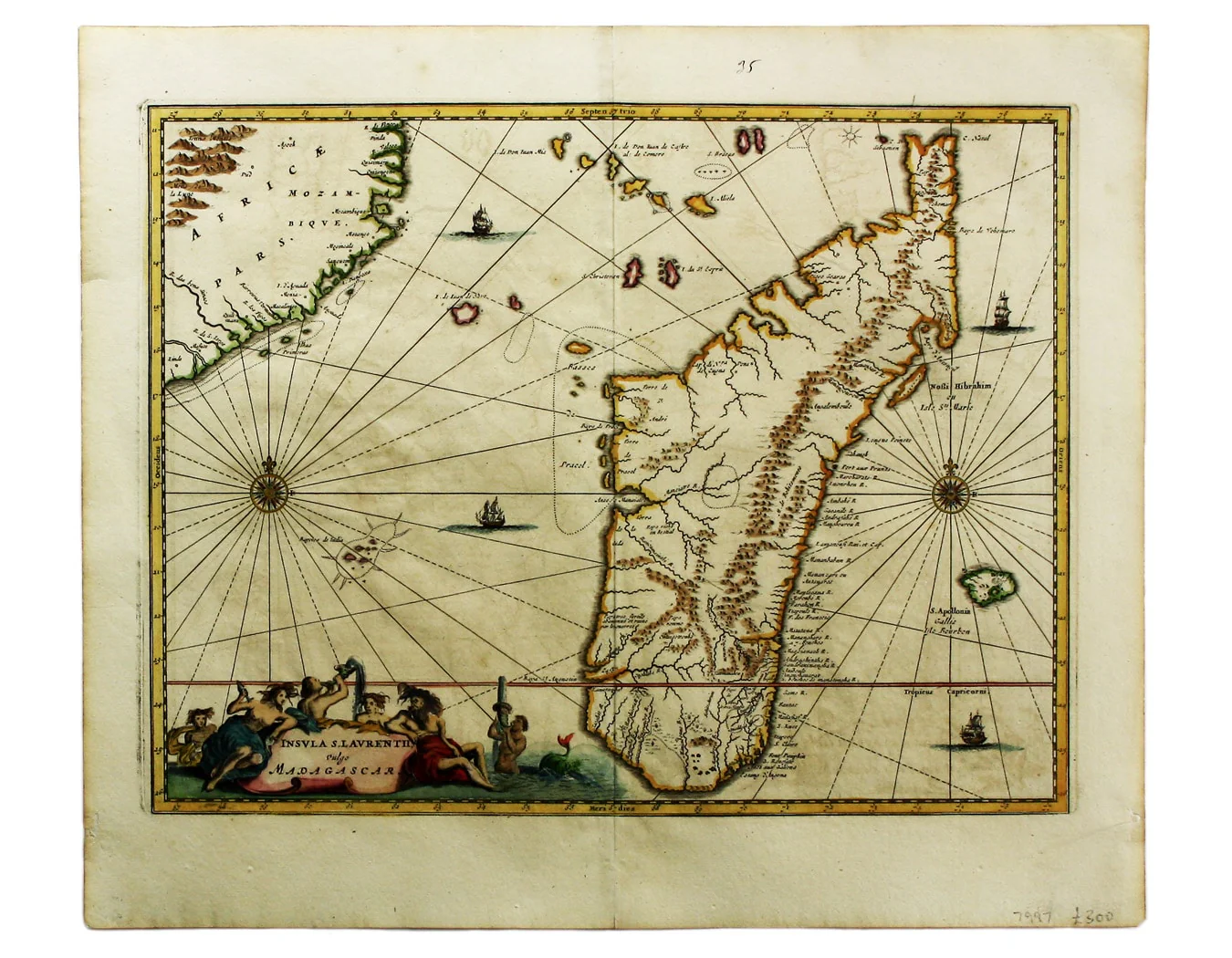
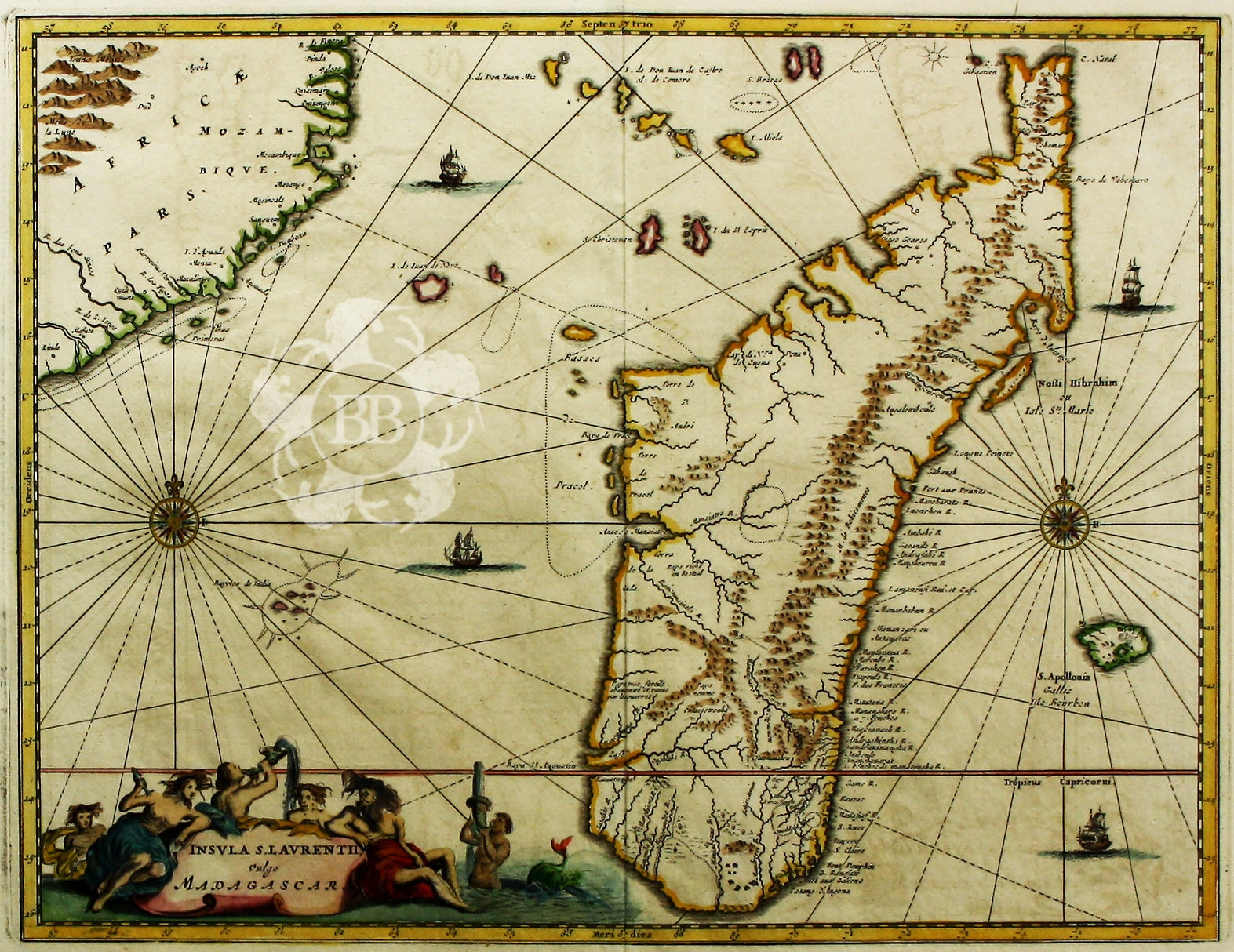
Dapper’s Map of Madagascar
SKU: 7997
Title:
Dapper’s Map of Madagascar
Date of publication:
Printed Measurement:
Colour:
Mapmaker:
Insula S. Laurentii, vulgo Madagascar
The name 'Isle of St Laurence' was given by the Portuguese, who landed on Madagascar on St Laurence's day (February 2nd) 1506. They were the first Europeans to arrive, although Arab traders had been visiting since at least the ninth century. Read more
As can be seen on the map, in the seventeenth century the interior remained relatively unexplored and most of the known settlements were on the East coast. The cartography reflects the European experience of failed colonisation, highly successful piracy, the burgeoning slave trade and occasional reports from the more fortunate shipwrecked mariners such as Robert Drury.
The Dutch, English, French and Portuguese all failed to establish permanent settlements there. The French were perhaps the most persistent and their settlement founded in 1643 at Tolagnaro (formerly Faradofay) survived for 30 years, before nearly all the colonists were massacred and survivors fled by sea to the neighbouring territory of Reunion.
Pirates of all nations established themselves on Madagascar's East coast with far greater success and used the island as a base in waters which were remote from any significant European naval power. In this period small coastal kingdoms on the island also began to flourish through the slave trade.
Olfert Dapper (1636-1689) was a Dutch physician and scholar who devoted most of his life to geographical studies without ever leaving his home town of Amsterdam. Using the most reliable eye-witness accounts and his own extensive library of travel books he composed authoratitive and entertaining finely-illustrated works on Asia, Africa and America. His Naukeurige Beschrijvinghe Der Afrikaensche was first published in Dutch in 1668, in German in 1670 and in French in 1686, and it was used by John Ogilby (1600-1676) as the basis for his Africa, the best account of the continent available in English at the time, using many of the same maps and views.
Condition & Materials
Copper engraving, 28.5 x 37 cm, modern hand colour, blank verso. Read less