

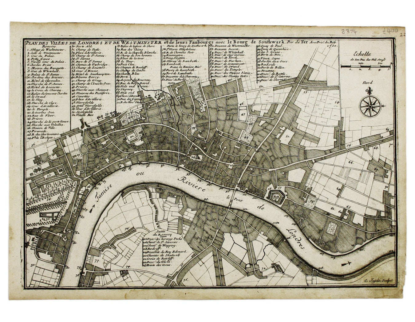
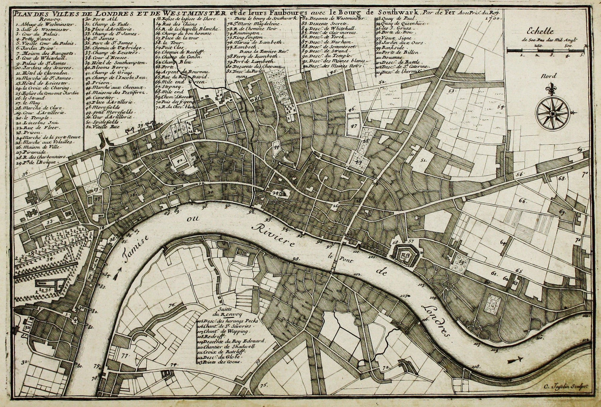
De Fer’s Map of London
SKU: 8374
Title:
De Fer’s Map of London
Date of publication:
Printed Measurement:
Colour:
Mapmaker:
Plan Des Villes De Londres et de Westminster et leurs Faubourgs avec le Bourg de Southwark
This is the first version of the map, before the date was amended. Read more
Condition & Materials
Copper engraving, 22.5 x 33.5 cm, map of London engraved by C. Inselin, black and white, slight soiling bottom right, blank verso; the key lists 113 places of interest.
References
Howgego, Printed Maps of London, 44 (1) Read less