

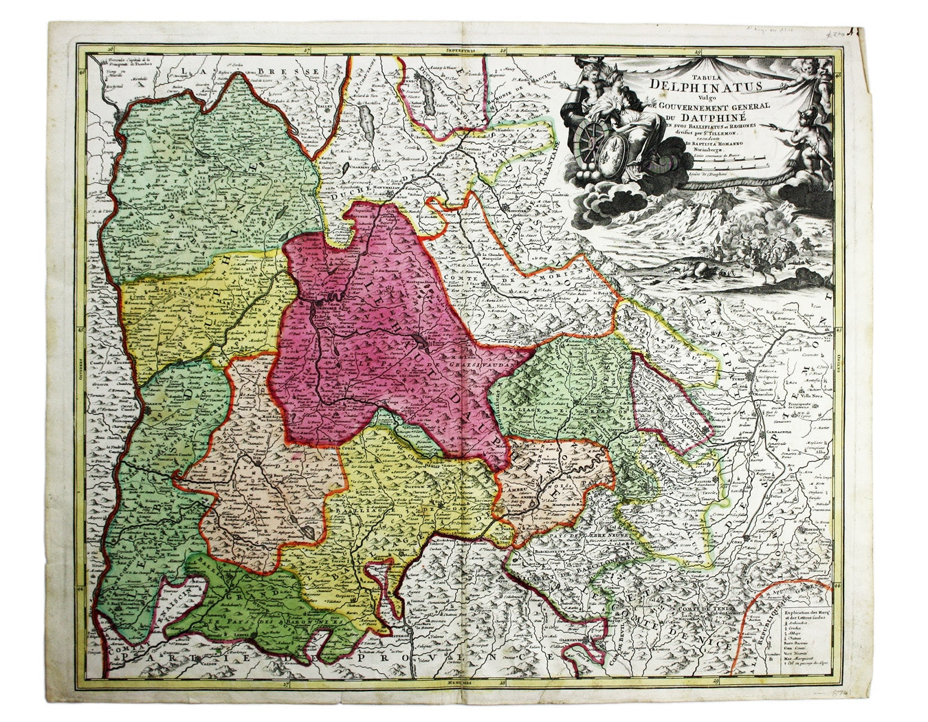
Homann’s Map of the Dauphiné
SKU: 6741
Title:
Homann’s Map of the Dauphiné
Date of publication:
Printed Measurement:
Colour:
Mapmaker:
A map of the French Alps, the Dauphiné, incuding Grenoble. The borders are those defined by the Treaty of Utrecht (1713) and the cartouche (putti menacing an astonished personification of France and a battle fought in the shadow of the Alps) probably refers to the Nine Years’ War and the invasion of the region by the Duke of Savoy in 1692.
The founder of the business, Johann Baptist Homann (1664-1724), was a self-taught copper engraver who founded the leading German cartographic publishing house of the eighteenth-century. Read more
He was appointed cartographer to the Holy Roman Emperor in 1715, and his maps were sold throughout Europe. After Homann's death his maps were published by his son, Johann Christoph, and then by the Homann Heirs (his friend Johann Michael Franz and his stepsister's husband Johann Georg Ebersberger).
Condition & Materials
Copper engraving, 49.5 x 58.5 cm, closed split at the foot of the centrefold, original hand-colour, blank verso. Read less