

Horwood’s Large-Scale Map of St James’s & Knightsbridge
SKU: 8749
Title:
Horwood’s Large-Scale Map of St James’s & Knightsbridge
Date of publication:
Printed Measurement:
Colour:
Mapmaker:
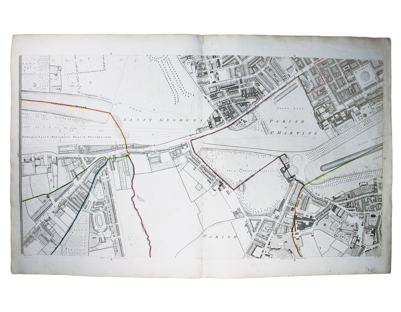
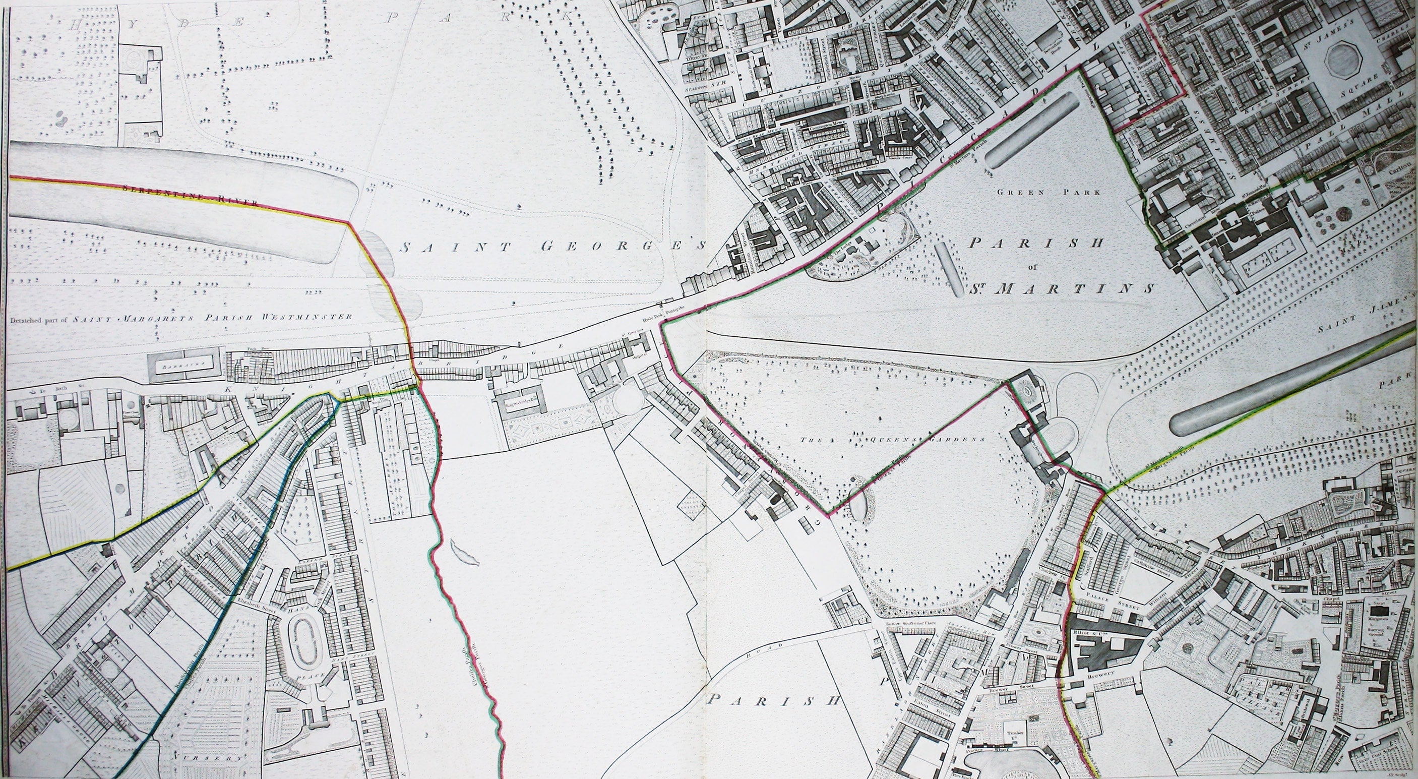
This map (two sheets from Horwood's magnificent 32 sheet survey) includes St James’s Square, the western part of Piccadilly, Green Park, Buckingham Palace, Hyde Park Corner, Knightsbridge and Brompton Road.
It is a landmark in London mapping on a number of counts. It was the first large-scale survey since John Rocque's, half a century earlier, and Horwood was the first to show individual house numbers. Numbering began in London in the 1760s (although house numbers were not used in official records until much later – the nineteenth-century in some cases) but Horwood was the first to mark them on the map.
Read more
The survey took Horwood almost a decade. He began work in 1790; the first sheets were published in 1793, and it was completed in 1799. He remarked that he "took every angle, measured almost every line and after that plotted and compared the whole work" in person.
The map is also an indicator of the changing face of patronage. Earlier map-makers such as William Morgan looked to royal or aristocratic patrons to shoulder the costs of their original, large-scale surveys, and in the mid eighteenth-century John Rocque was sponsored by the Aldermen of the City of London, but Richard Horwood's principal backer was the Phoenix Fire Company, an insurance firm.
Condition & Materials
Copper engraving, two map-sheets joined, 58 x 103 cm, black and white with original hand colour in outline to define the parish boundaries, a couple of short closed tears, blank verso.
References
Worms and Baynton Williams (‘Dictionary of British Map Engravers’) suggest that the engraver ‘J.T.’ may be John Thompson Read less