

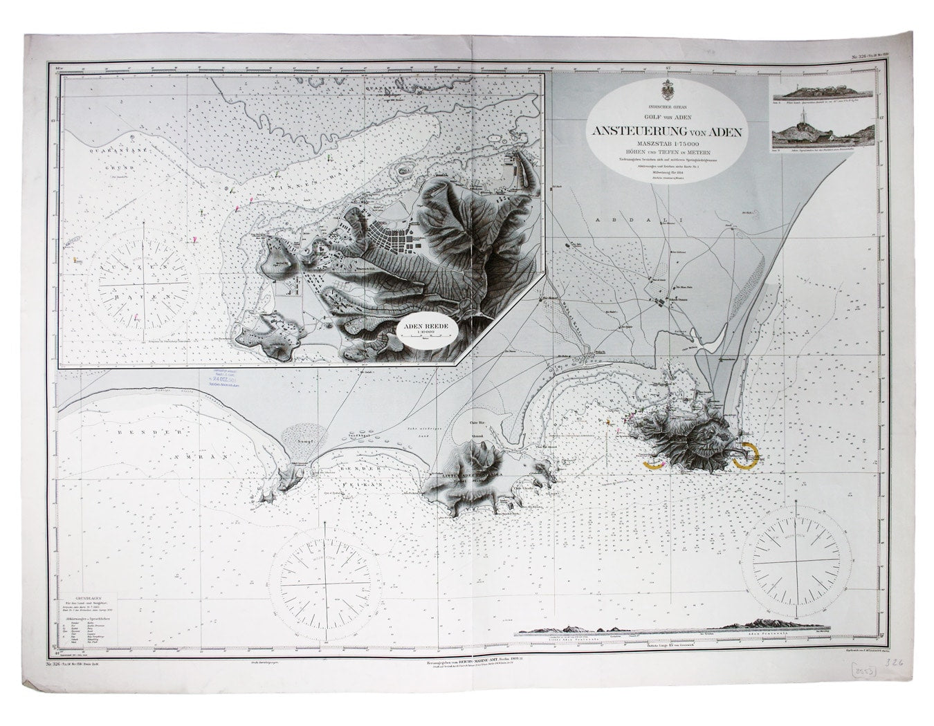
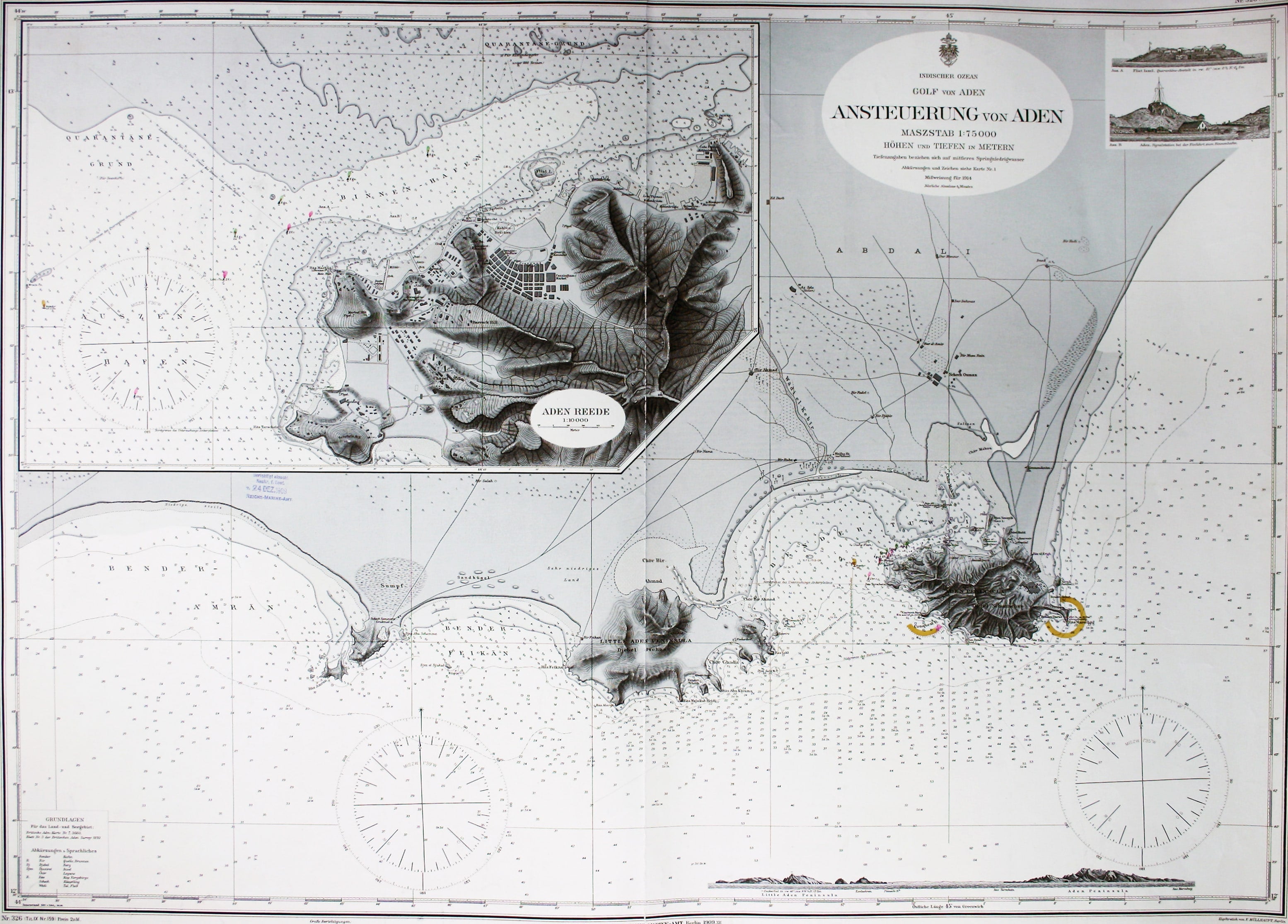
Imperial German Chart of Aden
SKU: 8553
Title:
Imperial German Chart of Aden
Date of publication:
Printed Measurement:
Colour:
Mapmaker:
Engraver:
Indsicher Ozean – Golf von Aden – Ansteuerung von Aden
This German naval chart of Aden shows breakwaters and lights highlighted in colour. It details sands, soundings etc, with interior relief, vegetation, roads and settlements. It also features inset profiles, and a plan of the port of Aden. Read more
Condition & Materials
Imperial German Naval Office chart of Aden, 67 x 91 cm, engraved by F. Müllhaupt, black and white, centrefold, date-stamped 24 December 1909, blank verso. Read less