

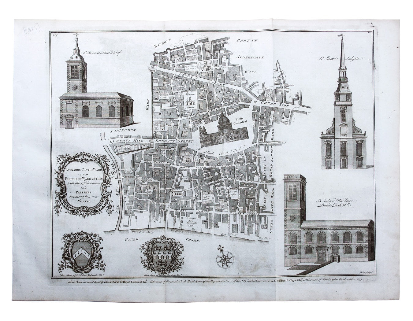
Maitland’s Plan of Baynard’s Castle & Faringdon Wards
SKU: 8815
Title:
Maitland’s Plan of Baynard’s Castle & Faringdon Wards
Date of publication:
Printed Measurement:
Colour:
Mapmaker:
Engraver:
Baynard’s Castle Ward [and] Faringdon Ward with their divisions into Parishes according to a new survey
This was plan of Baynard’s Castle and Faringdon was published in the greatly expanded second edition of Maitland’s History of London. Read more
Significant buildings, such as St Paul’s, are represented pictorially on the map; the River Fleet is labelled both ‘The New Canall’ and ‘Fleet Ditch’; with the arms of contemporary Aldermen Sir Robert Ladbroke and William Bridgen.
Condition & Materials
Copper engraving, 36.5 x 47 cm, engraved by Benjamin Cole, black and white, slight offsetting, blank verso.
References
Hyde, Ward Maps, 46. Read less