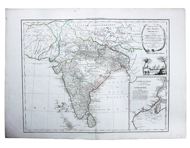
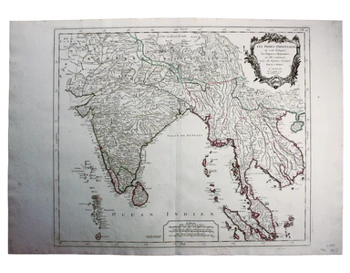
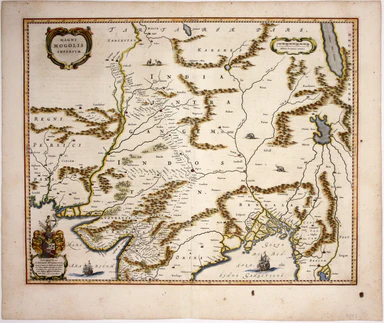
Robert de Vaugondy’s Map of The Subcontinent
Presqu’Isle des Indes Orientales, comprenant l’Indostan ou Empire du Mogol, differens Royaumes ou Etats, les vastes possessions des Anglais, et les...
View full detailsPresqu’Isle des Indes Orientales, comprenant l’Indostan ou Empire du Mogol, differens Royaumes ou Etats, les vastes possessions des Anglais, et les...
View full detailsLes Indes Orientales This is Santini’s edition of Robert de Vaugondy’s map of the Indian subcontinent and mainland southeast Asia. Venetian map-mak...
View full detailsThis map of Southern India and Sri Lanka on an east-west alignment is from the French text edition of Tabularum geographicarum contractarum libri, ...
View full detailsThis map of the Mughal Empire is dedicated by the Blaeu brothers to Joan Huydecoper van Maarsseveen (1599–1661), a prosperous dealer in pelts and a...
View full detailsThis map covers the southern part of the subcontinent (Mumbai is near the upper border), and includes the northern part of Sri Lanka. Pink denotes ...
View full detailsBradshaw’s Railway Manual, Shareholder’s Guide and Official Directory for 1868. Containing the History and Financial Position of Every Company, Bri...
View full detailsSheet III – West Coast of India – from Arnol I. to Kundari I This chart shows the approaches to Bombay harbour, modern Mumbai, with significant det...
View full detailsPhillimore, Colonel Reginald Henry: Historical Records of the Survey of India. Volumes 1 to 4... alas not including the suppressed fifth volume Col...
View full details