

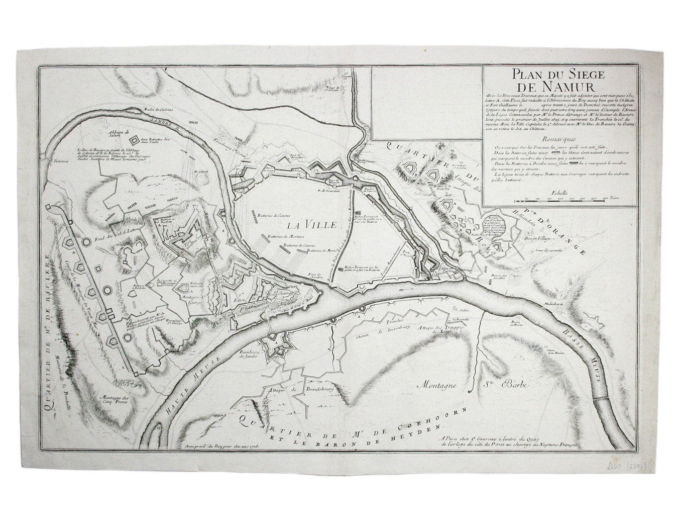
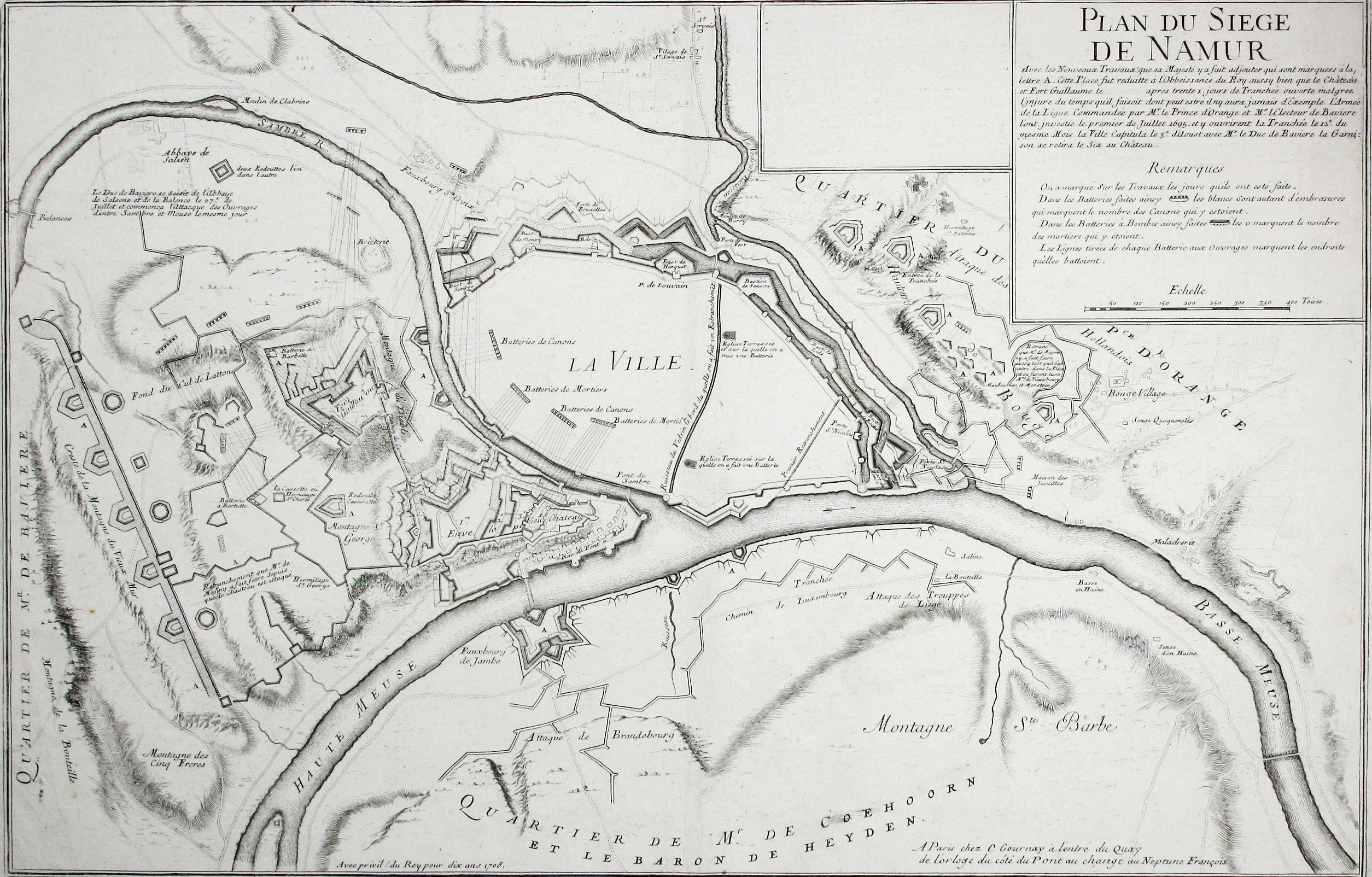
Map of the Second Siege of Namur
SKU: 8395
Title:
Map of the Second Siege of Namur
Date of publication:
Printed Measurement:
Colour:
Mapmaker:
Plan du Siege de Namur avec les nouveaux travaux que sa Majesté y a fait adjouter qui sont marquees à la lettre A. Cette place fut reduitte à l’obbeissance du Roy aussy bien que le château et Fort Guillaume […]
Gournay also produced a plan which showed Louis XIV’s successful siege of Namur in 1692, but our map shows the 1695 siege and recapture of Namur by the Allies. Read more
The second siege was a turning point in the Nine Years’ War, the precursor to the War of the Spanish Succession, which was still raging when our map was made. Gournay depicts the elaborate new fortifications built by the French (‘marked with the letter A’), but in spite of them Namur fell to British, Dutch and Habsburg forces after two months.
Sterne’s Uncle Toby, one of the central figures in Tristram Shandy, was wounded in the groin at Namur. He owns his own plan of the siege, pasted to a board, and he re-enacts it on model fortifications in the grounds of Shandy Hall. The Widow Wadman is anxious to ascertain the precise nature of Toby’s injuries, but when asked where he was wounded he will only show her on the map.
Condition & Materials
Copper engraving, 40.5 x 63 cm, black and white, blank verso. Read less