

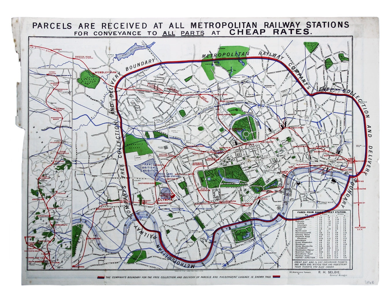
Metropolitan Railway Parcel Delivery Map
SKU: 8848
Title:
Metropolitan Railway Parcel Delivery Map
Date of publication:
Printed Measurement:
Publisher:
Colour:
Mapmaker:
Map with lines showing the boundary for free collection and delivery of parcels and passengers’ luggage
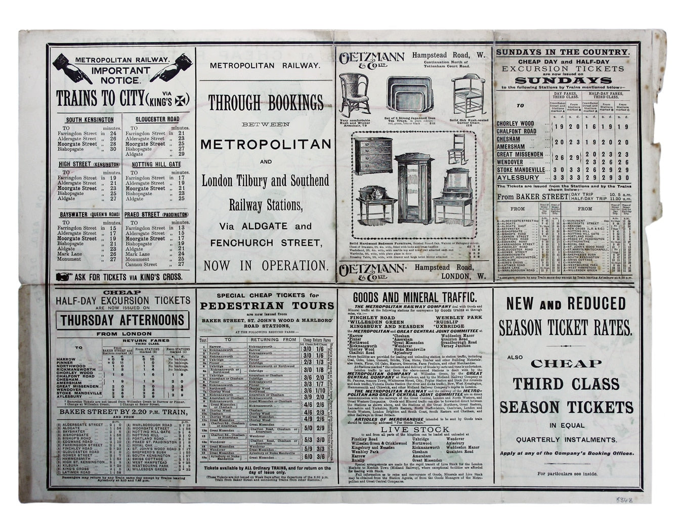
The main map shows central London, including the site of the 1908 Franco-British Exhibition; an inset shows the line between Harrow and the Met’s northern outpost at Verney Junction, and a fare table is included bottom right. A blue and red line shows the boundary for the free collection and delivery of parcels and passengers’ luggage, which could be handed in rather than carried on crowded trains. The text on the verso gives information about tickets and goods traffic, and carries an advertisement for the west end furniture supplier Oetzmann & Co. Read more
Condition & Materials
Sheet size 39 x 52 cm, printed in colours, text on verso, one or two small tape repairs to folds, tabbed and folded for inclusion in 1908 timetable booklet. Read less