

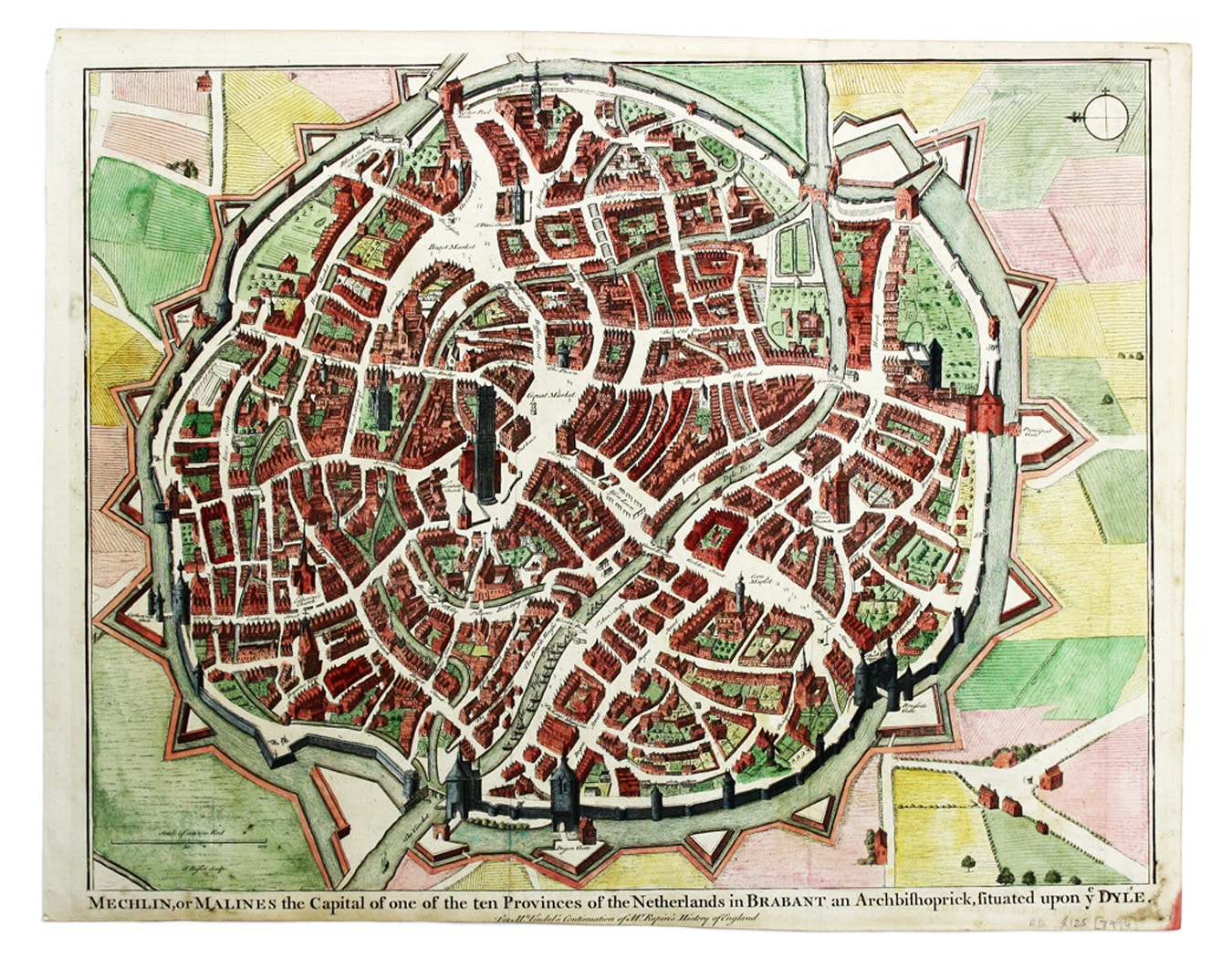
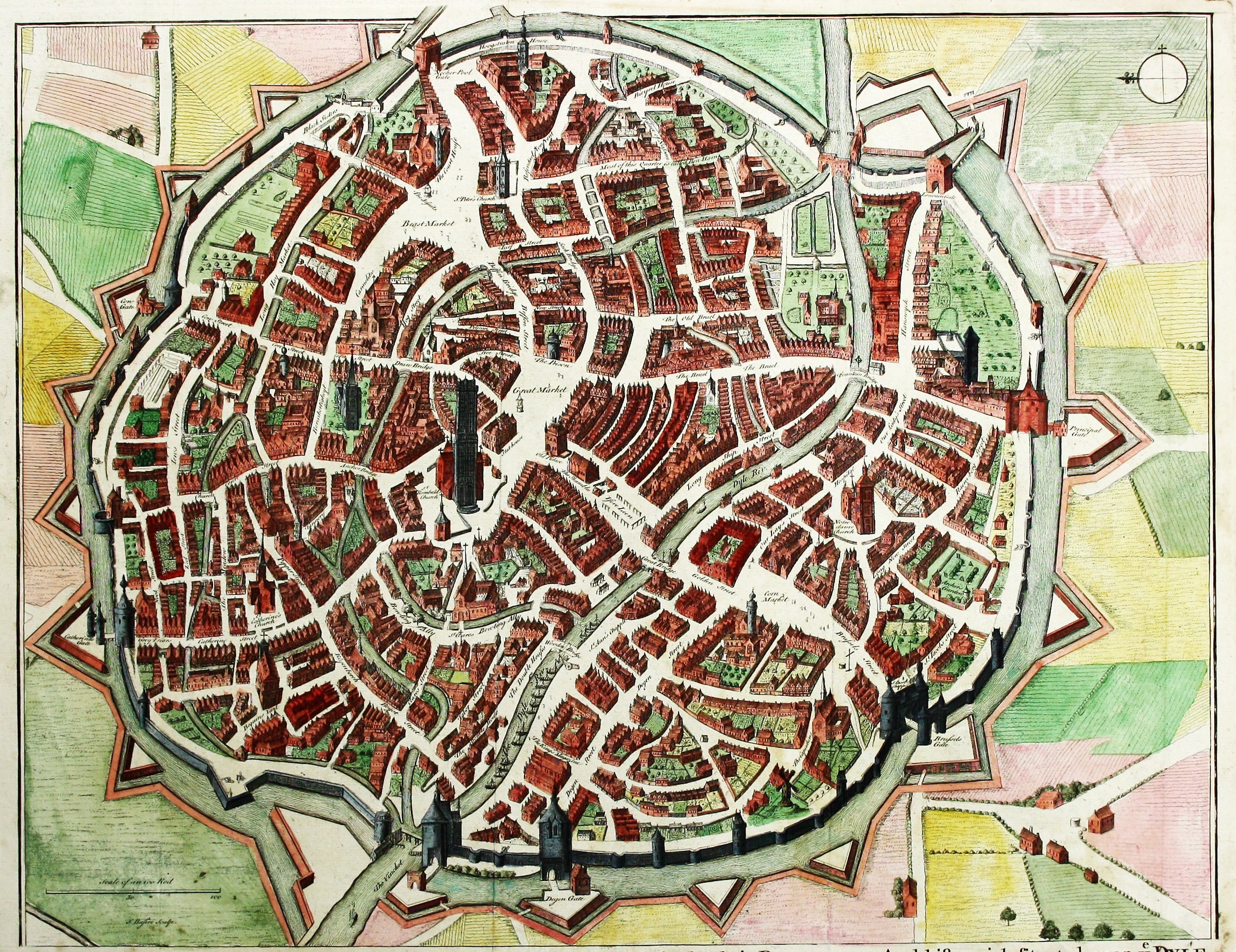
Map of Mechelen, from Rapin’s History
SKU: 7974
Title:
Map of Mechelen, from Rapin’s History
Date of publication:
Printed Measurement:
Publisher:
Colour:
Mapmaker:
Engraver:
Mechelin, or Malines, the Capital of one of the ten Provinces of the Netherlands in Brabant
This map of Mechelen was engraved by James Basire and published in Nicholas Tindal's continuation of Rapin de Thoyras's History of England. Many of the maps illustrating the work depict military actions fought by the British during the campaigns of the War of the Spanish Succession, mostly in Spain and the Low Countries. Read more
The Allies in the context of this conflict were Spanish supporters of the Habsburg Archduke Charles of Austria, with the backing of Austrian, British, Dutch, Prussian and Portugese troops, and they faced a Franco-Spanish Bourbon army. At stake was the European balance of power, which would shift dramatically if the Bourbon Philip V was allowed to unify Spain and France.
A compromise peace was achieved in 1714: Philip V remained King of Spain but was excluded from the French line of succession, precluding a union between the two kingdoms.
Condition & Materials
Copper engraving, 39.5 x 49 cm, modern hand colour, blank verso. Read less