

1915 London Underground Passenger Map
SKU: 9047
Title:
1915 London Underground Passenger Map
Date of publication:
Printed Measurement:
Colour:
Mapmaker:
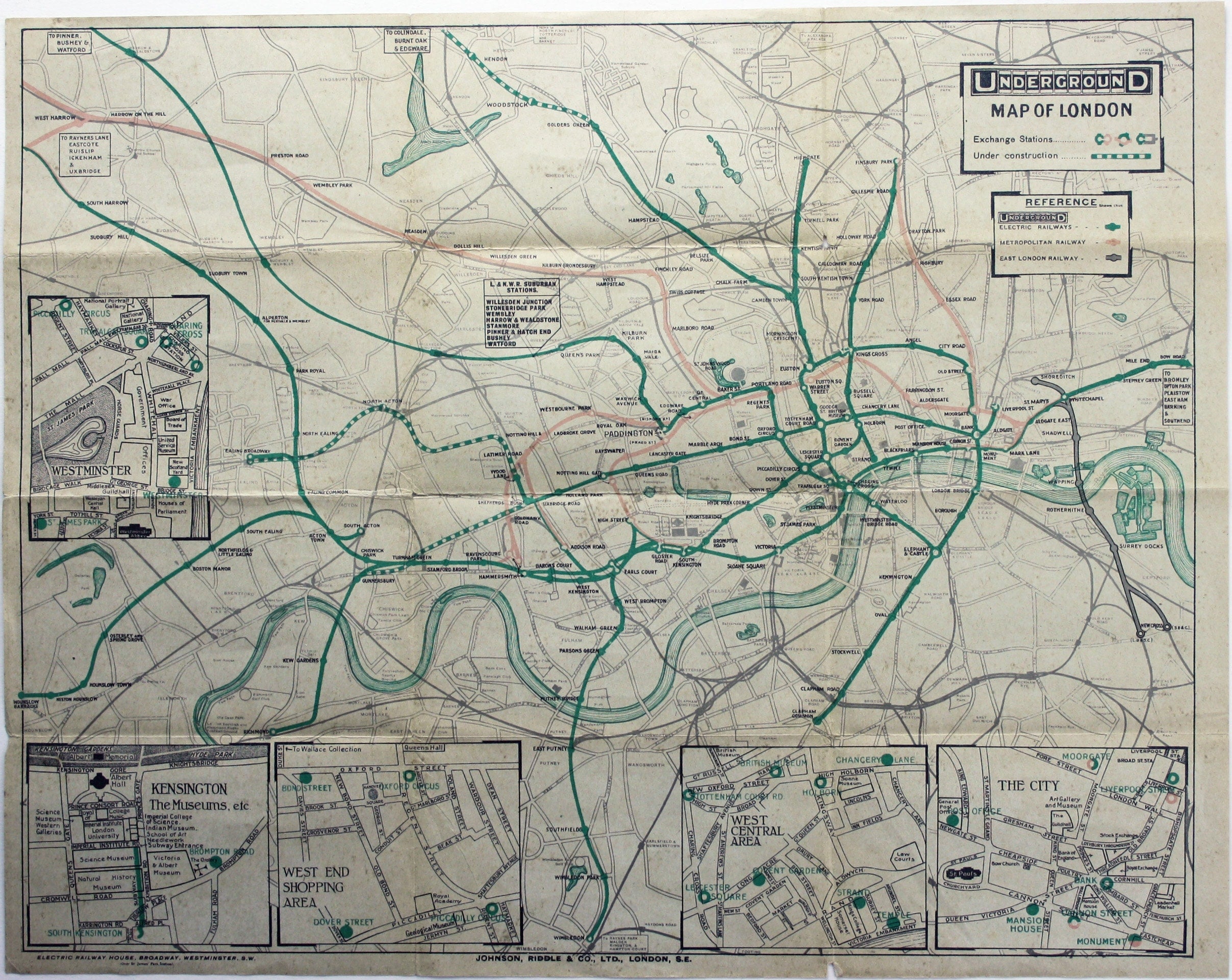
This is an interesting example of the London underground map produced under difficult wartime conditions.
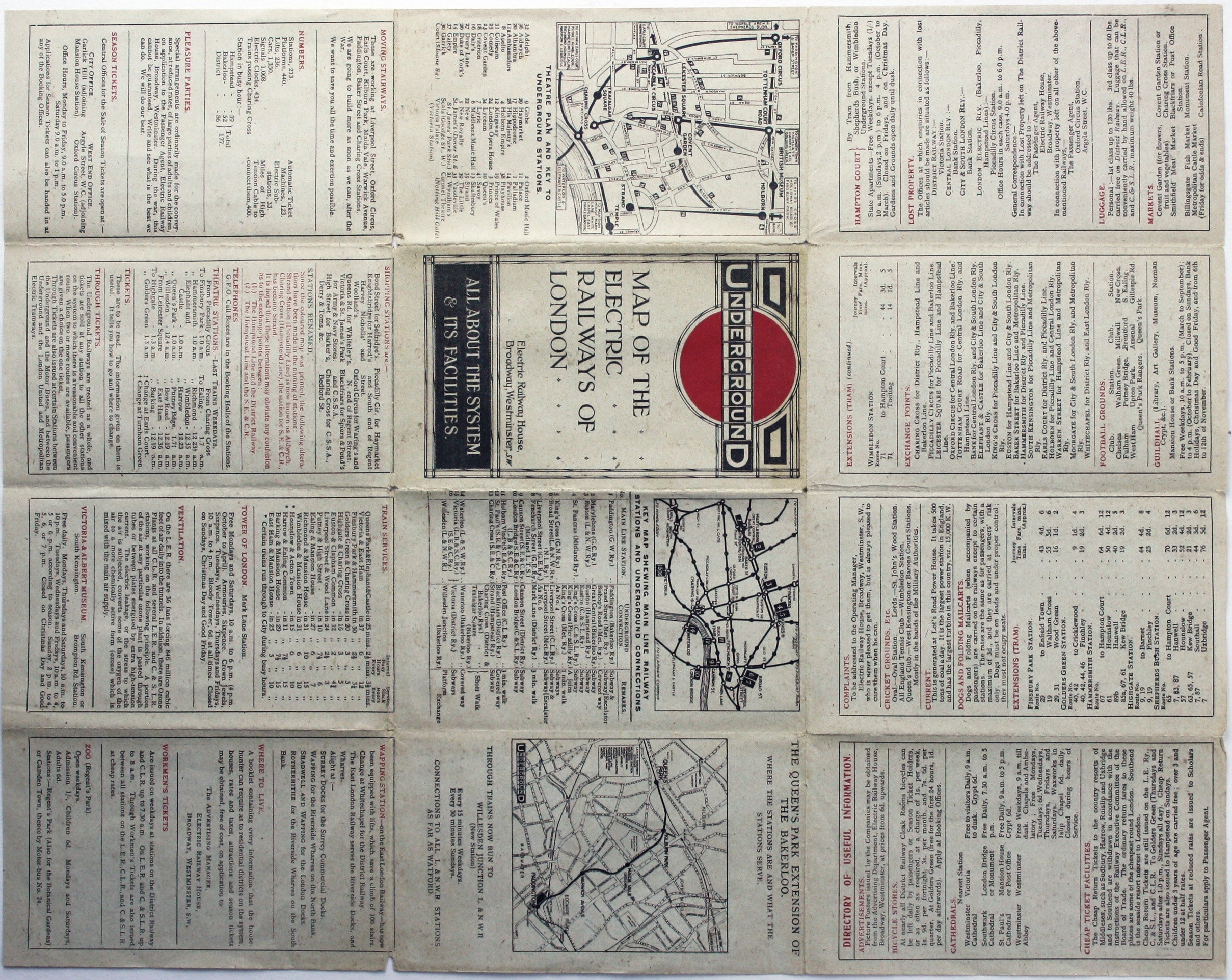
A number of variants of this map were issued 1913-1915. Our example has the subtitle on the cover ‘all about the system & its facilities’. First World War issues seem relatively scarce in acceptable condition, partly due to the poor quality of the paper used. Economies were also made in the use of colour, differentiating only between the lines of the UERL and the Metropolitan Railway.
Read more
Condition & Materials
12 panel passenger map of the London underground, 34 x 43.5 cm, printed in colours, slight wear at folds and age toning due to paper quality, text on covers includes ‘directory of useful information’, a map showing connections with mainline termini and a further map illustrating new services to Willesden Junction via Queen’s Park on the Bakerloo Line (post May 1915). Read less