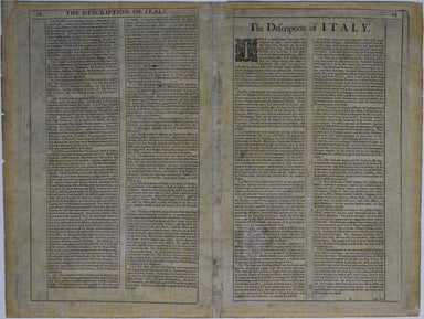
Speed's Carte à Figure of Italy
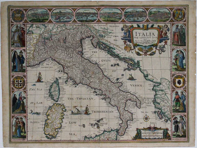
This 'carte à figure' map of Italy includes eight costume vignettes and six city views around the edges, with the coats of arms of Corsica and Sard...
View full details

This 'carte à figure' map of Italy includes eight costume vignettes and six city views around the edges, with the coats of arms of Corsica and Sard...
View full details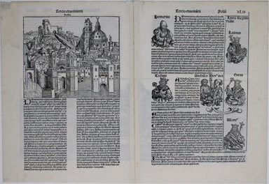
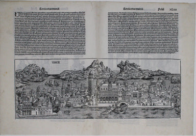
This is one of the earliest obtainable views of Venice, derived from a larger woodcut by Dutch artist Erhard Reuwich, which was published in the fi...
View full details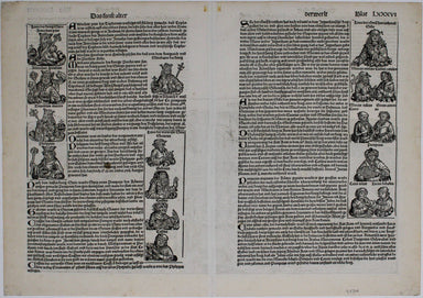
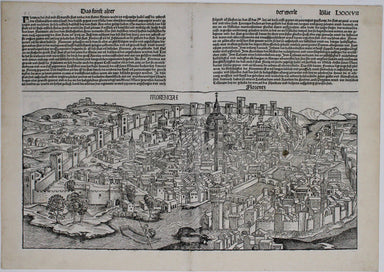
This is one of the earliest obtainable views of Florence, derived from a lost engraving by Francesco Rosselli. The woodcuts were created in the wor...
View full details
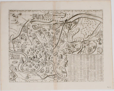
Plan Des Antiquitez De Rome, Représentées Et Distinguées Suivant La Situation De Chacun De Ses Anciens Monuments / Roma Vetus This map of Rome is a...
View full details
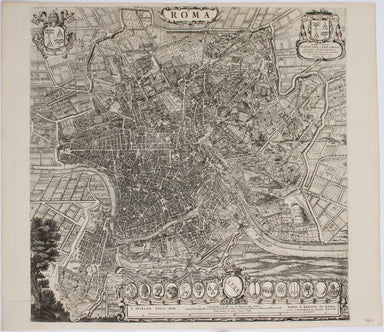
Pierre Mortier acquired the copper printing-plates for Blaeu's great town books of Italy, which were originally published from the 1660s onwards, a...
View full details
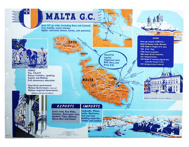
Come for the Stone Age remains, stay for the rawhide... This simplified map of Malta and Gozo is surrounded by views, statistics and historical inf...
View full details
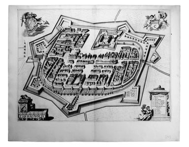
Carmagnola, just south of Turin in Piedmont, was fought over and extensively remodelled in the mid seventeenth-century; it was briefly recaptured b...
View full details
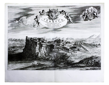
Exigua & celeberrima Verruca […] This is a map of Verrua Savoia, north east of Turin in Piedmont. Blaeu’s townbook of Savoy and Piedmont was fi...
View full details
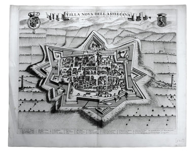
Villa Nova dell’ Astegiana This is a map of Villanova d’Asti, in Piedmont. Blaeu’s townbook of Savoy and Piedmont was first published by the Blaeu ...
View full details
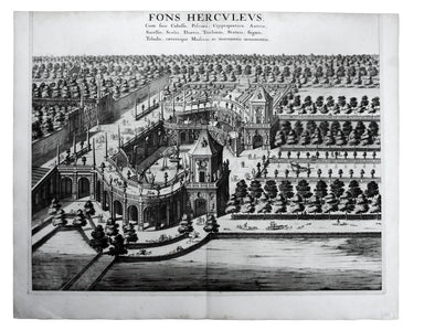
Fons Herculeus: Cum Suis Colosso, Cryptoporticu, Antris, Sacellis, Scalis, Dioetis, Tricliniis, Statuis, Signis, Tabulis, Coeterisque Musivis, ac m...
View full details
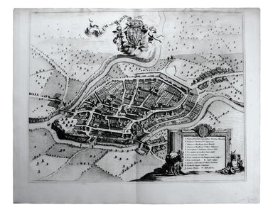
Rumiliacum vulgo Rumilly Blaeu’s townbook of Savoy and Piedmont was first published by the Blaeu heirs in 1682, but the plates were purchased and r...
View full details
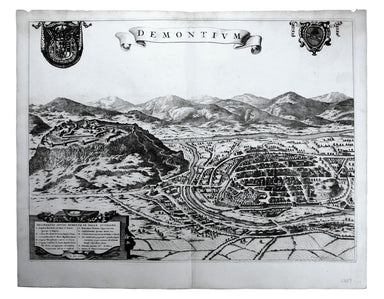
This map of Demonte in Piedmont was engraved by Juvenal Boetto. Blaeu’s townbook of Savoy and Piedmont was first published by the Blaeu heirs in 16...
View full details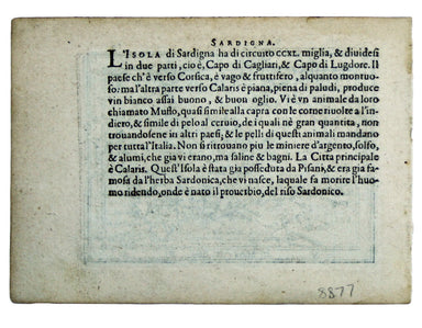
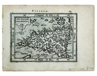
This map of Sicily is from the second series of maps engraved by Philip Galle for the Epitome, the pocket atlas version of Ortelius’ Theatrum. Cond...
View full details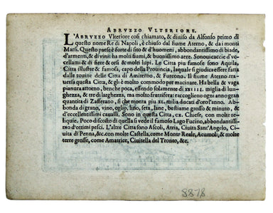
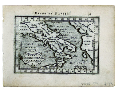
Typus Regni Neapolitani This map of the Kingdom of Naples is from the second series of maps engraved by Philip Galle for the Epitome, the pocket at...
View full details
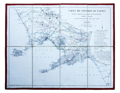
Carta de’ Contorni di Napoli, costrutta ed eseguita, sui piu recenti ed esatti materiali da Benedetto Marzolla, con tutte le strade postali, rotabi...
View full details
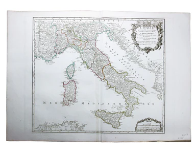
L’Italie qui comprend les Etats de Piémont, les Duchés de Milan, de Parme, de Modene, de Mantoue etc., les Républiques de Genes, de Venise, de Luqu...
View full details
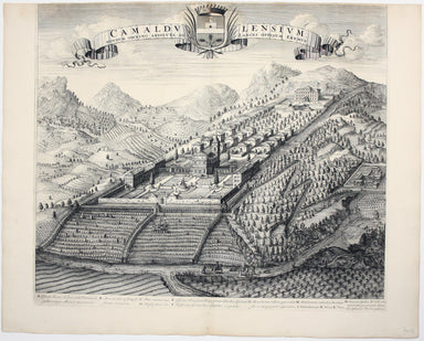
Camaldulensium, nondum omnino absoluta ad Lancei oppidum eremus This is the Camaldolese hermitage near Lanzo Torinese in Piedmont (which is visible...
View full details
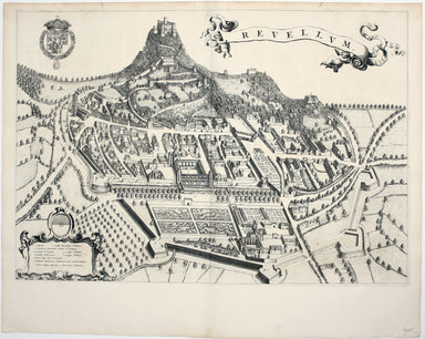
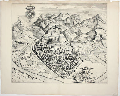
This is a map of Revello, near Cuneo in Piedmont. Blaeu’s townbook of Savoy and Piedmont was first published by the Blaeu heirs in 1682, but the pl...
View full details
This is a map of Ormea, near Cuneo in Piedmont. Blaeu’s townbook of Savoy and Piedmont was first published by the Blaeu heirs in 1682, but the plat...
View full details
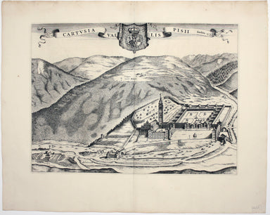
Cartusia Vallis Pisii, fundata 1173 This is the Charterhouse of Pesio, a Carthusian foundation near Cuneo in Piedmont. Blaeu’s townbook of Savoy an...
View full details
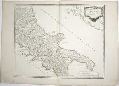
Partie Septentrionale du Royaume de Naples This is a later state of Robert de Vaugondy’s map of the northern part of the Kingdom of Naples. The ori...
View full details
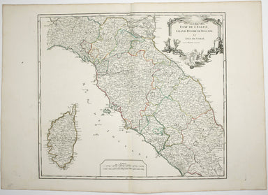
Etat de l’Eglise, Grand Duché de Toscane, et Isle de Corse This is a later state of Robert de Vaugondy’s map of the Papal States, Tuscany and Corsi...
View full details
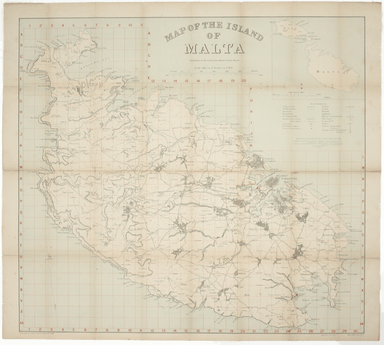
In the 1920s Valletta was the location of the Royal Navy's Mediterranean Fleet's headquarters. Prepared on the island, this map of Malta has a grid...
View full details
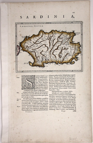
This is a map of the Italian island of Sardinia, oriented with north to the left of the map. Condition & Materials Copper engraving, sheet size...
View full details
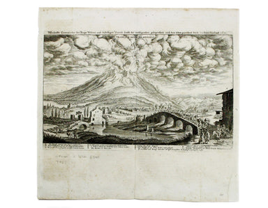
This view shows the major eruption of Vesuvius in December 1631, published by Merian and his heirs in various works, including the Itinerarium Ital...
View full details
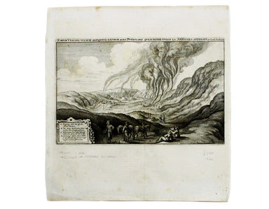
This is a view of the Solfatara volcanic crater, mythological home of Vulcan in the Phlegraean Fields at Pozzuoli, near Naples. It was published by...
View full details
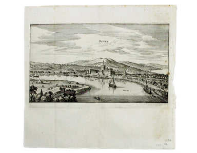
This plan of of Ostia was published by Merian and his heirs in various works, including the Itinerarium Italiae of 1640, the Archontologia cosmica ...
View full details
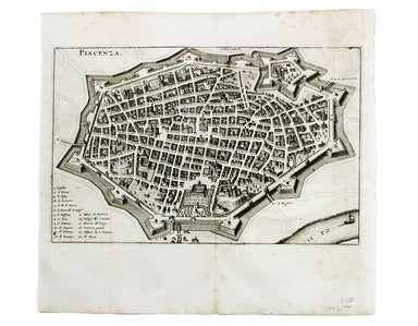
This plan of Piacenza was published by Merian and his heirs in various works, including the Itinerarium Italiae of 1640, the Archontologia cosmica ...
View full details
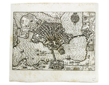
This plan of Mantua was published by Merian and his heirs in various works, including the Itinerarium Italiae of 1640 and editions of the Theatrum ...
View full details
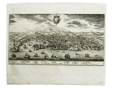
This plan of Genoa was published by Merian and his heirs in various works, including the Itinerarium Italiae of 1640 and editions of the Theatrum E...
View full details
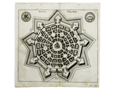
This plan of Palmanova (a Venetian town founded in 1593, sheltered behind innovative fortifications taking the form of a nine-pointed star) was pub...
View full details
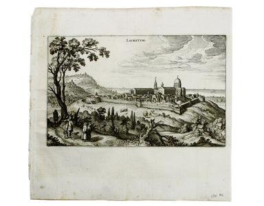
This plan of Loreto (site of the Basilica della Santa Casa) was published by Merian and his heirs in various works, including the Itinerarium Itali...
View full details
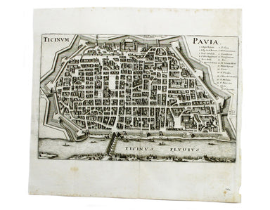
This plan of Pavia (the ancient Ticinum) was published by Merian and his heirs in various works, including the Itinerarium Italiae of 1640 and edit...
View full details
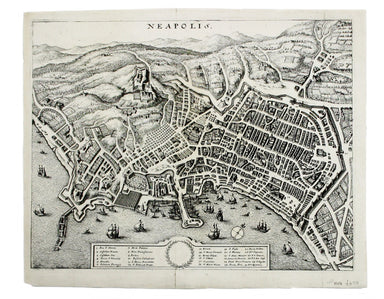
This plan of Naples was published by Merian and his heirs in various works, including the Itinerarium Italiae of 1640 and editions of the Theatrum ...
View full details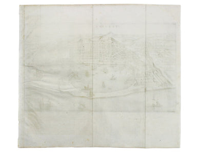
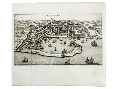
This plan of Messina was published by Merian and his heirs in various works, including the Itinerarium Italiae of 1640 and editions of the Theatrum...
View full details
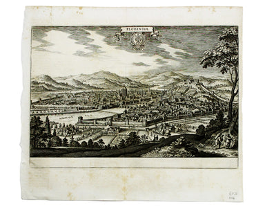
This plan of Florence was published by Merian and his heirs in various works, including the Itinerarium Italiae of 1640 and editions of the Theatru...
View full details
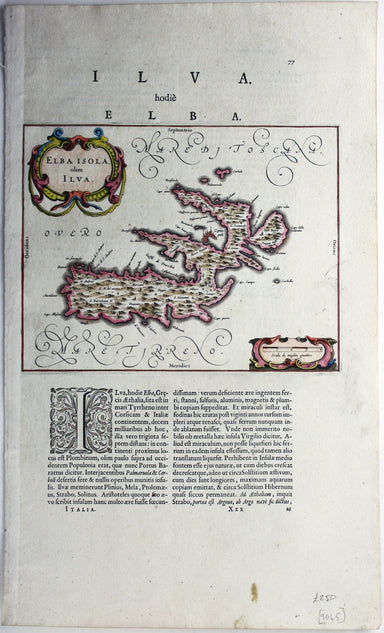
This is the Tuscan island of Elba, a map newly added to the ‘Atlas Novus’ in 1640. Koeman records that it was first published in the French text ed...
View full details
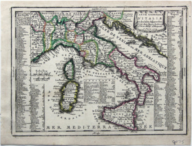
This map of Italy is coloured to show the Papal States, Kingdom of Naples, the Venetian and Genoese Republics etc, and is flanked by a chronologica...
View full details
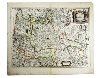
This map of Milan shows towns heightened in gold. Condition & Materials Copper engraving, 41.5 x 54 cm, original hand-colour, closed tears, min...
View full details
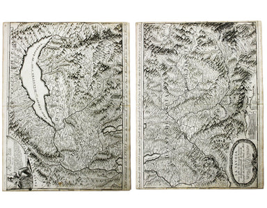
La Savoia divisa nelle sue Principali Provincie da Giacomo Cantelli da Vignola [….] This is a map of Savoy from Mercurio Geografico, an unusual and...
View full details
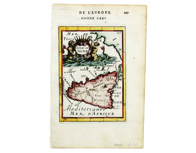
This map of Sicily is from Mallet’s Description de l’Univers, first published in Paris in 1683 and reprinted with German text in Frankfurt the foll...
View full details
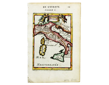
This map of Italy is from Mallet’s Description de l’Univers, first published in Paris in 1683 and reprinted with German text in Frankfurt the follo...
View full details
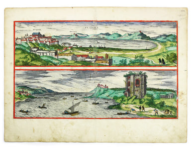
Views of two towns on the Bay of Naples, Pozzuoli and Baia, are here presented on one sheet. The Civitates Orbis Terrarum was one of the most signi...
View full details
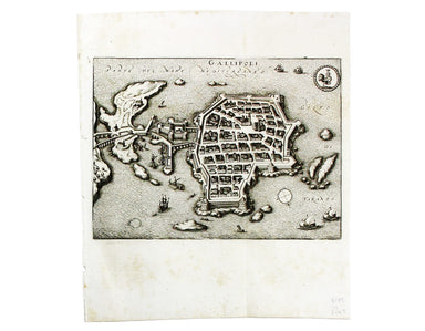
This map of Gallipoli in Apulia was published by Merian and his heirs in various works, including the Itinerarium Italiae of 1640, the Archontologi...
View full details
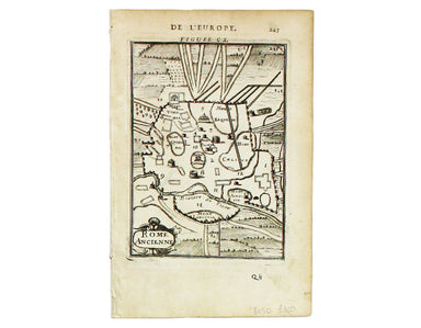
Rome Ancienne This plan of ancient Rome is from Mallet’s Description de l’Univers, first published in Paris in 1683 and reprinted with German text ...
View full details
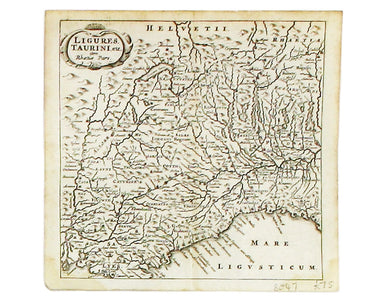
Ligures, Taurini etc, item Rhaetiae pars Clüver is regarded as one of the founders of historical geography; his Introductionis in universam geograp...
View full details
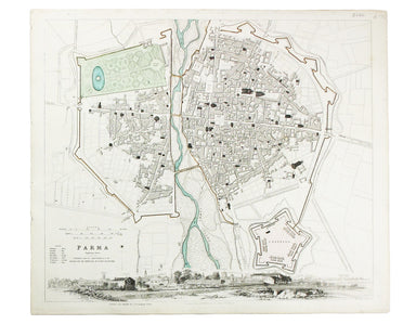
This map includes a panoramic view of Parma at its foot, blank. The Society for the Diffusion of Useful Knowledge was founded in 1826 with the high...
View full details
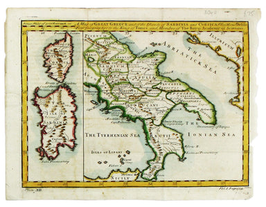
A Map of Great Greece and of the Islands of Sardinia and Corsica This map of the Greek colonies in southern Italy was published in An Universal His...
View full details
