

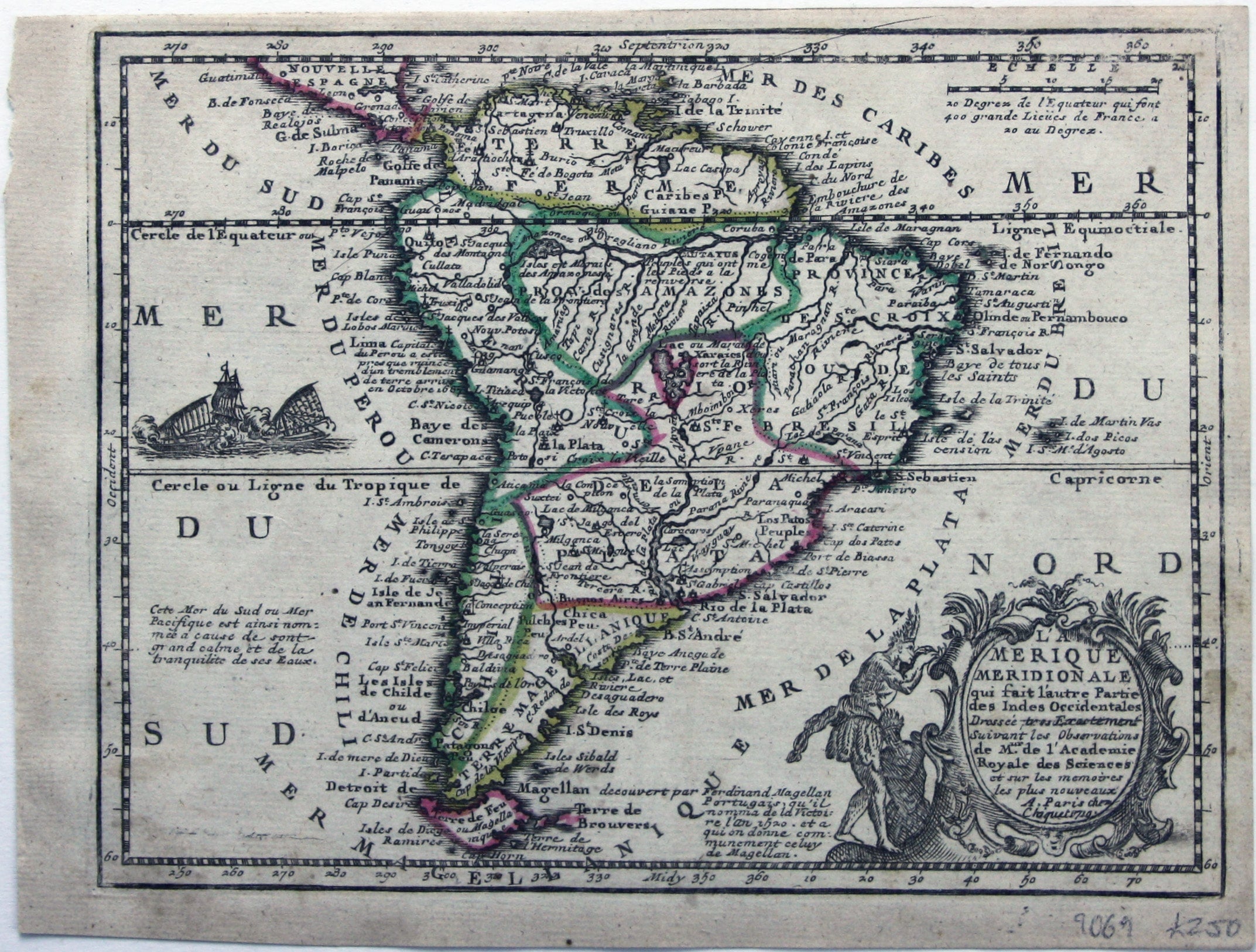
Chiquet’s Map of South America
SKU: 9069
Title:
Chiquet’s Map of South America
Date of publication:
Printed Measurement:
Colour:
Mapmaker:
L’Amerique Meridionale qui fait l’autre partie des Indes Occidentales
This map of South America features figures in indigenous costume and a vignette of a sea battle between a European galleon and local craft. Text at the foot of the map describes Magellan's discovery of the Magellan Straits in 1520. Read more
The map was published in Jacques Chiquet’s ‘Le nouveau et curieux atlas géographique et historique ...’.
Chiquet (1673-1721) was a relatively successful Parisian engraver, print- and map-seller. He published Antoine Menard’s ‘Le nouveau et curieux atlas’ in 1711, and reprinted it with Menard’s name burnished from the plate and replaced with his own and a new date, 1719, as here.
Condition & Materials
Copper engraving, 17 x 22 cm, original hand colour in outline, slight spotting to right of cartouche, blank verso. Read less