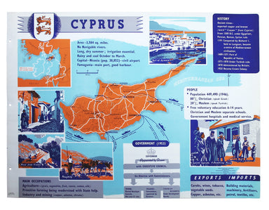
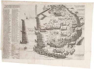
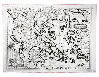
SDUK Map of Athens
SKU: 9210Title:
SDUK Map of Athens
Date of publication:
1832
Printed Measurement:
34.5 x 39.5 cm
Publisher(s):
Colour:
modern
Mapmaker(s):
Engraver(s):
Josiah Henshall
Steel engraving, 34.5 x 39.5 cm, engraved by Josiah Henshall after William Barnard Clarke, original hand colour, a couple of light spots, margins trimmed close as usual with this plate, numbered in an old hand, blank verso.
This map of Athens focuses on the antiquities: in the lower border are reconstructed elevations of the principal ancient buildings; the remaining three sides are derived from C.R. Cockerell’s panorama. Although Athens had emerged as the capital of newly independent Greece, the population in 1832 was a mere 4000 (estimates of the population in the mid 5th century BCE range from 120,000-180,000).
The Society for the Diffusion of Useful Knowledge was founded in 1826 with the high-minded aim of making 'useful' information available to self-taught members of the working and lower middle classes. Some of the material was decidedly abstruse, subscribers fell away and the Society was wound up in 1848; however, the series of 209 maps published over a 14 year period from 1829 onwards were highly praised for their superior quality, accuracy and aesthetic appeal and remain an outstanding achievement.