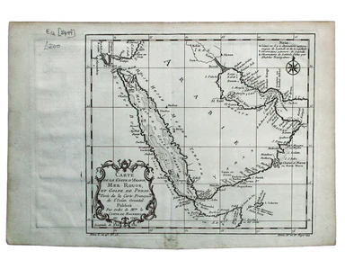
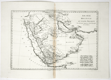
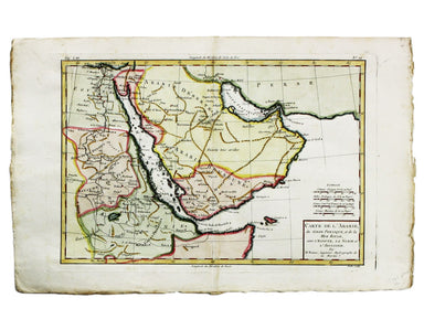
Weigel’s Map of Ancient Arabia
SKU: 9184Title:
Weigel’s Map of Ancient Arabia
Date of publication:
1720
Printed Measurement:
32 x 38.5 cm
Colour:
original
Mapmaker(s):
Arabiae Veteris Typus
Copper engraving, 32 x 38.5 cm, original hand colour, trivial spotting, blank verso; map of ancient Arabia, published in Johann David Köhler’s historical atlas "Descriptio Orbis Antiqui..."
The map is coloured to show the Roman classifications of the peninsula into Arabia Petraea (a frontier province of the Roman Empire), Arabia Deserta and Arabia Felix, the latter name a reference to prosperity brought by the spice trade. The title is surrounded by ancient coins and medals, some of Roman origin, mostly copied from genuine examples minted between circa 50 BCE to around 200 CE.