Bryars & Bryars
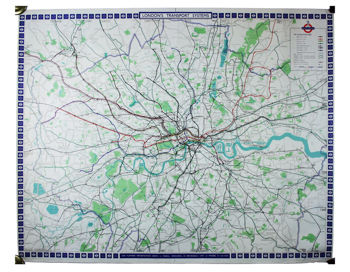
Lewis’ Map of the London Transport System
Lewis’ Map of the London Transport System
Couldn't load pickup availability
Benjamin Getzel Lewis' map of the London underground shows the Victoria Line under construction in the originally proposed colour
Lewis (1900-1966) designed posters for the Underground and London Transport between 1931 and the 1960s. His series of geographical maps were published 1956-1969, available as either folding passenger maps or (as here) station posters. He shows Underground and British Rail routes and roads serves by buses and coaches.
Roberts notes that they were expensive to print, and the print run of this edition was just 2500. The Victoria Line is shown as under construction, in the originally proposed lilac. The London Transport roundel has been adapted to include a north pointer.
Condition & Materials
Quad royal station wall map, 101 x 126.5 cm, one or two trivial marginal nicks and creases, blank verso, stamped ‘office copy’ beneath the imprint.
References
Roberts, ‘Underground maps after Beck’, p. 72.
Share