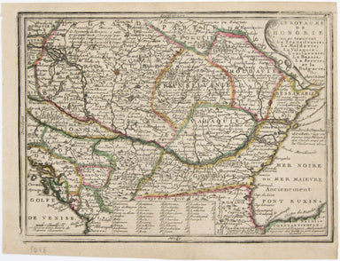
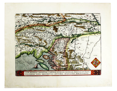
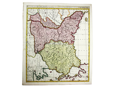
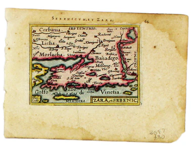
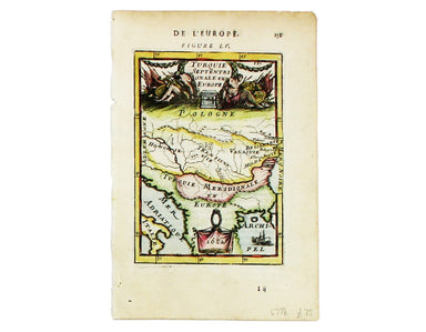
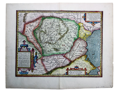

Mapping the Megali Idea
This map was first published by Stanford’s in 1918, and remained topical enough to be reprinted for British periodical ‘The Sphere’ the following y...
View full detailsThis map was first published by Stanford’s in 1918, and remained topical enough to be reprinted for British periodical ‘The Sphere’ the following y...
View full detailsIllustrating the Eastern Question The Great Eastern Crisis was sparked by rebellions in Ottoman territories in southeastern Europe: Herzegovina, Bo...
View full detailsLe Royaume de Hongrie, ou se trouvent la Transilvanie, la Moldavie, la Valaquie, la Bosnie la Servie et la Bulgarie, &c. Our map of Hungary and...
View full detailsThe Daily Mail War Map of the Balkan Peninsula An advertisement on inside cover of this war map of the Balkans advises readers to follow ‘the effec...
View full detailsCollection of 61 ‘basic’ and ‘zone’ handbooks covering enemy and occupied countries in Europe, and Siam. A collection of 61 intelligence handbooks,...
View full detailsEuropean Dominions of the Ottomans, or Turkey in Europe Greece had become an independent nation after the war of 1821-30, but most other Balkan sta...
View full detailsSchlavoniae, Croatiae, Carniae, Istriae, Bosniae, Finitimarumque Regionum Nova Descriptio. Copper engraving, 33 x 46 cm, modern hand-colour, Latin ...
View full detailsTransilvania Copper engraving, 33 x 45 cm, modern hand-colour, Latin text on verso. This is the second version of Ortelius’ map of Transylvania, n...
View full detailsRomaniae, (quae olim Thracia dicta) Vicinarumque Regionum, uti Bulgariae, Walachiae, Syrfiae, etc. Descriptio. Copper engraving, 36.5 x 50 cm, rec...
View full detailsBulgaria et Romania: divisa in singulares sangiacatus Silistriam, Nicopolin, Bodinum, Sardiam, Bysantium, Kirkeliam et Gallipolin, una cum finitimi...
View full detailsKriechich Wyssenburg Woodcut, 11.5 x 15.8 cm, black and white, set within descriptive German text, some spotting, sheet size 33.2 x 21.5 cm, old re...
View full detailsZara et Sebenic Copper engraving, 8 x 11 cm, recent hand-colour, waterstaining in upper margin, Latin text on verso. A map of Zara and Sebinico on ...
View full detailsRagusa [with] Negroponte Copper engraving, 20.5 x 30.5 cm, black and white, slight spotting, blank verso. Map of Dubrovnik and Chalcis, published b...
View full detailsTurquie Septentrionale en Europe Copper engraving, 15 x 10.5 cm, recent hand-colour, French text on verso, this map of the Northern Ottoman Territo...
View full detailsDaciarum, Moesiarumque, vetus descriptio. Copper engraving, 36 x 46 cm, modern hand colour, Latin text on verso. A map of Ancient Dacia and Moesia,...
View full details