

Ortelius' Miniature Epitome Map of Normandy
This miniature map of Normandy was engraved by brothers Ambrose and Ferdinand Arsenius circa 1601 for a third ‘epitome’ (or pocket version) of Orte...
View full details

This miniature map of Normandy was engraved by brothers Ambrose and Ferdinand Arsenius circa 1601 for a third ‘epitome’ (or pocket version) of Orte...
View full details

A voyage round the world, in the years MDCCXL, I II, III, IV by George Anson, esq; now Lord Anson... compiled from his his letters and papers by Ri...
View full details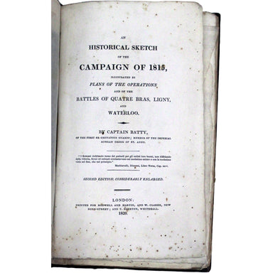

An Historical Sketch of the Campaign of 1815, illustrated by plans of the operations and of the battles of Quatre Bras, Ligny, and Waterloo... seco...
View full details

This map shows Lisbon on the banks of the River Tagus, still at the height of her prosperity as the hub of a Portuguese empire and trade network wh...
View full details

This plan of the town and harbour of Mahon, St. Philip’s Castle, and its fortifications was engraved by Isaac Basire and published in Nicholas Tind...
View full details

Celeberrima urbs Venetiae This bird's eye plan of the city of Venice and the larger islands is a revised and anonymous version of the Merian plan. ...
View full details

This miniature map of Austria was engraved by brothers Ambrose and Ferdinand Arsenius circa 1601 for a third ‘epitome’ (or pocket version) of Ortel...
View full details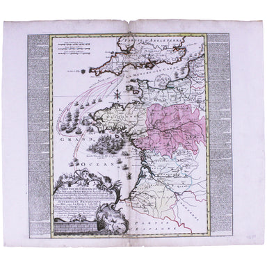
Brittische Übermacht zur See wieder Franckreich Ao. 1759... Superiorite Britannique par Mer contre La France l'An 1759... This map is a contemporar...
View full details
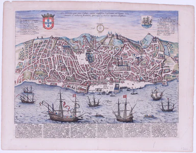
Olissippo quae nunc Lisboa, civitas amplissima Lusitaniae, ad Tagum, totius Orientis, et multarum Insularum Aphricaeque et Mericae emporium nobilis...
View full details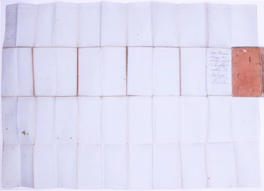
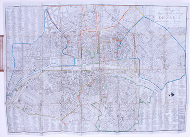
Plan Routiere de la Ville et Fauxbourgs de Paris divisé en douze Maries, revu et corrigé par Hérisson, géographe Our map shows the Paris of Charles...
View full details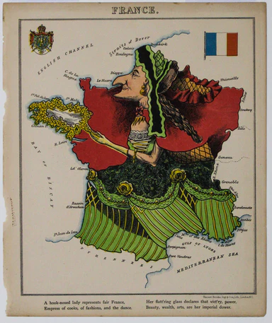
Though credited on the title-page under his pen-name ‘Aleph’, William Harvey himself gives all the credit for this series of comic maps to a “young...
View full details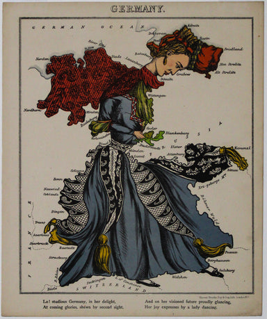
Though credited on the title-page under his pen-name ‘Aleph’, William Harvey himself gives all the credit for this series of comic maps to a “young...
View full details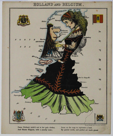
Thus anthropomorphic map of Holland and Belgium was published in “Geographical Fun: Being Humorous Outlines of Various Countries.”. Though credited...
View full details
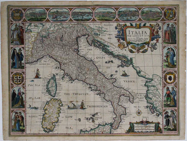
This 'carte à figure' map of Italy includes eight costume vignettes and six city views around the edges, with the coats of arms of Corsica and Sard...
View full details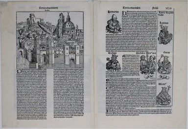
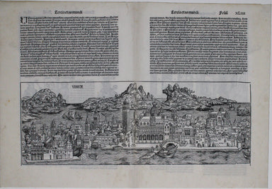
This is one of the earliest obtainable views of Venice, derived from a larger woodcut by Dutch artist Erhard Reuwich, which was published in the fi...
View full details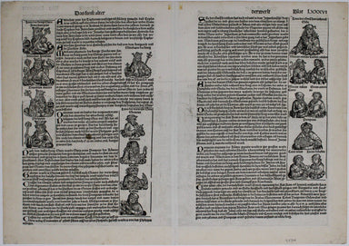
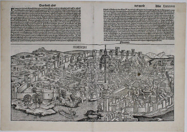
This is one of the earliest obtainable views of Florence, derived from a lost engraving by Francesco Rosselli. The woodcuts were created in the wor...
View full details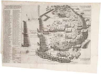
L’ordine et vera dispositione che tenero le galere de l’armata della Santa lega nel conflito navale ali 7 ottob. 1571 giorno de S.agiustina a cuzzo...
View full details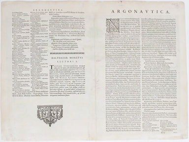
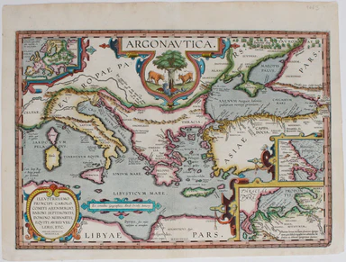
The Argonautica illustrates the mythical voyage of Jason and the Argonauts in their quest for the Golden Fleece. The map shows Black Sea and easter...
View full details
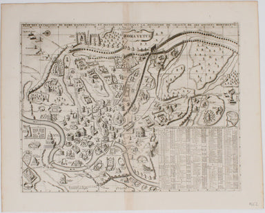
Plan Des Antiquitez De Rome, Représentées Et Distinguées Suivant La Situation De Chacun De Ses Anciens Monuments / Roma Vetus This map of Rome is a...
View full details
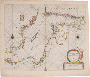
Pas-Caart van de Oost Zee Verthoonende alle de Ghelegentheydt tusschen t'Eylandt Rugen ende Wyborg From one of the finest Dutch marine atlases of t...
View full details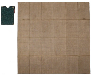
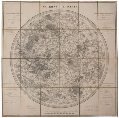
Condition & Materials Circular folding map of the environs of Paris, 79 x 79 cm, engraved by Barrière (Pére) after Bariolle, black and white, d...
View full details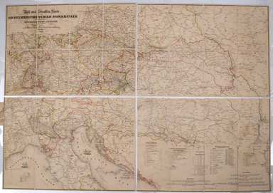
Folding map showing the post roads of the Austro-Hungarian Empire. Condition & Materials 4 folding engraved map sheets, which can be joined, e...
View full details
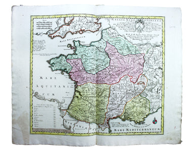
Gallia Augustiniana in suas provincias divisa… A map of Roman Gaul, with Lotter’s imprint. In 1756 Lotter succeeded his father-in-law, Georg Mattha...
View full details
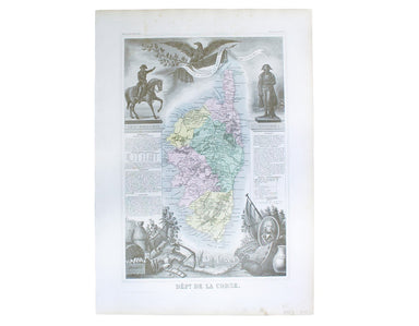
Départment de la Corse A map of Corsica from an edition of Levasseur’s ‘Atlas National Illustré’. Condition & Materials Steel engraving, engrav...
View full details
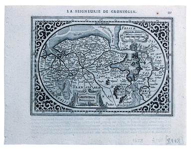
This map of the province of Groningen in the Netherlands, set within an elaborate strapwork border, was published in the ‘Atlas Minor’. A new serie...
View full details
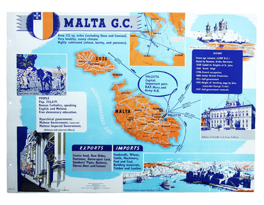
Come for the Stone Age remains, stay for the rawhide... This simplified map of Malta and Gozo is surrounded by views, statistics and historical inf...
View full details
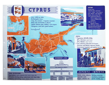
This simplified map of Cyprus was a visual aid published as sheet 4 in a portfolio titled ‘Empire Information Project. The island is surrounded by ...
View full details
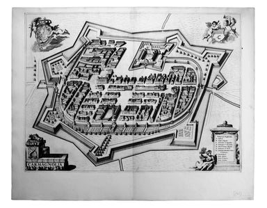
Carmagnola, just south of Turin in Piedmont, was fought over and extensively remodelled in the mid seventeenth-century; it was briefly recaptured b...
View full details
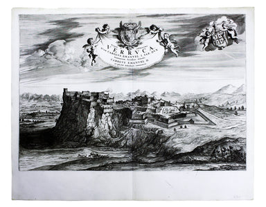
Exigua & celeberrima Verruca […] This is a map of Verrua Savoia, north east of Turin in Piedmont. Blaeu’s townbook of Savoy and Piedmont was fi...
View full details
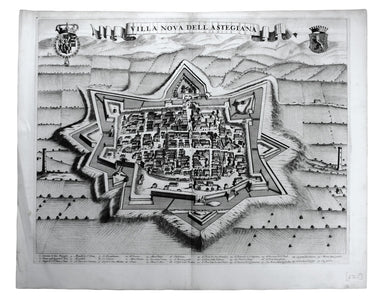
Villa Nova dell’ Astegiana This is a map of Villanova d’Asti, in Piedmont. Blaeu’s townbook of Savoy and Piedmont was first published by the Blaeu ...
View full details
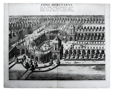
Fons Herculeus: Cum Suis Colosso, Cryptoporticu, Antris, Sacellis, Scalis, Dioetis, Tricliniis, Statuis, Signis, Tabulis, Coeterisque Musivis, ac m...
View full details
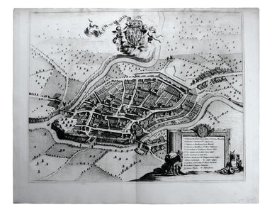
Rumiliacum vulgo Rumilly Blaeu’s townbook of Savoy and Piedmont was first published by the Blaeu heirs in 1682, but the plates were purchased and r...
View full details
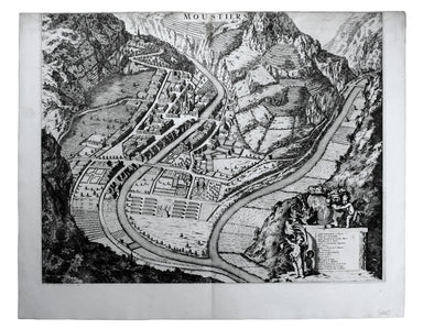
Moustiers Blaeu’s townbook of Savoy and Piedmont was first published by the Blaeu heirs in 1682, but the plates were purchased and reissued (with B...
View full details
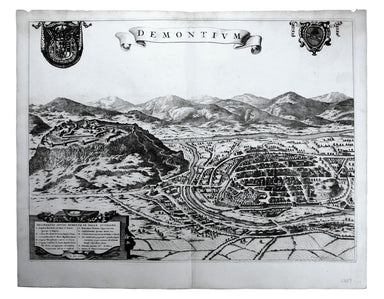
This map of Demonte in Piedmont was engraved by Juvenal Boetto. Blaeu’s townbook of Savoy and Piedmont was first published by the Blaeu heirs in 16...
View full details
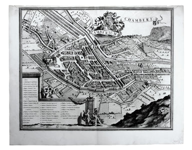
Camberium / Chambery Blaeu’s townbook of Savoy and Piedmont was first published by the Blaeu heirs in 1682, but the plates were purchased and reiss...
View full details
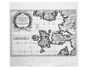
Famosae in. Archipelago, Chius hodie Scio Insulae, victricibus nuper Venetorum classe et armis Turcarum imperio ereptae, nec non aliarum adjacentiu...
View full details
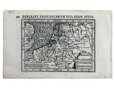
This miniature map of the Low Countries was published in the first edition of Tabularum geographicarum contractarum libri, a geographical work whic...
View full details
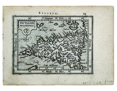
This map of Sicily is from the second series of maps engraved by Philip Galle for the Epitome, the pocket atlas version of Ortelius’ Theatrum. Cond...
View full details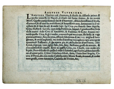
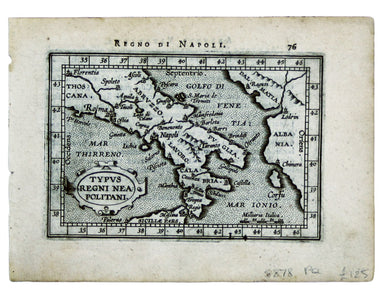
Typus Regni Neapolitani This map of the Kingdom of Naples is from the second series of maps engraved by Philip Galle for the Epitome, the pocket at...
View full details
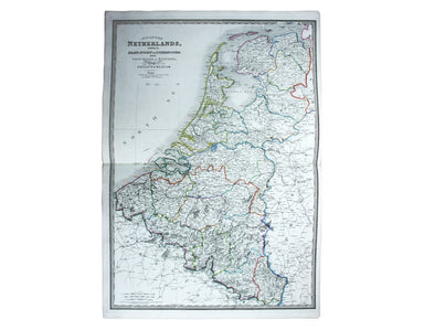
Map of the Netherlands including the Grand Duchy of Luxembourg. With the post roads and stations and the limites of Holland and Belgium This map of...
View full details
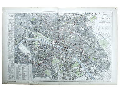
Ultimately derived from the SDUK but reflecting Haussman’s redevelopment of the city centre under Napoleon III, our example is from one of the last...
View full details
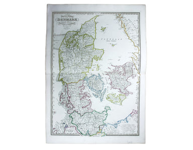
This map of Denmark is from Wyld's New General Atlas. James Wyld senior established a highly successful firm of map publishers, which passed to his...
View full details
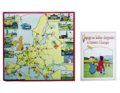
Voyage en ballon dirigeable a travers l’Europe No rule sheet, but fairly self explanatory: the board is a simplified map of Europe with vignettes o...
View full details
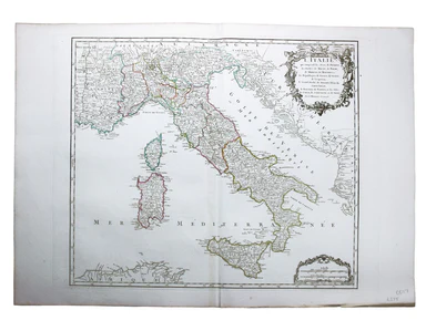
L’Italie qui comprend les Etats de Piémont, les Duchés de Milan, de Parme, de Modene, de Mantoue etc., les Républiques de Genes, de Venise, de Luqu...
View full details
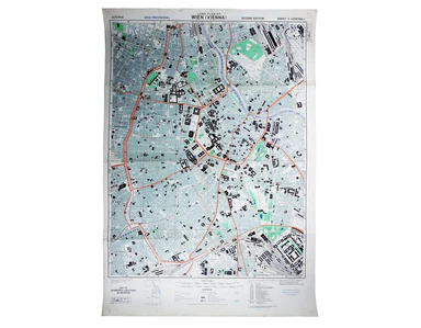
Town Plan of Wien (Vienna) – Second Edition –- Sheet 5 (Central) The Prater Park with its famous giant wheel is a fraction to the east of the city ...
View full details
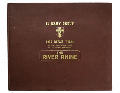
The first part of this work details the construction of semi-permanent bridges at Arnhem, Xanten, Rees and Spyck. The second part covers the equall...
View full details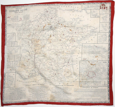
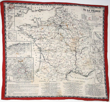
This educational handkerchief (why not?) is in the same format as the series of thirteen 'mouchoirs militaire d'instructions' patented by the comma...
View full details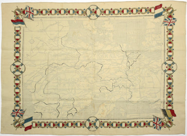
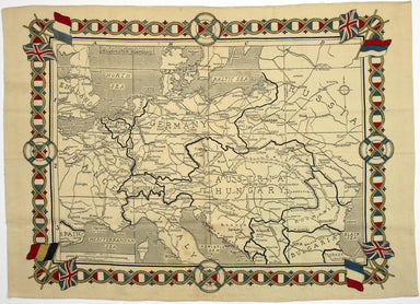
This wartime souvenir handkerchief map of Europe was issued ‘by permission of the Manchester Guardian’, who printed the map over a full broadsheet ...
View full details
