

Daily Telegraph Underground Railway and Tramway Map of London
The Daily Telegraph was one of a number of newspapers to sponsor London underground maps, like our example from 1919 which also includes the tramwa...
View full details

The Daily Telegraph was one of a number of newspapers to sponsor London underground maps, like our example from 1919 which also includes the tramwa...
View full details

A Mapp of the Parish of St Giles’s in the Fields John Stow's A Survey of the Cities of London and Westminster was originally published in 1598 and ...
View full details

Beck’s 1938 passenger map features on its reverse an enlargement of the central London area with interchange stations named inside large diamonds. ...
View full details

Underground map of London with some motor bus connections, September 1916 issue. The London General Omnibus Company was by this point owned by the ...
View full details

A New and Accurate Map of the City of Westminster, the Dutchy of Lancaster and Places Adjacent This ward plan of Westminster was engraved by Benjam...
View full details

The May 1925 issue of Stingemore’s passenger map shows Wembley Exhibition Grounds, and its covers advertise the number of escalators and other amen...
View full details

Cassell's 'immense map' of London, of which this is the central sheet, was prepared for the Weekly Dispatch and published in nine parts between Jan...
View full details

Cassell's 'immense map' of London, of which this is the south sheet, was prepared for the Weekly Dispatch and published in nine parts between Janua...
View full details

London, the Bastion of Liberty On returning to Blandford Studio in 1946 after his war service with the Air Ministry, Kerry Lee spent six months wor...
View full details

This is the North Eastern sheet of Stanford’s Library Map, extending as far east as Straford and West Ham; further sheets were available to extend ...
View full details

Wallis's Guide for Strangers, through London, and its Evirons, 1821 The stranger will here find an alphabetical list of streets corresponding to a ...
View full details

Stanford’s map of London and the twelve miles round was published in various editions between (at least) 1860 and 1903. Condition & MaterialsLi...
View full details
The Central London Railway pioneered giving maps like this one to passengers free of charge, something which we now take for granted but which only...
View full details

This issue of Beck’s 1934 map saw a slight increase in size of the card folder given away to passengers. Beck’s diagram is one of the most innovat...
View full details

Our map of the London underground is the second edition in a series designed by Fred Stingemore, issued free to passengers from May 1925 onwards an...
View full details

Souvenir Map of the Coronation procession May 12th, 1937. This decorated Map is drawn to mark the Royal Procession of Their Majesties Coronation......
View full details
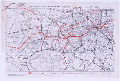
The “District Railway” Miniature Map of London and Environs (6th edition) District Railway routes are overprinted in red on this road and rail map ...
View full details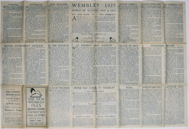
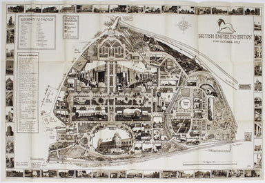
The British Empire Exhibition originally ran between April and November 1924, but it was not a financial success, and the decision was taken to reo...
View full details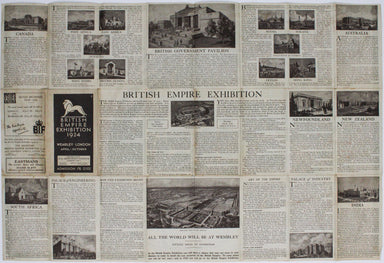
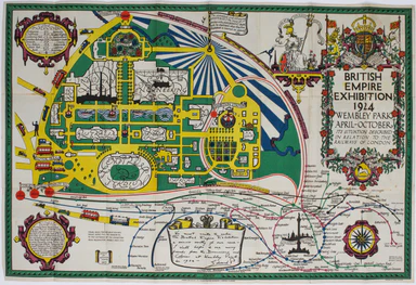
The British Empire Exhibition was, at the time, the largest exhibition staged anywhere in the world; a high profile, postwar statement of confidenc...
View full details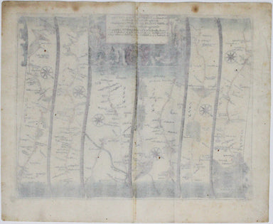
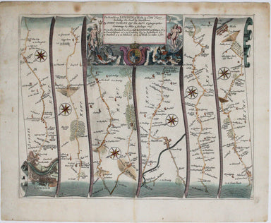
Our journey to Hythe begins in London and follows the road through East Peckham and Eltham, reaching Hythe via Maidstone. Thousands of miles of roa...
View full details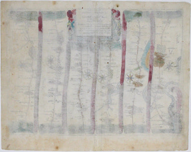
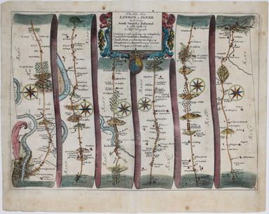
Our journey to Dover begins in London and follows the road through Deptford, Blackheath, Shooter’s Hill, and Dartford, reaching Dover via Rochester...
View full details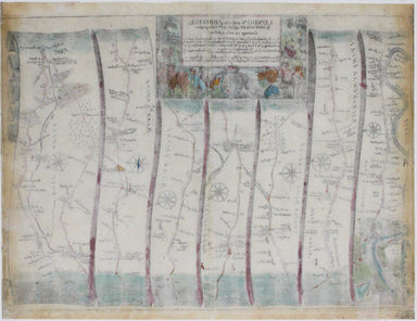
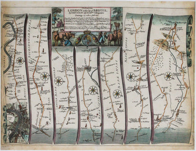
Our journey begins in London and follows the road west through Knightsbridge and Kensington (with Hyde Park to one side), Hammersmith and Turnham G...
View full details
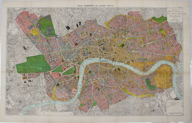
This map of London was published in the Report of the Royal Commission on London Traffic, a detailed eight volume investigation of the nature, admi...
View full details
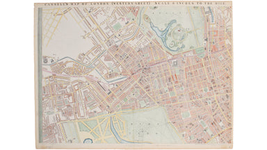
Cassell's 'immense map' of London was prepared for the Weekly Dispatch and published in nine parts between January 1861 and April 1862. This exampl...
View full details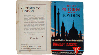
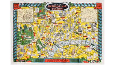
This pictorial map of London is generally dated 1931 in institutional catalogues, but here Geographia’s date-code for November 1934 is worked into ...
View full details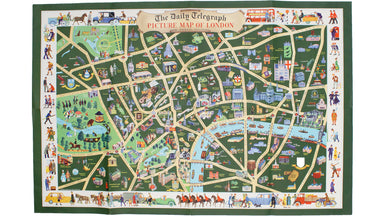
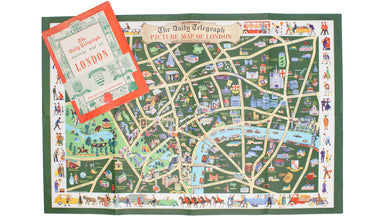
This pictorial map depicts various London ‘types’ in the borders, and shows the Royal Festival Hall (built for the 1951 Festival of Britain) and th...
View full details
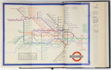
A first edition of the famous diagram from January 1933 Beck’s diagram is one of the most innovative and influential designs of the twentieth centu...
View full details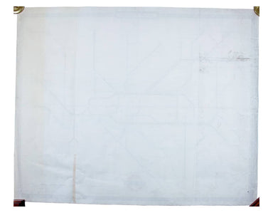
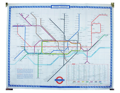
Garbutt believed he had ‘rescued’ the London Underground map from the clutches of Harold Hutchison and his ‘ham-fisted parody’ of Beck’s designs ...
View full details
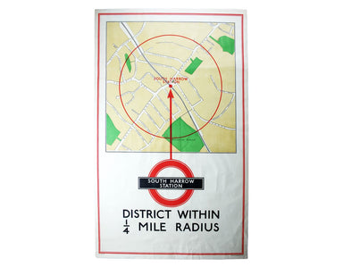
District within ¼ mile radius [of] South Harrow Stanford’s was a firm of map publishers as well as map retailers until after the Second World War, ...
View full details
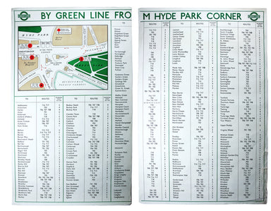
By Green Line from Hyde Park Corner This pair poster was issued in April 1947 for the start of the first summer of the fully re-instated coach netw...
View full details
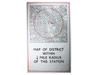
District within ¼ mile radius [of] Turnpike Lane Stanford’s was a firm of map publishers as well as map retailers until after the Second World War,...
View full details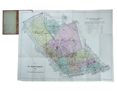
Plan of St Marylebone 1900 Detailed map of the Metropolitan Borough of St Marylebone as created by the London Government Act 1899, coloured to show...
View full details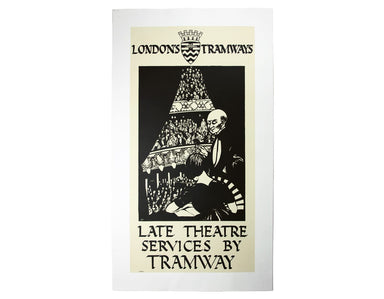
Late Theatre Services by Tramway is one of at least three posters designed by Haythorne for LCC Trams, the others being ‘Dull days made bright in t...
View full details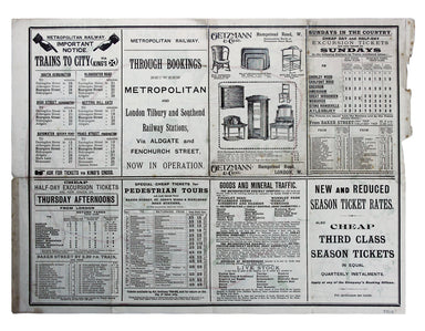
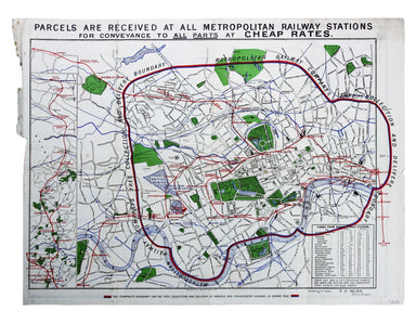
Map with lines showing the boundary for free collection and delivery of parcels and passengers’ luggage The main map shows central London, includin...
View full details
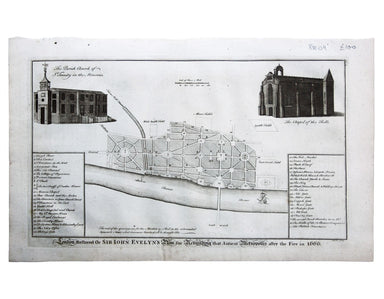
London Restored or Sir John Evelyn’s Plan for Rebuilding the Antient Metropolis after the Fire in 1666 Evelyn, Wren and Hooke were among the archit...
View full details
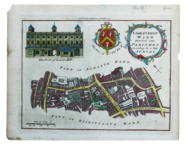
Limestreet Ward divided into Parishes according to a late Survey Possibly engraved by Thomas Bowen and first published in the London Magazine, this...
View full details
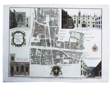
Cheap Ward with its Divisions into Parishes according to a New Survey This ward plan of Cheap was published in the greatly expanded second edition ...
View full details
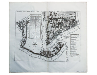
The Parish of St Johns Wapping; The Parish of St. Paul Shadwell This detailed ward plan of Wapping and Shadwell includes Execution Dock, where sent...
View full details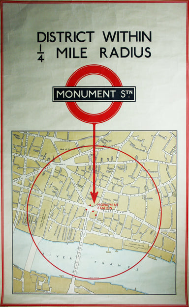
District within ¼ mile radius [of] Monument Stanford’s was a firm of map publishers as well as map retailers until after the Second World War, with...
View full details
Mary Sims and Mary Camidge, both signing as 'of Maps and Guides, Ltd', each produced posters for British Railways (Eastern Region) in 1960. They th...
View full details
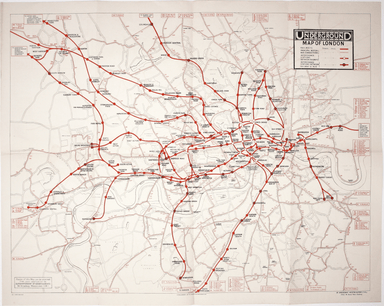
The map shows bus, tram and train services operated by the Underground Group and is very similar to the pocket map issued in guidebooks c.1924 (ill...
View full details
Beck’s diagram is possibly one of the most innovative and influential designs of the 20th century. First published in 1933, Beck remained directly ...
View full details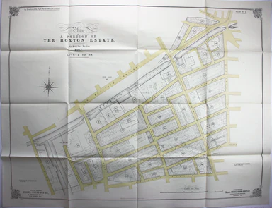
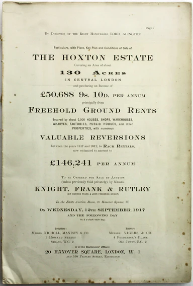
Particulars, with Plans, Key Plan and Conditions of Sale of the Hoxton Estate The Hoxton estate passed by marriage from the Pitfield to the Sturt f...
View full details
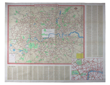
Clang, clang, clang went the trolley… Trolleybus services were introduced to London in 1931 and phased out between 1954 and 1962, making this one o...
View full details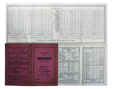
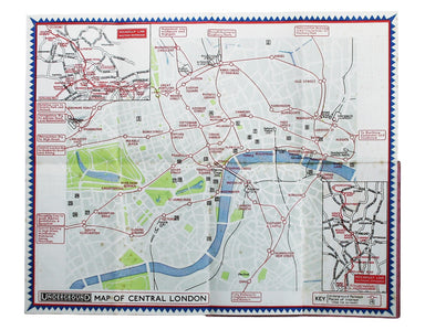
Underground Map of Central London/A Guide to Underground Travel, Through Service Sth. Harrow and the West End Leboff and Demuth draw attention to t...
View full details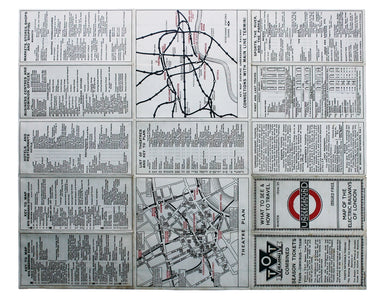
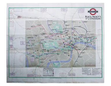
Underground Railways of London/What to see and how to travel: Map of the Electric Railways of London The continuation of lines in the margins is no...
View full details
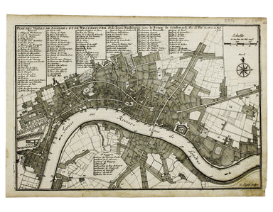
Plan Des Villes De Londres et de Westminster et leurs Faubourgs avec le Bourg de Southwark This is the first version of the map, before the date wa...
View full details
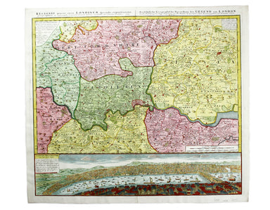
Regionis, quae est circa Londinum […] This map follows Thomas Bowles’ ‘A New and Correct Map of Thirty Miles round London’ published c. 1740. The f...
View full details
