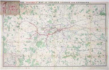
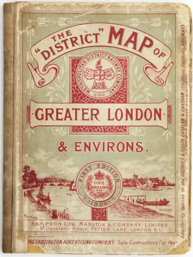
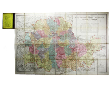
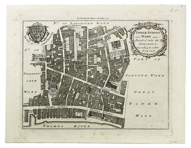
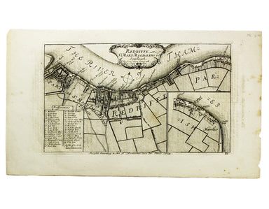
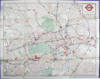
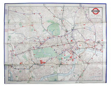
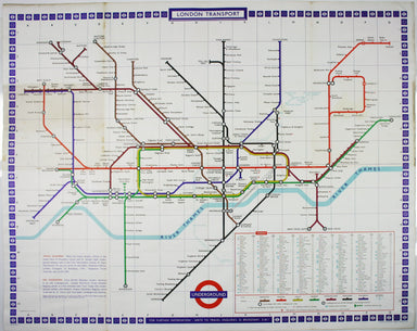
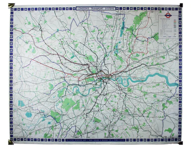
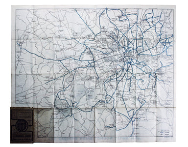
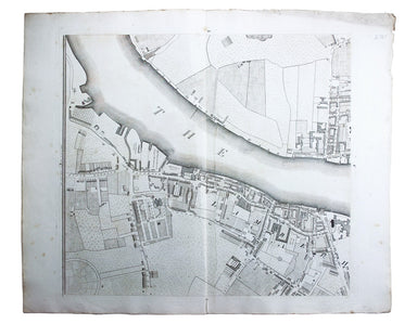
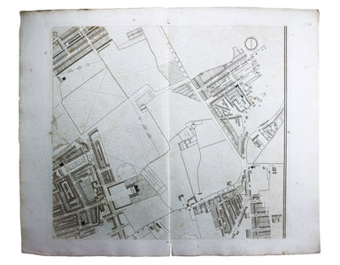
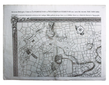
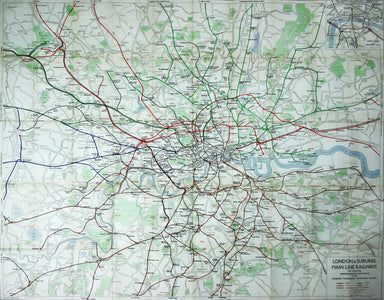
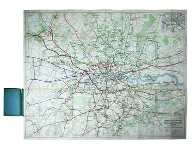
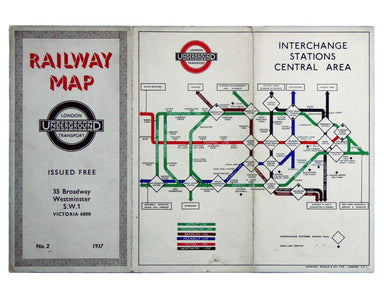
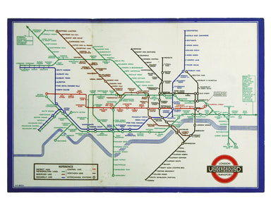
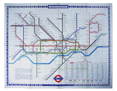
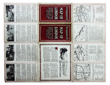
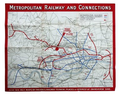

Lewis’ Quad Royal Trolleybus Map of London
Clang, clang, clang went the trolley… Trolleybus services were introduced to London in 1931 and phased out between 1954 and 1962, making this one o...
View full detailsClang, clang, clang went the trolley… Trolleybus services were introduced to London in 1931 and phased out between 1954 and 1962, making this one o...
View full detailsUnderground Map of Central London/A Guide to Underground Travel, Through Service Sth. Harrow and the West End Leboff and Demuth draw attention to t...
View full detailsUnderground Railways of London/What to see and how to travel: Map of the Electric Railways of London The continuation of lines in the margins is no...
View full detailsPlan Des Villes De Londres et de Westminster et leurs Faubourgs avec le Bourg de Southwark This is the first version of the map, before the date wa...
View full detailsRegionis, quae est circa Londinum […] This map follows Thomas Bowles’ ‘A New and Correct Map of Thirty Miles round London’ published c. 1740. The f...
View full details
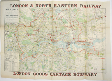
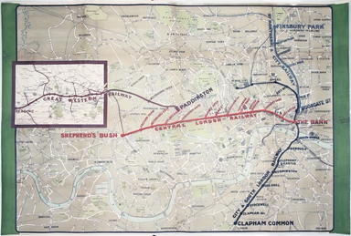
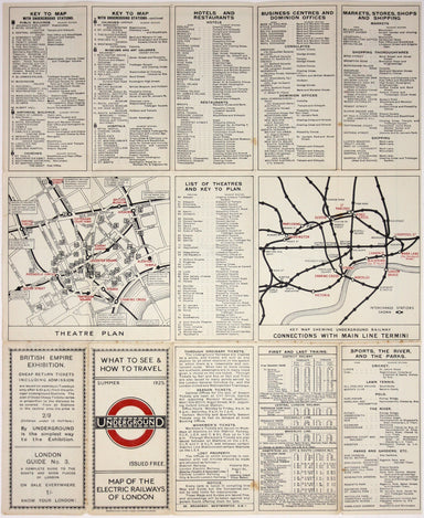
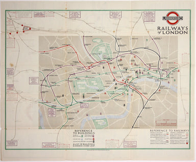
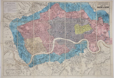
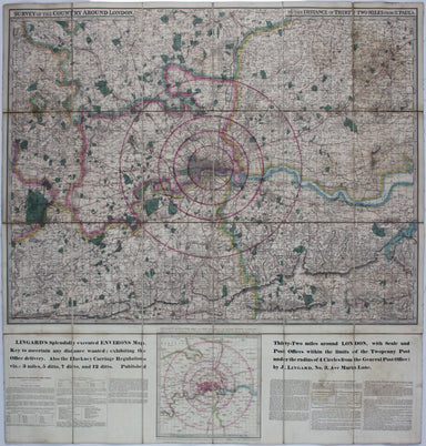
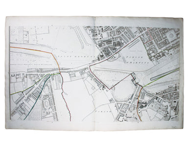
This District Railway map of Greater London shows the approximate extent from Epsom to Enfield and from Windsor to Grays, with inset of the Henley ...
View full detailsMap of London shewing Goods, Coal and Passenger Stations, Depots and Receiving Offices of the London & North Eastern Railway, also the Ordinary...
View full detailsUn-titled, undated and without a printer, this exceptionally scarce early poster was created for display in stations, but establishing which ones p...
View full detailsAn Account of the Legacies, Gifts, Rents, Fees &c. appertaining to the Church and Poor of the Parish of St, Alphege Greenwich in the County of ...
View full detailsThe history and topography of the parish of Saint Mary, Islington, in the county of Middlesex. London: printed for the author, by Gilbert & Riv...
View full detailsThis pictorial map of London employs an unusual form of Turkish fold which makes use of inclined folding lines. The map is a simplified pocket vers...
View full detailsMacDonald Gill, brother of Eric, was a successful commercial artist in his own right, and a noted calligrapher who designed the font used on all he...
View full detailsThis iteration of the UERL common design marks George Philip & Son’s first official map for the Underground Group; the firm had designed the fi...
View full detailsThe earliest versions of this map advertised the Franco-British Exhibition which closed at the end of October 1908, marked here as ‘Exhibition’. In...
View full detailsOur map shows bus, tram and train services operated by the Underground Group and is very similar to the pocket map issued in guidebooks c. 1924. T...
View full detailsThe London General Omnibus Company was by this point owned by the Underground Group and this is an early attempt at transport integration, with the...
View full detailsBacon’s large scale plan of the City of London Condition & Materials Folding map, 42.5 x 71 cm, printed in colours, laid on linen as issued, a ...
View full detailsNew Map of London with the recent improvements Condition & Materials Folding map, 51.5 x 77.5 cm, dissected into 32 panels and laid on linen as...
View full detailsA Map of the Metropolitan Boroughs within the County of London The date of publication in the lower margin of this map is significant: 25th October...
View full detailsJohn Stow's A Survey of the Cities of London and Westminster was originally published in 1598 and 1603, but revised and expanded works under his na...
View full detailsCondition & Materials Copper engraving, 19 x 25 cm, recent hand-colour, blank verso; a plan of Tower Ward published in Noorthouck’s History of ...
View full detailsJohn Stow's A Survey of the Cities of London and Westminster was originally published in 1598 and 1603, but revised and expanded works under his na...
View full detailsPlan of Coleman Street and Bassishaw Wards; Plan of Portsoken Ward; Plan of Cripplegate Ward Condition & Materials Copper engraving, 34 x 22 cm...
View full detailsA New and Correct Map of the Countries Twenty Miles round London Condition & Materials Copper engraving, 34 x 39 cm, recent hand-colour, blank ...
View full detailsThe first edition of this map was printed in 1932 but the introduction of Beck's diagram in 1933 did not obviate the need for geographically accura...
View full detailsThis was the first official London Underground passenger map to be printed since spring 1943, at least partly due to paper shortages. When printed ...
View full detailsUnderground Railways of London What to see and how to travel: Map of the Electric Railways of London Condition & Materials Summer 1925 issue of...
View full detailsThe Central London Railway produced a considerable quantity of advertising material in the Edwardian period. Other postcards included views of Lots...
View full detailsMetropolitan Goods Conference Map of Collection & Delivery Boundary This map is a variant of the London plan typically issued with Kelly’s Dire...
View full detailsSurvey of the country around London to the distance of thirty two miles from St Paul’s The map extends between Ware and Chatham, Bray and Dorking. ...
View full detailsDistrict within ¼ mile radius [of] Manor House Stanford’s was a firm of map publishers as well as map retailers until after the Second World War, w...
View full detailsGarbutt believed he had ‘rescued’ the London Underground map from the clutches of Harold Hutchison and his ‘ham-fisted parody’ of Beck’s designs. H...
View full detailsMap of London with John Rennie’s Waterloo and Southwark Bridges (opened 1817 and 1819) shown First published in 1818, the scale, top left on our ex...
View full detailsDistrict within ¼ mile radius [of] Uxbridge Stanford’s was a firm of map publishers as well as map retailers until after the Second World War, with...
View full detailsThe guide seems to have been aimed at an American audience, with several pages devoted to converting prices in pounds, shillings and pence into dol...
View full detailsThis Central London Railway map is similar in style to the UERL common design which had been in circulation since 1908, although with a chocolate r...
View full detailsBenjamin Getzel Lewis' map of the London underground shows the Victoria Line under construction in the originally proposed colour Lewis (1900-1966)...
View full detailsThe Evening News was responsible for coining the name ‘Bakerloo Line’ for the Baker Street and Waterloo Railway, and here the newspaper makes a rel...
View full detailsTower Street Ward with their [sic] divisions into Parishes according to a new survey This plan of Tower Street was published in the greatly expande...
View full detailsCheap Ward with its divisions into Parishes according to a new survey This ward plan of Cheap was published in the greatly expanded second edition ...
View full detailsBaynard’s Castle Ward [and] Faringdon Ward with their divisions into Parishes according to a new survey This was plan of Baynard’s Castle and Farin...
View full detailsPlan of Lambeth Palace 1750… from the original in the possession of Mr Singleton of Lambeth This plan of Lambeth Palace published in Ducarels’s ‘Th...
View full detailsSheet C4 from Horwood’s ‘Plan of the Cities of London and Westminster…’ Horwood’s plan is a landmark in London mapping on a number of counts. It wa...
View full detailsSheet C1 from Horwood’s ‘Plan of the Cities of London and Westminster…’ Horwood’s plan is a landmark in London mapping on a number of counts. It wa...
View full detailsEnvirons of Wembley from Rocque’s ‘An Exact Survey of the City’s of London, Westminster, ye Borough of Southwark and the Country Near Ten Miles Rou...
View full detailsThis is a view showing London before the Great Fire, from the South Bank of the Thames, including London Bridge and old St Paul’s. Principal buildi...
View full detailsThis map (two sheets from Horwood's magnificent 32 sheet survey) includes St James’s Square, the western part of Piccadilly, Green Park, Buckingham...
View full detailsPublished in March 1935, this is a commercially available map showing the operating area of the recently formed London Passenger Transport Board, a...
View full details