

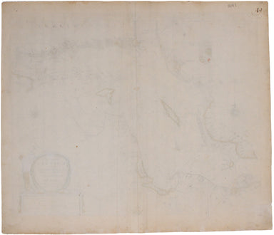
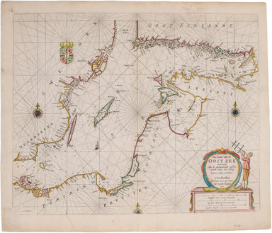
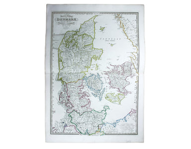
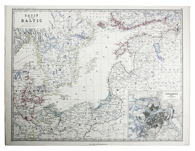
Goos' Sea Chart of the Baltic
From one of the finest Dutch marine atlases of the era comes this chart of the Baltic and the Gulf of Finland. It covers the coastlines of northeas...
View full detailsFrom one of the finest Dutch marine atlases of the era comes this chart of the Baltic and the Gulf of Finland. It covers the coastlines of northeas...
View full detailsThe warlike putti on the cartouche of this map of what is now Latvia and Estonia, with parts of Lithuania, emphasise the contested nature of the re...
View full detailsMap of the Kingdom of Denmark Copper engraving, 73.5 x 53 cm, original hand colour, blank verso; map of Denmark from Wyld's New General Atlas. Jame...
View full detailsPomeraniae Ducatus Pomerania, running along the Baltic coast between Rostock and Gdansk, is now divided between Germany and Poland. The 'Atlas Mino...
View full detailsThe Society for the Diffusion of Useful Knowledge was founded in 1826 with the high-minded aim of making 'useful' information available to self-ta...
View full detailsLe Royaume de Danemark subdivisée en ses quatre Dioceses, avec les isles ajacentes, le Duché de Slewick &c The table at the top left of this ma...
View full detailsEsats de la Couronne de Suede dans la Scandinavie Copper engraving, 16.5 x 22.5 cm, original hand colour in outline, blank verso. This map shows th...
View full detailsLe Royaume de Norwege divisé en ses cinq Principaux Gouvernements Copper engraving, 22 x 16.5 cm, original hand colour in outline, blank verso. Nor...
View full detailsPomeraniae Wandalicae Regionis Typ. [on sheet with] Livoniae Nova descriptio [and] Ducatus Oswieczensis et Zatoriensis Descriptio. An early example...
View full detailsA New Map of Sweden and Norway Copper engraving, 74 x 52 cm, original hand colour, blank verso; a map of Scandinavia from Wyld's New General Atlas....
View full detailsBasin of the Baltic Lithographed map, 45 x 57 cm, inset of St Petersburg, original colour, light waterstaining in upper margin, blank verso; a map ...
View full detailsGotland oder Gothen Woodcut, 10 x 13.5 cm, modern hand-colour, set within descriptive German text, some spotting, sheet size 32.5 x 19.5 cm. A map ...
View full detailsDie Statt Riga Woodcut, 10 x 15.8 cm, modern hand-colour, set within descriptive German text, sheet size 32.5 x 19.5 cm. A view of the Latvian capi...
View full detailsBaltic Sea Steel engraving, 25.5 x 34 cm, original outline colour, blank verso; a map of the Baltic Sea engraved by John Rapkin for the Illustrated...
View full detailsRoi de Danemarc Copper engraving, 15 x 10.5 cm, recent hand-colour, light waterstaining in margin, French text on verso, from Mallet’s ‘Description...
View full detailsSuedois Copper engraving, 15 x 10.5 cm, recent hand-colour, light waterstaining in margin, French text on verso, from Mallet’s ‘Description de l’Un...
View full detailsScandinavia complectens Sveciae, Daniae et Norvegiae Regna ex novissimis subsidiis delineata et ad Leges Projectionis Stereographicae legitimae red...
View full detailsLa Scandinavie ou sont les Royaumes de Suede, Danemark et Norwege Copper engraving, 51.5 x 60 cm, after Jaillot, original hand-colour, waterstain a...
View full details