

UERL 1909 Common Design Passenger Map
SKU: 9234
Title:
UERL 1909 Common Design Passenger Map
Date of publication:
Printed Measurement:
Publisher:
Colour:
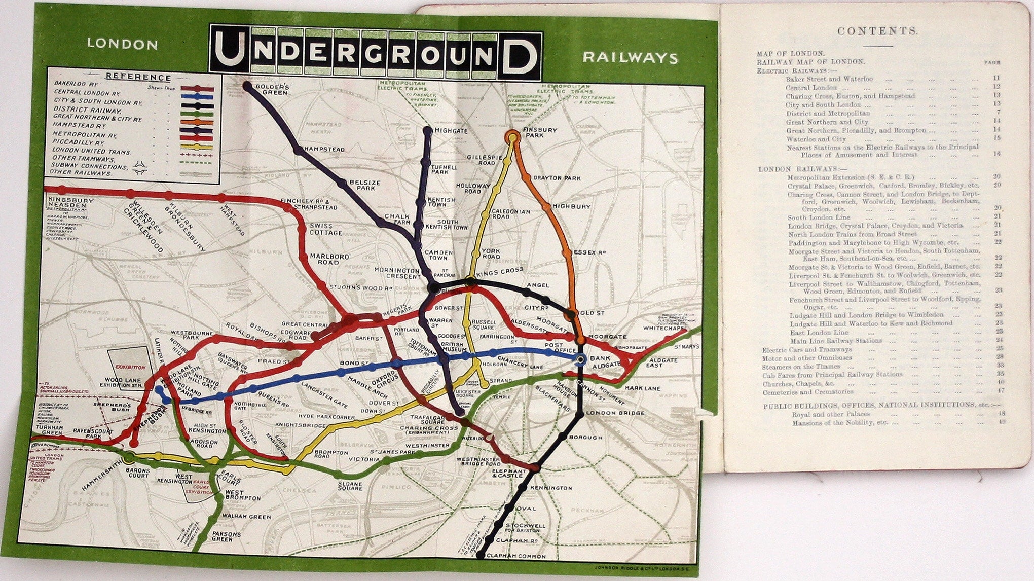
The earliest versions of this map advertised the Franco-British Exhibition which closed at the end of October 1908, marked here as ‘Exhibition’. In all other respects the map conforms to the smaller of the two maps shown on page 50 of Leboff and Demuth’s ‘No Need to Ask’. Bishopsgate, shown on our map, was renamed Liverpool Street in November 1909.
The map, in both sizes, represents a significant advance towards the issuing of passenger maps in a convenient format, but it is also a record of the extensive development of deep-level lines in the Edwardian period, and a highly significant advance cartographically, in terms of colour coding the lines and granting them equal weighting.
Read more
At this point only four of the lines shown were under the umbrella of the UERL (Underground Electric Railways Company of London Ltd, a precursor of London Transport), the others remained independent. However, no distinctions are made on the map – which makes it easier to read, including where to change trains to complete a journey. Most earlier maps prioritised the line of the issuing company, but passengers were now encouraged to view the Underground as an integrated network. The Underground logo in the upper border is an early exercise in branding.
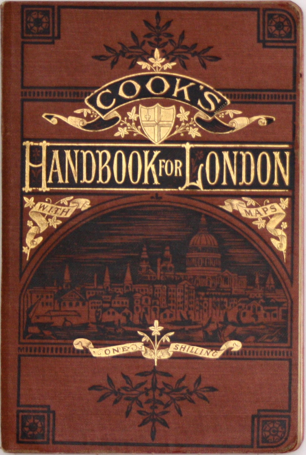
This example is still tipped into the 1909 edition of Cook’s Handbook (facing the contents, page vii) a 212 page guide bound into flexible brown cloth covers, blocked in black and gilt, and also containing a folding b/w map of central London. For much of the 20th Century, London Transport and its predecessors seem to have been happy to distribute quantities of the official map at no charge (or a minimal one?) to commercial publishers to be bound into guide books. Presumably it was seen as free advertising. Some were the standard issue with text on the verso, as distributed to passengers; some were the normal issue but supplied flat, and folded differently to fit the format of the book; some, as here, were special guide book issues, supplied with a blank verso. Many have been removed from their original context over time, and it is interesting to note the range of publishers who were able to obtain supplies of maps.
Condition & Materials
Green-bordered 'common design' Underground map, tipped into Cook’s Handbook for London, 22 x 27 cm, printed in colours with green border, trimmed by the publisher as usual where tabbed into the book, and with a tiny tear (without loss) where it has been opened, blank verso; publisher’s crease to bottom left corner. Read less