


Hollar's Hull
I’m often asked how maps were printed in the hand-press period. And the (short) answer is that that between the late fifteenth and the early nineteenth-centuries, the finest results were obtained by taking impressions, one at a time, from etched and/or engraved metal plates, which were usually made of copper. The next question, sometimes, is to ask me if there is anything to stop people using these plates to turn out facsimiles today. There is plenty one can say about early paper stocks and original hand-colour, but the shortest answer (again) is that very few original copper-plates have come down to us. Copper (then, as now) was a valuable raw material. There were very few incentives not to melt down and re-use plates which were worn or carried out-of-date information. Some copper plates had long lives, but once their commercial usefulness was over, if even ‘antiquarian’ interest was exhausted, they went into the melting pot. But every now and again there is an exception.
Bohemian artist and etcher Wenceslaus Hollar (1607-1677) was probably the greatest exponent of his craft active in mid seventeenth-century England. He arrived in London in 1636, was a Royalist during the Civil Wars and took temporary refuge in Antwerp, but he returned to London in 1650, and following the Restoration he was appointed ‘Scenographer or designer of Prospects to the King’. He died in penury, “owning little more than his bed and a few pots and pans” (Worms/Baynton-Williams Dictionary of Map Engravers, Rare Book Society 2011; NB, if you are a librarian, collector or dealer and don’t have this book by now, shame on you). If you haven’t guessed by now, it is one of Hollar’s plates, his map of Kingston-upon-Hull, engraved c. 1642, which I have just purchased.
 W. Hollar fecit, his signature

The scholarly importance of the plate lies in the clues it might offer us about Hollar’s working techniques. I suspect that there is much work to be done on that score. But there is also a thrill in handling the skilfully worked metal which Hollar created with his own hands 370 years ago, the very plate which each and every subsequent impression was pulled from, the same plate which sat in the shops of Robert Sayer and Robert Laurie and James Whittle. There is something of the relic hunter in us all, perhaps! But before considering the transmission of the plate in detail, here it is in its entirety:

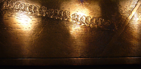
In the upper part of the plate is a view of the city and its fortifications taken from the Humber; there is an inset map of the general environs, and Hollar’s own signature can be seen bottom centre, below the town plan itself. All delicately etched and, of course, everything is reversed. Working with acid must have been second nature to a seasoned professional like Hollar, and mirror writing something he could do in his sleep, but the workmanship of a plate like this demands enormous respect from a layman like me.

Very few of Hollar’s original plates are known to have survived. Richard Pennington attempts a census in his Descriptive Catalogue of the Etched Work of Wenceslaus Hollar (CUP 1982, p. lii). Hollar produced numerous maps but, leaving this plate of Hull aside, no others are listed - although there are a handful of topographical views. Hollar’s famous prospect of London before and after the Great Fire would be among the most impressive, but although Pennington was aware that it had surfaced in the London trade, its current whereabouts were unknown to him. This then, could be a unique surviving example of a cartographic copperplate in Hollar’s hand. The map forms item 984 in Pennington’s Catalogue; in terms of the transmission of the plate, Pennington notes that the map was still being offered in the late eighteenth-century, appearing in printseller Robert Sayer’s catalogue of 1766 and in Laurie & Whittle’s of 1795. Also in the 1790’s an entirely new plate, following Hollar’s map, was engraved by Isaac Taylor (1759-1829 - being the second of the two Isaacs in Worms/Baynton-Williams) which was used to illustrate John Tickell’s The History of the town and country of Kingston-upon-Hull. However, the original copperplate is known to have survived: it still existed in 1933, when it was in the possession of Hull printing firm Richard Johnson & Sons. And, if I’m right, I’m looking at it now. Edited to add (08/11/12): Really excellent news. The plate has found a permanent home in the national map collection at the British Library - which is where such a unique and potentially illuminating fragment of British cartographic history really belongs. Pinda and I carried it over this morning, and rare maps curator Tom Harper and colleagues were genuinely thrilled. From now on it will be available for anyone who is researching Hollar (and I can visit it myself) and Tom tells me that after cleaning (I didn’t get out the duraglit …) it may be displayed to the public in the Sir John Ritblat Gallery, which houses a permanent display of the treasures of the British Library. The rediscovery of the plate may also be in time for inclusion in Simon Turner’s updated edition of Pennington. Edited to add (02/03/13): Thanks to Tom Harper and the professional photographers at the BL, this image of the printing plate, a vast improvement on my own:

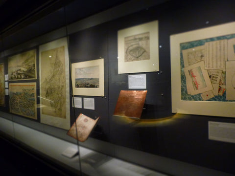
Finger marks more in evidence but far less glare … Edited to add (04/14): You can now go and see Hollar’s plate for yourself. As promised, it is now on public display in the Treasures gallery in the British Libary at St Pancras, selected from 4.5 million other maps and atlases in our national map collection.
Leave a comment