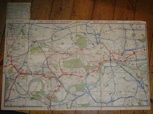
I’m facing one of those conundrums which occur in the daily life of an antiquarian mapseller. A map I’ve never seen before, not described in any of the relevant bibliographical material, no author, no imprint, no date. Ho hum. Here it is: It shows the District railway, and in style (eg depiction of the stations) it is very similar to the official District Railway maps. Here’s an example from the 1890s: The official map is much larger (106 x 67 cms vs. 61 x 40 cms) and the lines are superimposed on a detailed street map, rather than a skeleton map of major thoroughfares punctuated with pictorial representations of London landmarks, but the influence is unambiguous. Dating our mystery map is not too hard. There are a number of supporting factors, but the most straightforward method is to go by stations and station names. Monument Station was was opened as Eastcheap in October 1884 and renamed the following month; neither form appears on the map, giving us a handy terminus ante quem. Tower Station was opened in 1882 but replaced by Mark Lane Station in October 1884, which gives us a viable terminus post quem and a date range of 1882-84. It’s always possible that our map-maker hadn’t seen the latest District Railway map, but broadly speaking I think we can say so far, so good. Now to the vexing question of who made the map and where. It looks like a tourist map, especially with its pictorial elements. The stations are numbered 1-30 and A-F, presumably for an accompanying guide. It was my friend Winfrid, though, who spotted the curious spellings. I’d been seeing what I expected to see. The most conspicuous one is OXFORT Street instead of Oxford Street. Also, COWER Street instead of Gower Street, FARRINGTON instead of Farringdon, and ST JAMES PARK for St James’s Park. There’s also some very unorthodox hyphenation in the various station names, all pointing to a foreign publisher. As always, if you happen to be reading this and have the map, complete with guide, in front of you, do drop me a line and let me know more.


Leave a comment