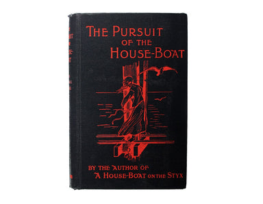
Pursuit of the House-Boat
Signed limited edition screenprint Colour screenprint, sheet size 78 x 57.5 cms, signed by the artist and inscribed 'AP' (Artist’s Proof) in pencil...
View full details
Signed limited edition screenprint Colour screenprint, sheet size 78 x 57.5 cms, signed by the artist and inscribed 'AP' (Artist’s Proof) in pencil...
View full details
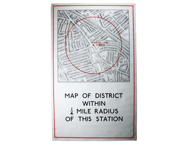
District within ¼ mile radius [of] Turnpike Lane Stanford’s was a firm of map publishers as well as map retailers until after the Second World War,...
View full details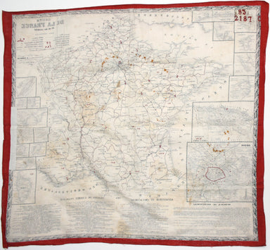
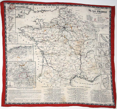
This educational handkerchief (why not?) is in the same format as the series of thirteen 'mouchoirs militaire d'instructions' patented by the comma...
View full details
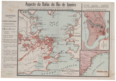
The 'Revoltas da Armada', the Brazilian naval mutinies of 1893-1894, were linked with the Federalist Rebellion against the recently-formed First Br...
View full details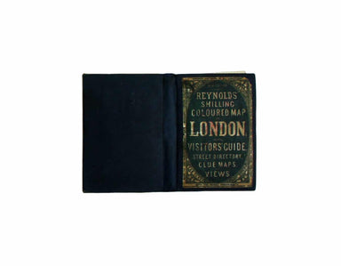
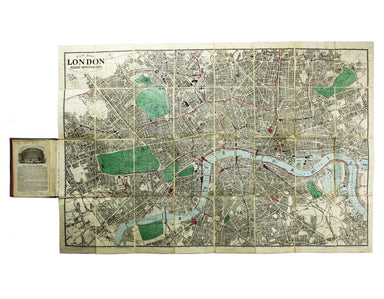
New Map of London with the recent improvements Condition & Materials Folding map, 51.5 x 77.5 cm, dissected into 32 panels and laid on linen as...
View full details
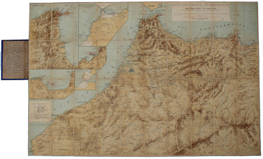
The Empire of Morocco, since 1912, had been divided between the Spanish and French. Our map dates to the period of the Rif War, 1921-26, in which a...
View full details
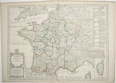
La France divisée suivant ses Provinces ou Gouvernemens Militaires This map of France is coloured by departments, with a table listing different fo...
View full details

Le Royaume de Hongrie, Principaute de Transilvanie, Sclavonie, Croatie, et partie de la Principaute de Valaquie, de la Bosnie, de la Servie et de l...
View full details
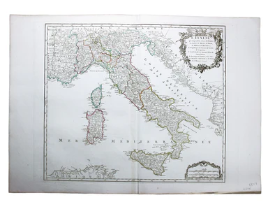
L’Italie qui comprend les Etats de Piémont, les Duchés de Milan, de Parme, de Modene, de Mantoue etc., les Républiques de Genes, de Venise, de Luqu...
View full details
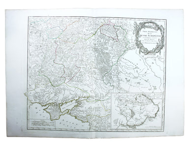
Partie Méridionale de la Russie Européenne This is a late state of Robert de Vaugondy’s map of southern Russia, Ukraine and parts of Poland. The or...
View full details
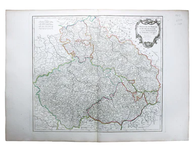
Le Royaume de Boheme, le Duche de Silesie, et les Marquisats de Moravie et Lusace, dressés d’apres les cartes de Muller The second state of Robert ...
View full details
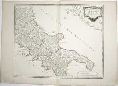
Partie Septentrionale du Royaume de Naples This is a later state of Robert de Vaugondy’s map of the northern part of the Kingdom of Naples. The ori...
View full details
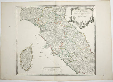
Etat de l’Eglise, Grand Duché de Toscane, et Isle de Corse This is a later state of Robert de Vaugondy’s map of the Papal States, Tuscany and Corsi...
View full details
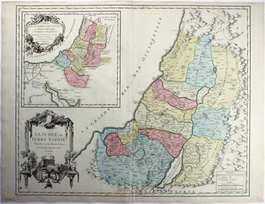
La Judée ou Terre Sainte, divisée en ses douze Tribus This is the second state of Robert de Vaugondy’s Old Testament map of the Holy Land. The map ...
View full details
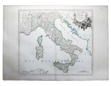
Carte de l’Italie, dans laquelle sont tracées les Routes des Postes This is a later state of Robert de Vaugondy’s road map of Italy, showing the Ve...
View full details
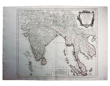
Les Indes Orientales This is Santini’s edition of Robert de Vaugondy’s map of the Indian subcontinent and mainland southeast Asia. Venetian map-mak...
View full details
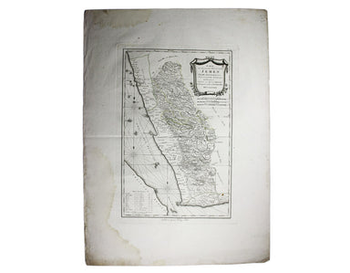
Karte von dem groessten theil des landes Jemen, Imame, Kaukeban &. &. […] This map of Yemen and the Red Sea follows the detailed maps by Ge...
View full details
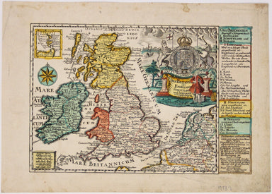
Gros Britanni[en] oder Engelland Schottland und Irrland The cartouche of this map is dominated by the Hanoverian coat of arms, and the legend on th...
View full details
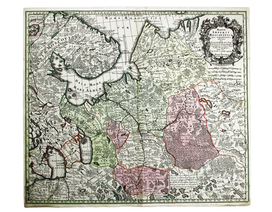
Mappae Imperii Muscovitici pars Septentrionalis This detailed early 18th century map of Muscovy follows the cartography of De l’Isle, which include...
View full details
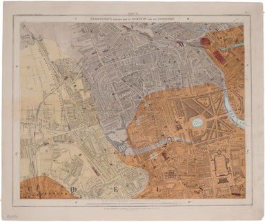
Since its first publication in 1862, and before the detailed Ordnance Survey map of London, Stanford's scrupulously revised and updated Library Map...
View full details

Also published in Stanford’s London Atlas, our example of this map of Africa was separately issued and illustrates the speed and scale of the Scram...
View full details
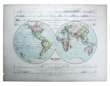
This double hemisphere world map was published in the second trade edition of Stanford’s London Atlas. Edward Stanford (senior) acquired Arrowmsith...
View full details
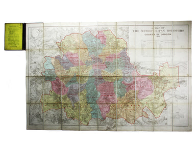
A Map of the Metropolitan Boroughs within the County of London The date of publication in the lower margin of this map is significant: 25th October...
View full details
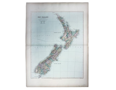
This map of New Zealand was published in the second trade edition of Stanford’s London Atlas. Edward Stanford (senior) acquired Arrowmsith's stock ...
View full details
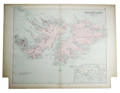
The Falkland Islands, surveyed by Captains Robert Fitz Roy R.N., William Robinson R.N. and Bartholomew James Sulivan R.N. This map of the Falkland...
View full details

Our map of the London underground is the second edition in a series designed by Fred Stingemore, issued free to passengers from May 1925 onwards an...
View full details
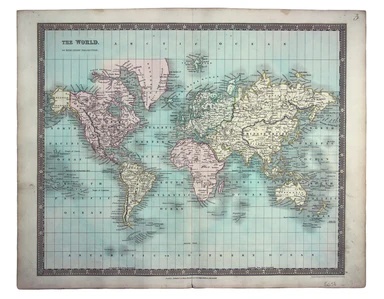
This map of the world is coloured by continent, with the exception of Russian America which is coloured as an extension of Asia. It was published i...
View full details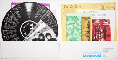

This pictorial map of Liverpool is folded into a souvenir record-sleeve style pack which comprises: ‘Nothing to get hung up about’, a 30 page shor...
View full details
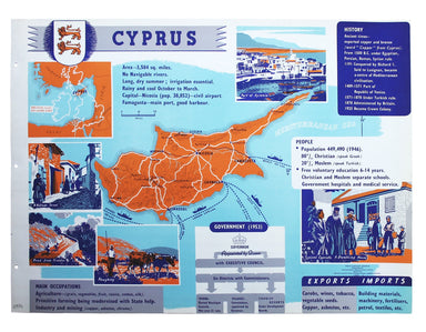
This simplified map of Cyprus was a visual aid published as sheet 4 in a portfolio titled ‘Empire Information Project. The island is surrounded by ...
View full details
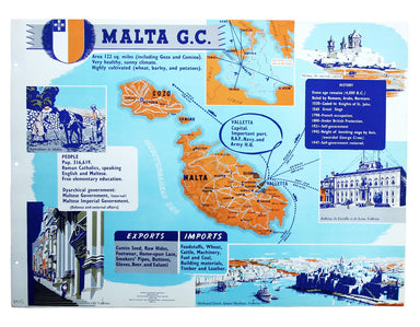
Come for the Stone Age remains, stay for the rawhide... This simplified map of Malta and Gozo is surrounded by views, statistics and historical inf...
View full details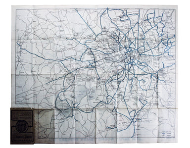
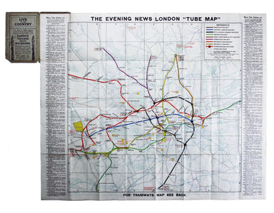
The Evening News was responsible for coining the name ‘Bakerloo Line’ for the Baker Street and Waterloo Railway, and here the newspaper makes a rel...
View full details
Signed limited edition screenprint Colour screenprint, sheet size 78 x 57.5 cms, signed by the artist and inscribed 'AP' (Artist’s Proof) in pencil...
View full details
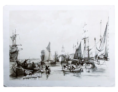
From ‘Sketches at Home and Abroad’, printed by Charles Hullmandel for Charles Tilt. London Bridge and the Monument can be glimpsed through a forest...
View full details
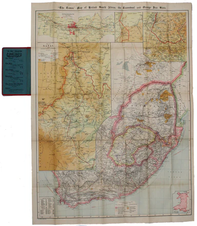
This map of South Africa was published by The Times during the Second Anglo-Boer War, for the benefit of members of the British public following th...
View full details
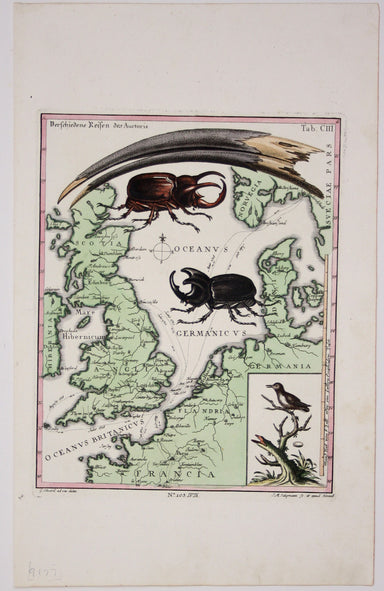
This map of the British Isles and northwestern Europe charts George Edwards's travels between 1716 and 1730 and features male and female stag beetl...
View full details
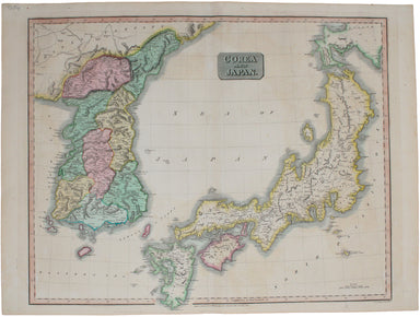
John Thomson's map of Korea and Japan was engraved by John and George Menzies in 1814 and published in his ‘New General Atlas’ in 1815. Walter sugg...
View full details
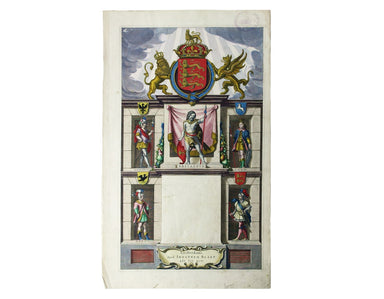
[Title page: Atlas Novus, volume IV] This is an architectural title page, engraved for the fourth volume of Blaeu’s Atlas Novus. The central panel ...
View full details
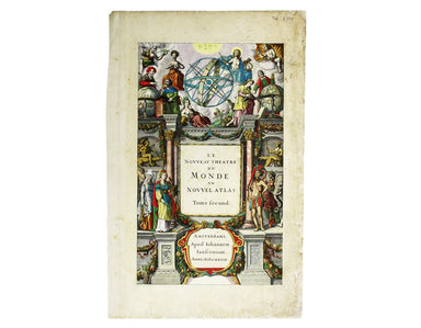
[Title-page] Le Nouveau Theatre du Monde ou Nouvel Atlas, Tome second Through groups of allegorical figures the atlas makers ‘sought to promise the...
View full details

This Edwardian map of the London underground represents a significant advance both in the issuing of passenger maps in a convenient format, and in ...
View full details
Cloth Survival Chart S-12: Western Pacific Covering the Western Pacific, this is the largest of the US Navy ‘handkerchief’ charts. One side shows ...
View full details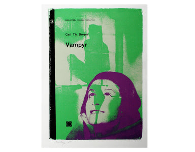
Signed limited edition screenprint Colour screenprint, sheet size 78 x 57.5 cms, signed by the artist and inscribed 'AP' (Artist’s Proof) in pencil...
View full details
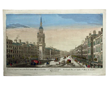
Prospectus majoris viae, et Ecclesiae Sanctae Mariae in Londino / La Grande Ruë et l’Eglise Ste. Marie Jean François Daumont (fl. 1740-1775) was a ...
View full details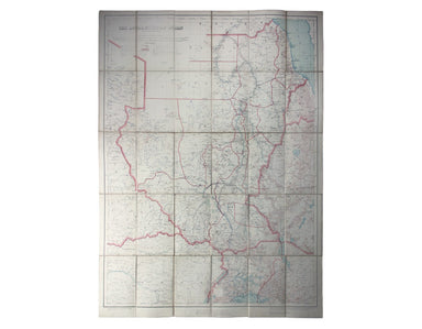
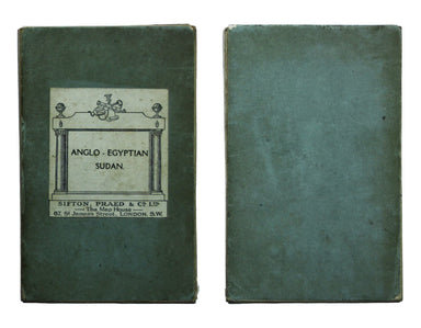
First published in 1914, this revised edition highlights administrative boundaries. Though technically administered jointly by Egypt and Britain be...
View full details
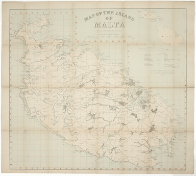
In the 1920s Valletta was the location of the Royal Navy's Mediterranean Fleet's headquarters. Prepared on the island, this map of Malta has a grid...
View full details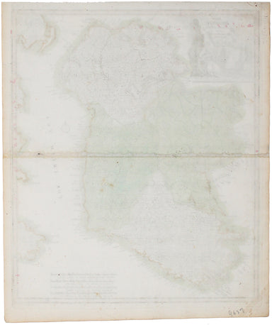
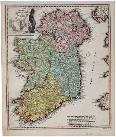
Regni Hiberniae accurata tabula Christoph Weigel's map of Ireland was engraved by Michael Kauffer after Herman Moll and published in Samuel Faber’s...
View full details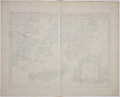
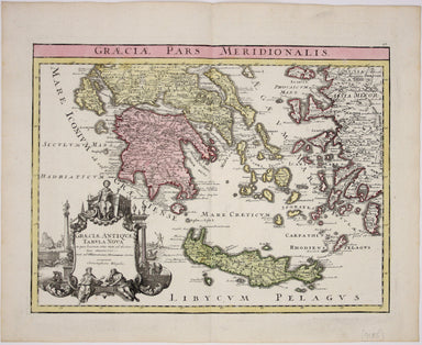
Graeciae Pars Meridionalis / Graciae Antiquae Tabula Nova in qua locorum situs tum ad distantias itinerarias tum ad Observationes Astronomicas exac...
View full details
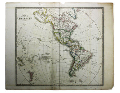
This map of America is from Wyld's New General Atlas. James Wyld senior established a highly successful firm of map publishers, which passed to his...
View full details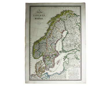
This map of Scandinavia is from Wyld's New General Atlas. James Wyld senior established a highly successful firm of map publishers, which passed to...
View full details
