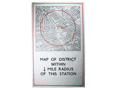
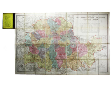
Quarter Mile Radius Map of Turnpike Lane Station
District within ¼ mile radius [of] Turnpike Lane Stanford’s was a firm of map publishers as well as map retailers until after the Second World War,...
View full details
District within ¼ mile radius [of] Turnpike Lane Stanford’s was a firm of map publishers as well as map retailers until after the Second World War,...
View full details
Stanford’s map of London and the twelve miles round was published in various editions between (at least) 1860 and 1903. Condition & MaterialsLi...
View full details
Also published in Stanford’s London Atlas, our example of this map of Africa was separately issued and illustrates the speed and scale of the Scram...
View full details
A Map of the Metropolitan Boroughs within the County of London The date of publication in the lower margin of this map is significant: 25th October...
View full details
This map of New Zealand was published in the second trade edition of Stanford’s London Atlas. Edward Stanford (senior) acquired Arrowmsith's stock ...
View full details
The Falkland Islands, surveyed by Captains Robert Fitz Roy R.N., William Robinson R.N. and Bartholomew James Sulivan R.N. This map of the Falkland...
View full details