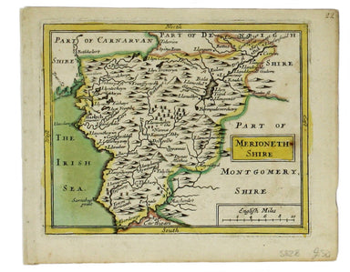
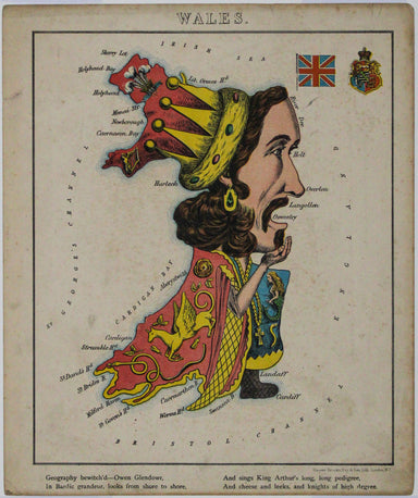
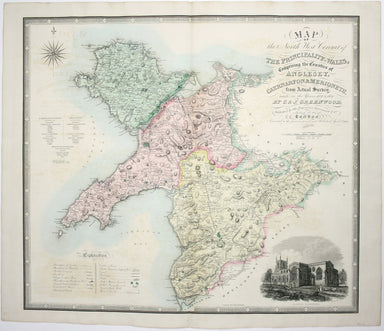
Aleph's Caricature Map of Wales
This anthropomorphic map depicting Wales as "Owen Glendowr, in Bardic grandeur" is from 'Geographical Fun: Being Humorous Outlines of Various Count...
View full details
This anthropomorphic map depicting Wales as "Owen Glendowr, in Bardic grandeur" is from 'Geographical Fun: Being Humorous Outlines of Various Count...
View full details
New Road Map of England & Wales... shewing all the lines of railway, canals &c., describing the picturesque scenery and forming a complete ...
View full details
A New Geographical Pastime: Walker’s Tour through England and Wales Most games of this nature were educational, and in this case players learn as t...
View full details
A New Geographical Pastime The elder John Wallis (c. 1745-1818) recovered from bankruptcy to become one of the major publishers of children’s games...
View full details
This map of Monmouthshire and the Severn Estuary is from ‘the rarest edition of Blaeu’s Large Atlases’: only ten of the proposed eleven volumes wer...
View full details
England, with all the railways… This edition of Lizars’ railway map was published c. 1845, featuring lines such as the Maryport & Carlisle Rail...
View full details
Cruchley’s Improved Geographical Companion throughout England & Wales including part of Scotland In this map of England and Wales, we have an i...
View full details
Map of the North West Circuit of the Principality of Wales, comprising the Counties of Anglesey, Caernarfon & Merioneth, from an Actual Survey…...
View full details
Mogg’s New Map of the Roads. A New Travelling Map of England, Wales and Scotland […] Condition & Materials Copper engraving, 77 x 63.5 cm, a ro...
View full details
This map of Merionethshire was prepared for Anglia Contracta, Seller's miniature county atlas. Seller's atlases are notoriously difficult to date b...
View full details
Ceretica sive Cardiganensis Comitatus; Anglis Cardigan Shire Blaeu and the rival Golden Age Dutch cartographic publishing house of Janssonius raced...
View full details