

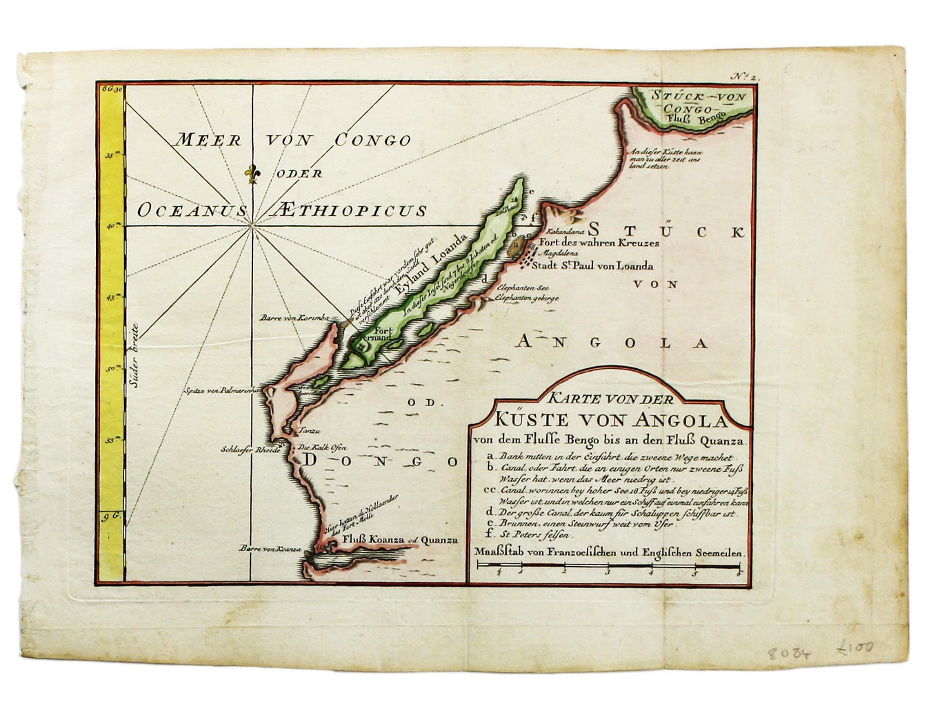
Bellin’s Map of Angola
SKU: 8084
Title:
Bellin’s Map of Angola
Date of publication:
Printed Measurement:
Colour:
Mapmaker:
Karte von der Küste von Angola von dem Flusse Bengo bis an den Fluss Quanza
This map show the coastline of northern Angola between the rivers Bengo and Cuanza, with Luanda and the neighbouring Portuguese fort, from the German edition of Prévost's Voyages. Read more
Jacques Nicolas Bellin the elder (1703-1772) was first chief hydrographic engineer of the Dépôt des cartes, plans et journaux du Ministère de la Marine, charged by the French king with mapping the coasts of France first and then the rest of the world. He was also a member of the Royal Society of London.
Bellin compiled the maps for Prévost's Histoire Générale des Voyages, and he later reworked them for his Petit Atlas Francaise and his Petit Atlas Maritime.
Condition & Materials
Copper engraving, 21.5 x 27.5 cm, modern hand-colour, tiny wormtrack in the body of the map, blank verso. Read less