

Dapper’s Map of Tenerife
SKU: 8074
Title:
Dapper’s Map of Tenerife
Date of publication:
Printed Measurement:
Colour:
Mapmaker:
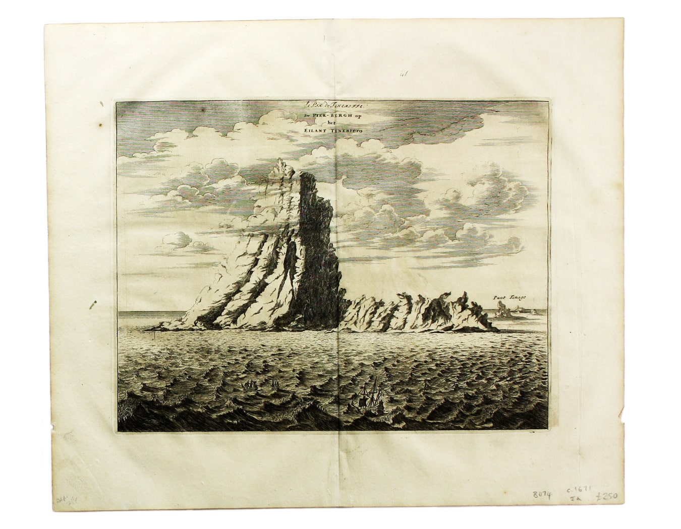
Le Pik de Teneriffe/De Piek-Bergh op het Eilant Tenerifto
The Anaga mountain range meets the sea in the northeastern part of Tenerife, close to the Punta de Anaga, named here Punt Tenago. Early British writers who mention the Pike of Tenerife are referring to the the snow covered peak of the Teide volcano in the centre of the island, which gives the island its name. Read more
Richard Burton saw an example of this illustration in Ogilby’s Africa and in To the Gold Coast for Gold (1881) he notes: ‘it is curious to compare the realistic accounts of the nineteenth century with those of the “vulcanio” two centuries ago... [Ogilby’s] illustration shows an almost perpendicular tower of natural masonry rising from a low sow-back whose end is the Punt Tenago (Anaga Point)’.
Olfert Dapper (1636-1689) was a Dutch physician and scholar who devoted most of his life to geographical studies without ever leaving his home town of Amsterdam. Using the most reliable eye-witness accounts and his own extensive library of travel books he composed authoratitive and entertaining finely-illustrated works on Asia, Africa and America. His Naukeurige Beschrijvinghe Der Afrikaensche was first published in Dutch in 1668, in German in 1670 and in French in 1686, and it was used by John Ogilby (1600-1676) as the basis for his Africa, the best account of the continent available in English at the time, using many of the same maps and views.
Condition & Materials
Copper engraving, 24.5 x 32 cm, black and white, blank verso. Read less