

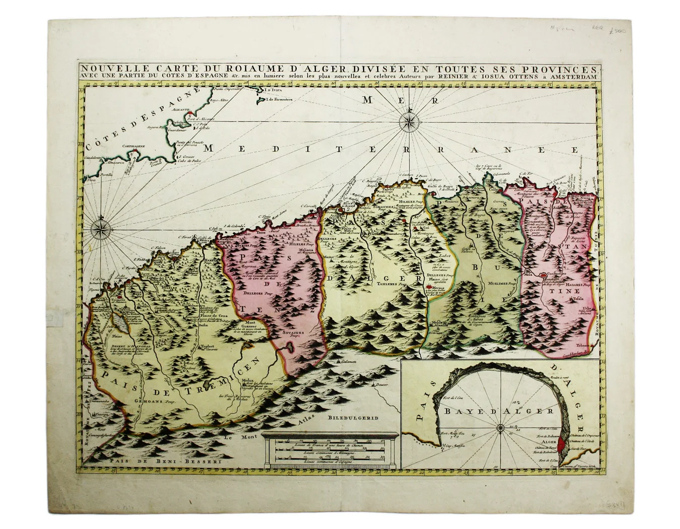
Ottens’ Map of Algeria
SKU: 5881
Title:
Ottens’ Map of Algeria
Date of publication:
Printed Measurement:
Colour:
This map of Algeria features an inset of the Bay of Algiers.
Ottoman Algeria was a hub of privateering and the Mediterranean slave trade. Well known to European map-makers since Roman times, the threat from the Barbary pirates kept interest in north Africa current. Read more
Condition & Materials
Copper engraving, 44.5 x 56 cms, original hand-colour, blank verso. Read less