

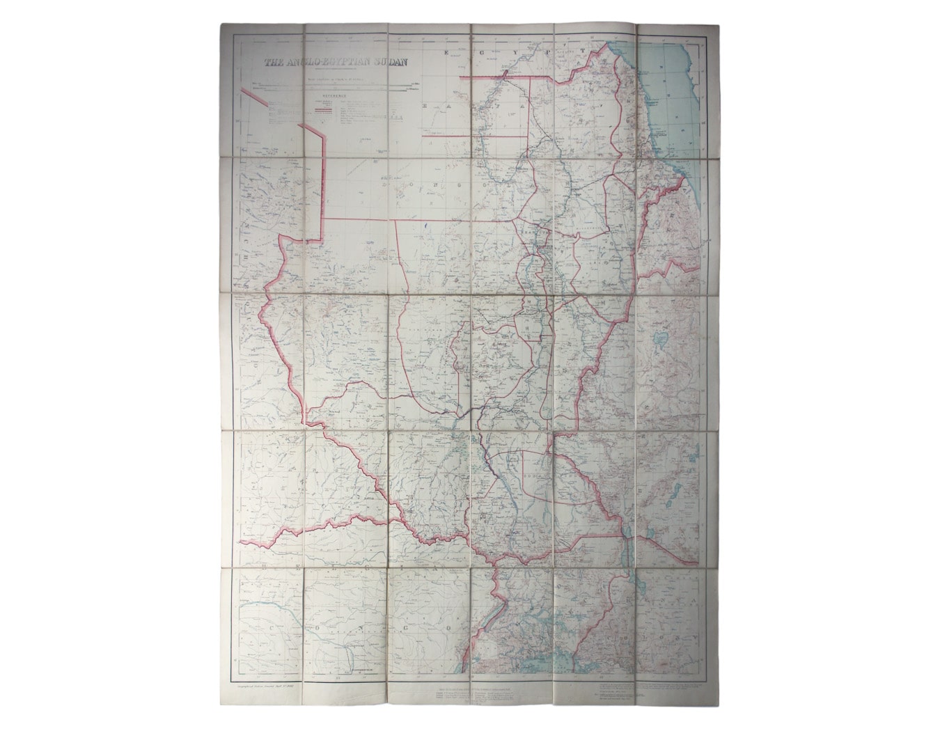
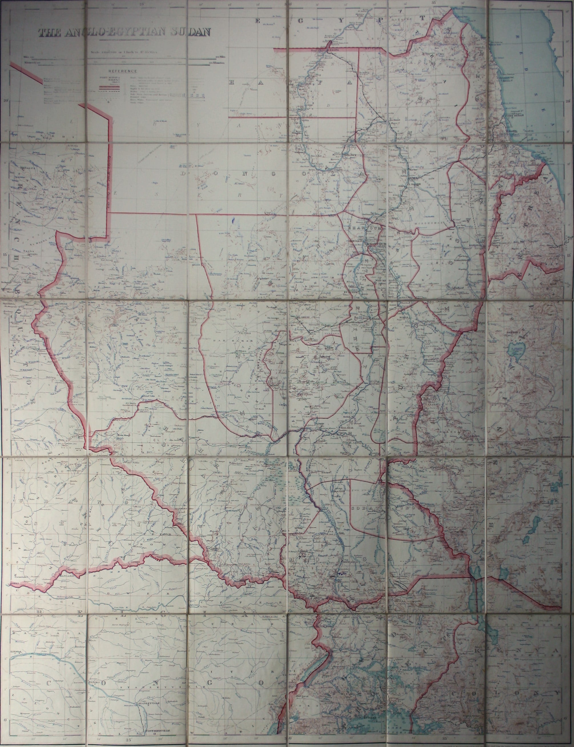
War Office Map of Anglo-Egyptian Sudan
SKU: 8771
Title:
War Office Map of Anglo-Egyptian Sudan
Date of publication:
Printed Measurement:
Colour:
Mapmaker:
First published in 1914, this revised edition highlights administrative boundaries.
Though technically administered jointly by Egypt and Britain between 1899 and 1956, today’s Sudan and South Sudan were effectively ruled as a Crown Colony. Read more
The Sudan Political Service, often considered the elite of the British colonial civil servants in Africa, never employed more than 150 Europeans at once.
Condition & Materials
Folding lithographically printed map of Anglo-Egyptian Sudan, GSGS War Offfice sheet 2692, 95 x 72 cm, dissected into 30 panels and laid on linen, printed in colours, printing of title and legend a little weak, one or two neat annotations in blue pen, printed bookseller’s label of Sifton Praed, lacks slipcase. Read less