Ortelius' Western Balkans
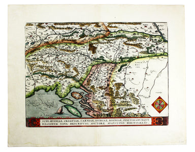
Schlavoniae, Croatiae, Carniae, Istriae, Bosniae, Finitimarumque Regionum Nova Descriptio Ortelius’ map of the western Balkans drew on the cartogra...
View full details

Schlavoniae, Croatiae, Carniae, Istriae, Bosniae, Finitimarumque Regionum Nova Descriptio Ortelius’ map of the western Balkans drew on the cartogra...
View full details
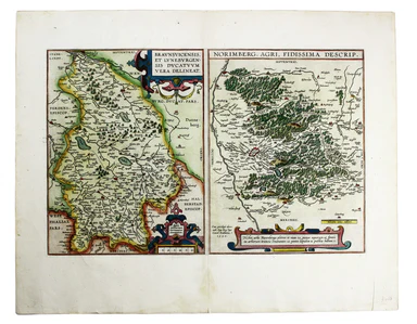
Braunsvicensis, et Luneburgensis dvcatvvm vera delineat… Norimberg. Agri, Fidissima descrip… Here we see two maps on one sheet, the Duchy of Brunsw...
View full details
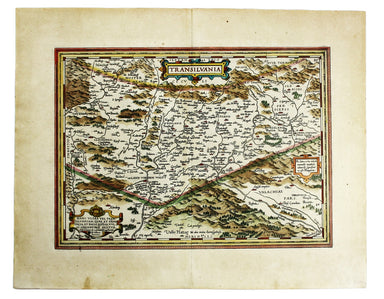
Transilvania Copper engraving, 33 x 45 cm, modern hand-colour, Latin text on verso. This is the second version of Ortelius’ map of Transylvania, n...
View full details
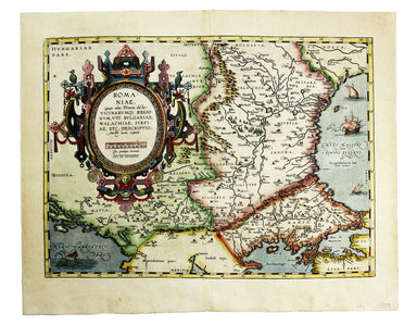
Romaniae, (quae olim Thracia dicta) Vicinarumque Regionum, uti Bulgariae, Walachiae, Syrfiae, etc. Descriptio This map shows the Lower Danube regio...
View full details
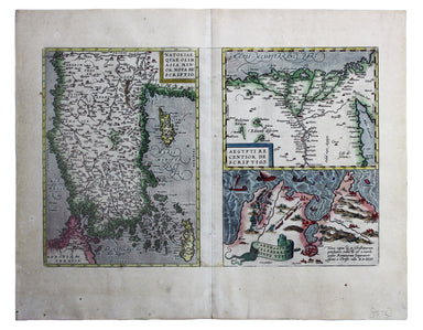
Natoliae quae olim Asia Minor nova descriptio / Aegypti recentior descriptio / Carthaginis celeberrimi sinus typus Here on one sheet we have three ...
View full details
