First Printing of Kashgari's 11th Century Manuscript World Map
SKU: 9574
Title:
First Printing of Kashgari's 11th Century Manuscript World Map
Date of publication:
Printed Measurement:
Publisher:
Colour:
Mapmaker:
Please note: this is not an 11th century manuscript map, it is the first printed edition (centuries after the map was drawn) following its rediscovery by Ali Amiri.
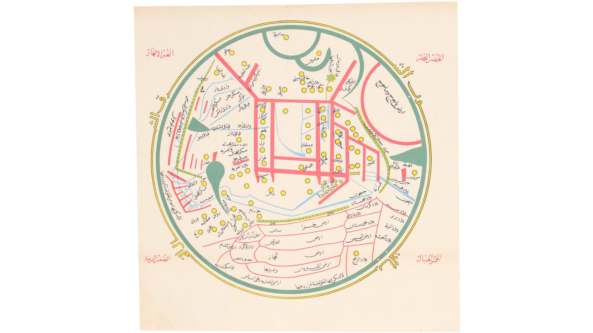
This is the first printed edition of a world map in Arabic, which was originally drawn in the 11th century CE to illustrate Mahmud al-Kashgari’s ‘Diwan Lughat al-Turk’ (‘The Compendium of the Turkic Dialects’), one of the most important early sources for Turkish language and culture. Read more
Oriented with East at the top, in terms of scale and detail the map is focussed on the Turkic heartlands of central Asia, but the extent of the map is far greater. Kashgari includes the Franks and the Iberian peninsula, Berbers, Egyptians and Abyssinians, Hindustan and, in the far east, ‘Mashin’ (China) and ‘Japarqa’ (Japan, surrounded by a green semi-circle at the top of the map). Kashgari shows the Great Wall of China, and this is also the earliest known map to include Japan (see Jim Siebold’s discussion of the map). Geographical features on the map are colour-coded: green for seas and blue for rivers, red for mountains, and yellow for towns and deserts.
Kashgari’s work was lost for centuries before its rediscovery in Istanbul’s secondhand book market by bibliophile Ali Amiri, who then supervised its publication.
Condition & Materials
World map in Arabic, 29 x 29.5 cm, printed in colours, old folds, lower left hand corner unobtrusively reinstated (no loss of image), blank verso. Published in Istanbul. Read less


