

Map of Gibraltar & The Siege of 1727
SKU: 8402
Title:
Map of Gibraltar & The Siege of 1727
Date of publication:
Printed Measurement:
Colour:
Mapmaker:
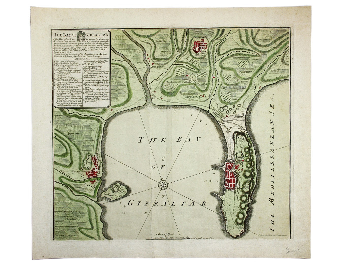
The Bay of Gibraltar. With a plan of the Town, Rocks and Fortifications of Gibraltar as they now are. Also a plan of Algezira… Copied from the Draught of his Excellency the Marquis Verboom, Engineer General to the Spanish Army
This map of Gibraltar may be one of Wilkinson’s earliest publications, printed as a companion to his reissue of ‘Several Prospects of the Rock, Town, Castle, Fortifications, & Bay of Gibraltar’, which he seems to have inherited with the stock of John Bowles. Indeed, it may have come from the same source: the British Library holds an anonymous example which has been tentatively dated to c. 1727 and the Harvard copy has been attributed to John Bowles. Read more
Roughly contemporary with the Great Siege of 1779-1782, Wilkinson’s edition still refers to George Prosper Verboom, the Spanish engineer at the 1727 siege, and makes repeated references to this ‘present’ siege which had ended over twenty years before Wilkinson’s birth. Perhaps Wilkinson reasoned that his public would enjoy a reminder of an earlier English success, or possibly he hoped that they would not notice that his map was no longer current.
Condition & Materials
Copper engraving, 46 x 52 cm, original hand colour, additional light vertical creases to either side of centrefold, blank verso. Combined title and key in the panel, upper left.
References
OCLC 557547832
OCLC 945751831 Read less