

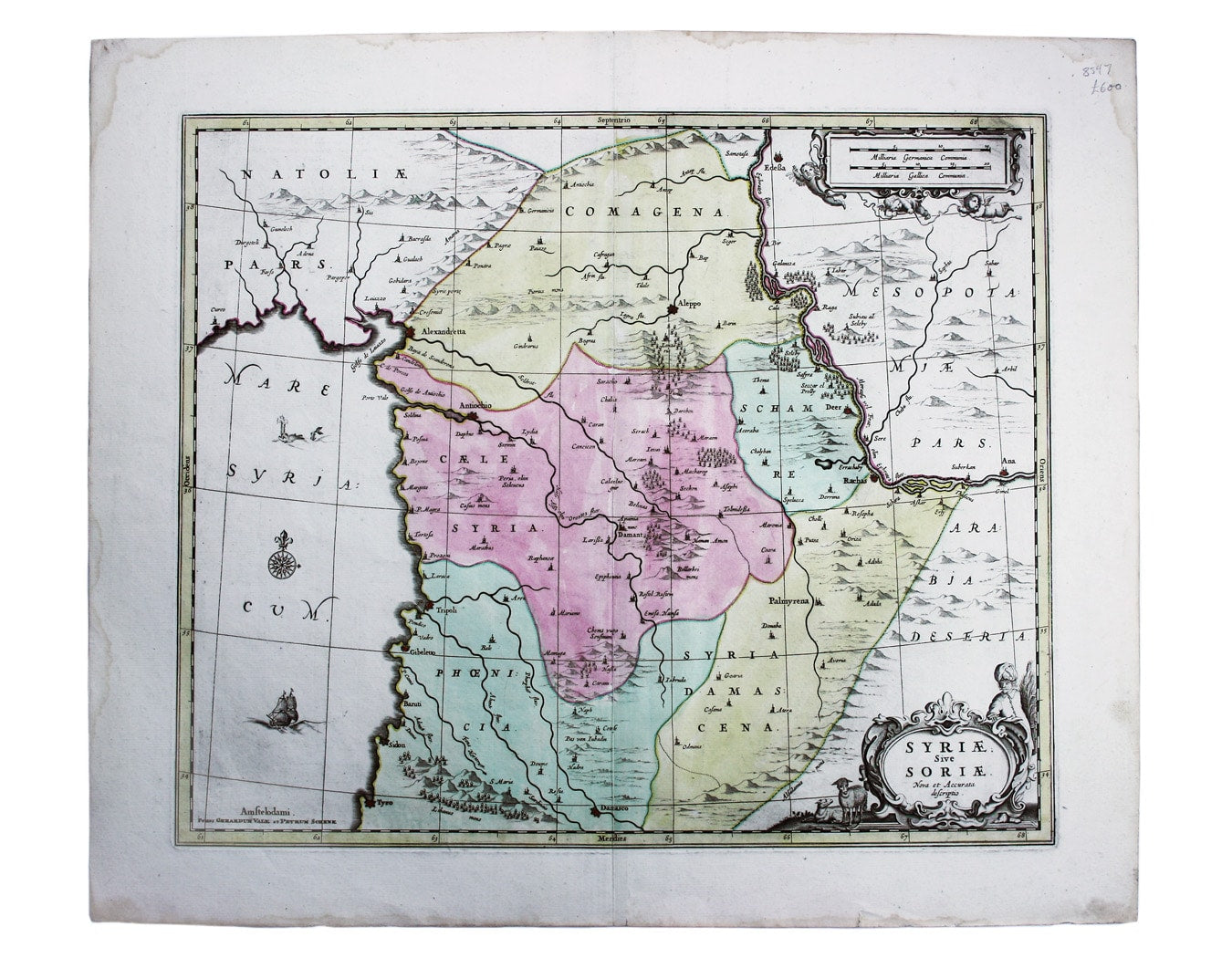
Schenk & Valk’s Map of Syria
SKU: 8597
Title:
Schenk & Valk’s Map of Syria
Date of publication:
Printed Measurement:
Colour:
Syriae sive Soriae, nova et accurata descriptio
Petrus Schenk and Gerard Valk often worked in partnership, towards the end of the Dutch Golden Age, when the United Provinces still led Europe in the field of map-making. Together they purchased the surviving copper printing plates of the famous Janssonius firm, among others, and reissued them under their own imprint. This map, covering the region of Syria in antiquity, was originally issued by Janssonius in the late 1650s.
Read more
Condition & Materials
Copper engraving, 43.5 x 52 cm, original hand colour, trivial waterstaining to the outer margins, not approaching the printed area; blank verso. Read less