SDUK Map of Australia
SKU: 9213
Title:
SDUK Map of Australia
Date of publication:
Printed Measurement:
Publisher:
Colour:
Mapmaker:
Engraver:
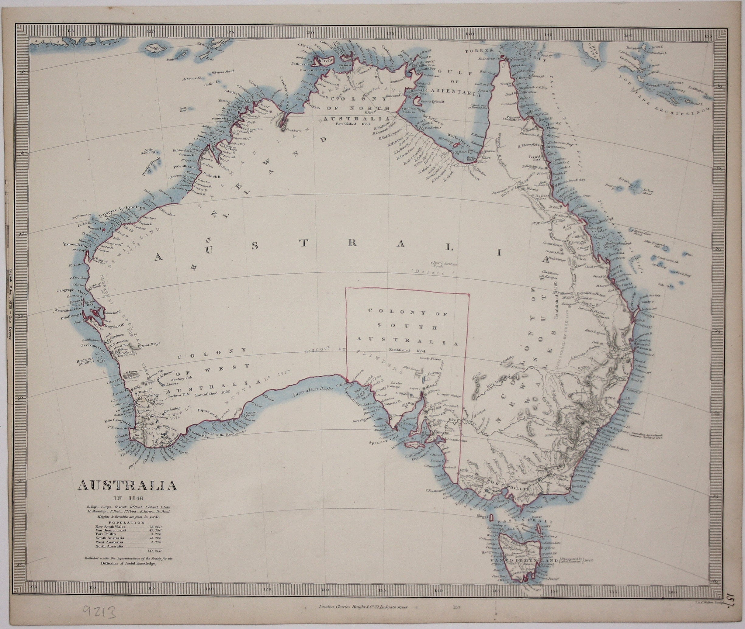
This map of Australia has a table in the bottom left, showing the European population (supposedly revised to 1846 but with the original figure given in 1840, total 141,000) concentrated in New South Wales and Van Diemen’s Land, the focus for early convict settlement.
The coastline has been almost wholly mapped, with a few short breaks in the northwest, and the map also reveals the results of recent exploration in the interior, although it remained largely unmapped and only the Colony of South Australia is supplied with a border.
Read more
The Society for the Diffusion of Useful Knowledge was founded in 1826 with the high-minded aim of making 'useful' information available to the self-taught. Some of the material was decidedly abstruse, subscribers fell away and the Society was wound up in 1848; however, the series of 209 maps published over a 14 year period from 1829 onwards were highly praised for their superior quality, accuracy and aesthetic appeal and remain an outstanding achievement.
Condition & Materials
Steel engraving, 32.5 x 40 cm, engraved by John and Charles Walker, original hand colour in outline, scale slightly trimmed and short tear in left hand margin without loss, numbered in an old hand, blank verso. Read less


