

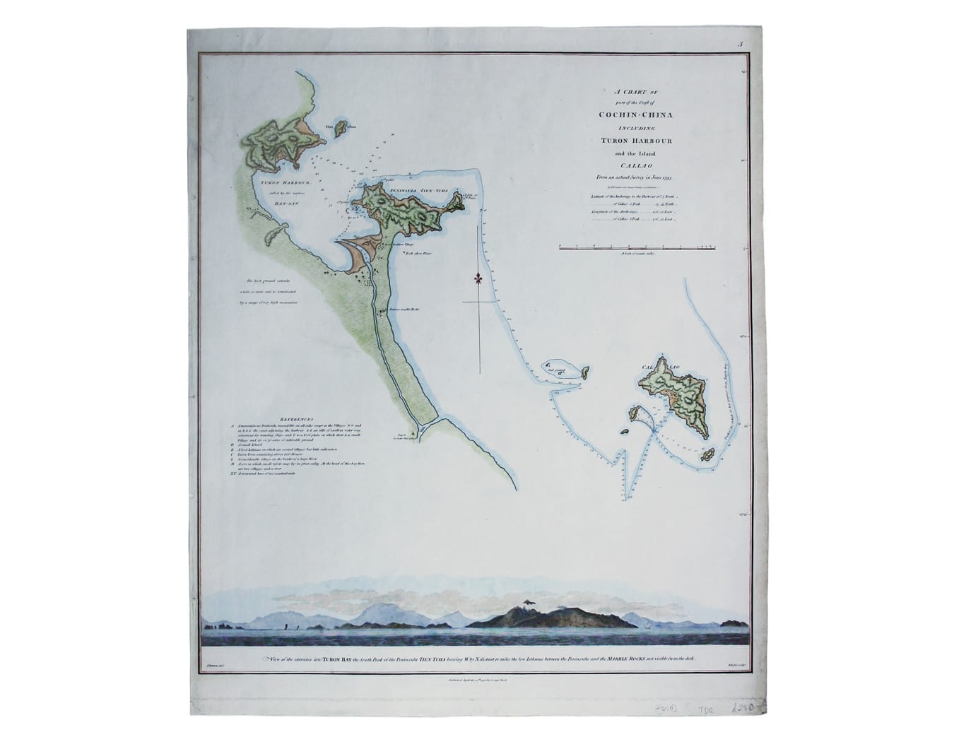
Staunton’s Chart of Da Nang
SKU: 5450
Title:
Staunton’s Chart of Da Nang
Date of publication:
Printed Measurement:
Publisher:
Colour:
Mapmaker:
Engraver:
A chart of part of the coast of Cochin-China including Turon Harbour and the island Callao from an actual survey in June 1793. By HW Parish of the Royal Artillery and J Barrow
The survey for this map was made on the outward voyage of Lord Macartney's embassy to China and shows the entrance to Turon Harbour – Da Nang in modern Vietnam – and the course of the brig HMS Jackall. Read more
The map was published in Sir George Leonard Staunton's ‘An Authentic Account of an Embassy from the King of Great Britain to the Emperor of China’. Staunton was a longstanding friend of Macartney and Secretary to the British diplomatic mission of 1793, the first of its kind, and he was charged with compiling the official account.
Condition & Materials
Copper engraving, 49.5 x 42 cm, engraved by Benjamin Baker after J Barrow, coastal profile showing the harbour entrance at the foot of the map, modern hand-colour, blank verso. Read less