

Walter Blackie’s Map of Africa
SKU: 8070
Title:
Walter Blackie’s Map of Africa
Date of publication:
Printed Measurement:
Colour:
Mapmaker:
Engraver:
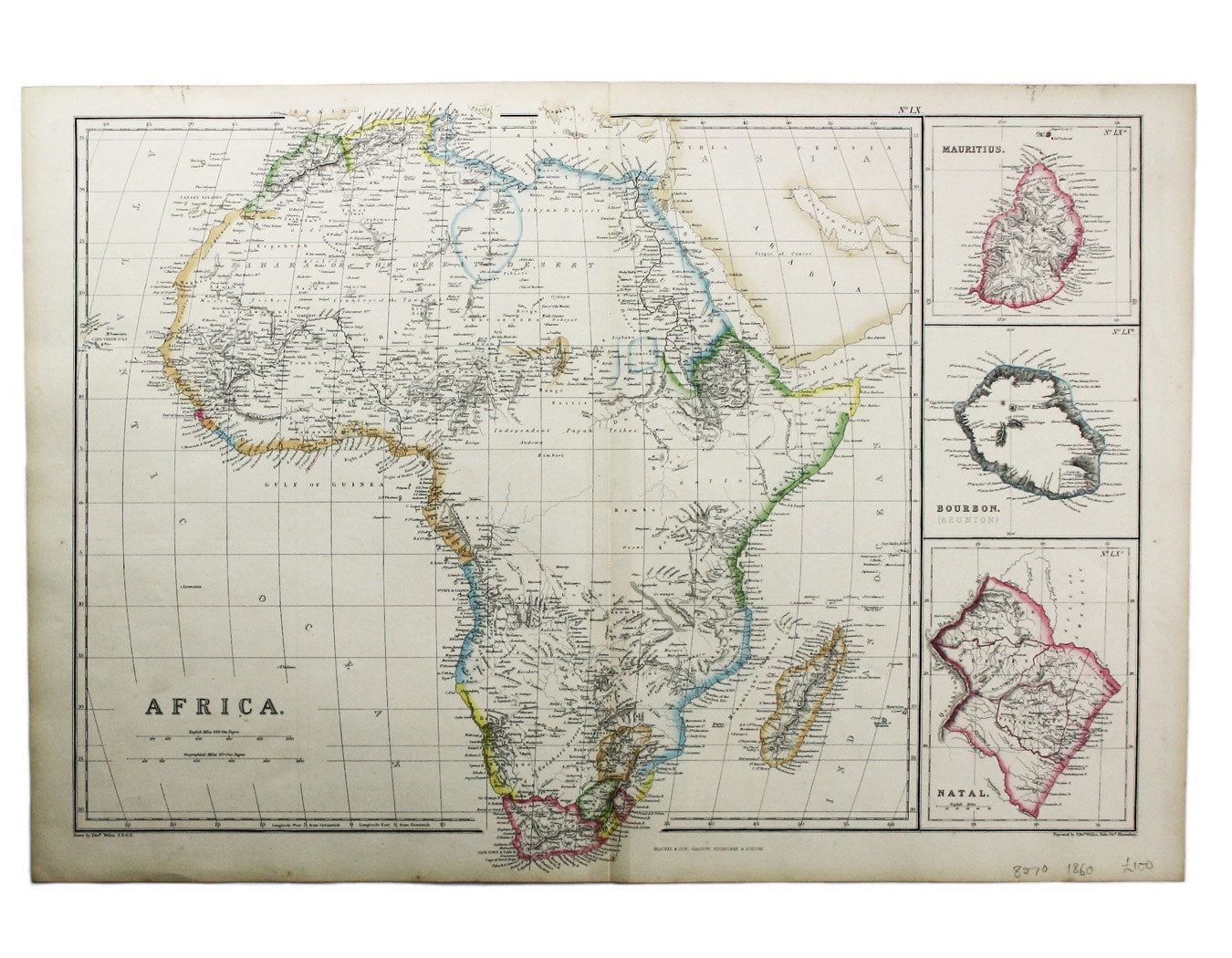
This map of Africa was drawn and engraved by Edward Weller, and includes insets of Mauritius, Réunion and Natal,
Some of the most recent geographical information about the interior of the continent appears on the map, though much remains tentative or speculative. Read more
Mount Keenia had been sighted by a German missionary in 1849; Lake Taganyika (Tanganyika), sighted by Burton and Speke in 1858, is named, though here it seems to be an extension of Lake Maravi (generally identified with Lake Nyasa); the vast body of water which Speke named Lake Victoria is not marked at all. The regions which remained unexplored by Europeans are simply labelled ‘independent pagan tribes’.
The map was published in The imperial atlas of modern geography... compiled and engraved from the most authentic sources under the supervision of WG Blackie.
Condition & Materials
Lithograph, 36.5 x 50 cm, original hand colour in outline, blank verso. Read less