

Ortelius' Miniature Epitome Map of Normandy
This miniature map of Normandy was engraved by brothers Ambrose and Ferdinand Arsenius circa 1601 for a third ‘epitome’ (or pocket version) of Orte...
View full details

This miniature map of Normandy was engraved by brothers Ambrose and Ferdinand Arsenius circa 1601 for a third ‘epitome’ (or pocket version) of Orte...
View full details

Fessae et Marocci Regna – a miniature map of Morocco. Condition & MaterialsCopper engraving, printed area measurement 7.8 x 10.6 cm. Modern ha...
View full details

This miniature map of Austria was engraved by brothers Ambrose and Ferdinand Arsenius circa 1601 for a third ‘epitome’ (or pocket version) of Ortel...
View full details
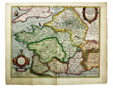
Van den Broecke stresses the significance of this map of Gaul: “in contrast to plate Ort 194 [Gallia vetus, based on Caesar’s commentaries], this m...
View full details
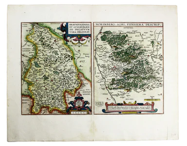
Braunsvicensis, et Luneburgensis dvcatvvm vera delineat… Norimberg. Agri, Fidissima descrip… Here we see two maps on one sheet, the Duchy of Brunsw...
View full details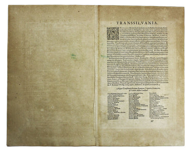
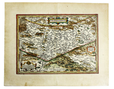
Transilvania Copper engraving, 33 x 45 cm, modern hand-colour, Latin text on verso. This is the second version of Ortelius’ map of Transylvania, n...
View full details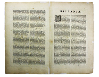
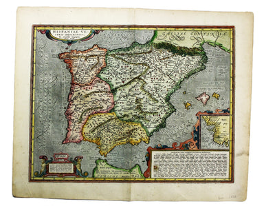
Hispaniae veteris typus Our example of this map of Ancient Spain was published by Balthasar Moretus at the Plantin Press, in the final edition of t...
View full details
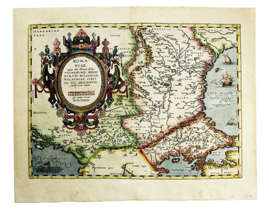
Romaniae, (quae olim Thracia dicta) Vicinarumque Regionum, uti Bulgariae, Walachiae, Syrfiae, etc. Descriptio This map shows the Lower Danube regio...
View full details
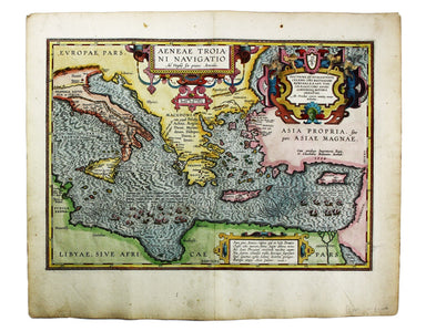
Aeneae Troiani Navigatio, as Virgilii sex priores Aeneidos This of the eastern Mediterranean depicts the wanderings of the legendary Trojan prince ...
View full details
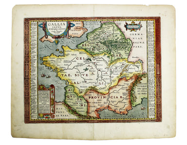
This map of Ancient Gaul was engraved on the basis of Caesar’s commentaries on the Gallic Wars, his first hand account of the campaign. The text on...
View full details
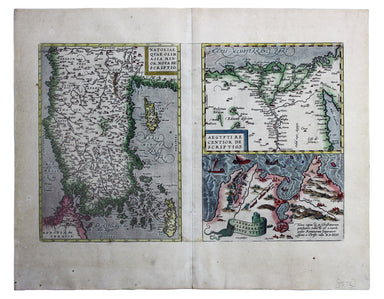
Natoliae quae olim Asia Minor nova descriptio / Aegypti recentior descriptio / Carthaginis celeberrimi sinus typus Here on one sheet we have three ...
View full details
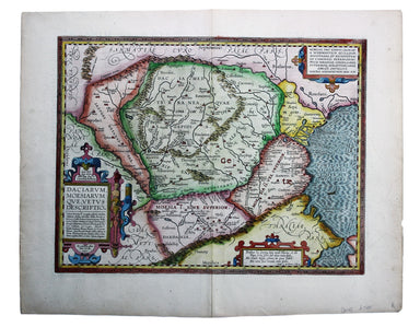
Daciarum, Moesiarumque, vetus descriptio This map of Ancient Dacia and Moesia, modern Romania and Bulgaria on the Black Sea was published by Baltha...
View full details
