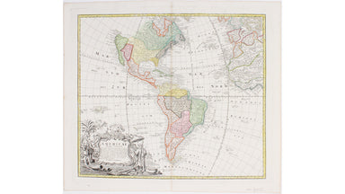
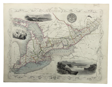
Dawson's Map of the Dominion of Canada
This map of the Dominion of Canada was made by John Bartholomew & Son for Dawson Brothers. It features insets of the environs of Montreal, New...
View full details
This map of the Dominion of Canada was made by John Bartholomew & Son for Dawson Brothers. It features insets of the environs of Montreal, New...
View full details
Paul Bunyan's pictorial map of the United States depicting some of his deeds and exploits Stories about Paul Bunyan, the lumberjack of gigantic pr...
View full details
This map of Nova Scotia was engraved by John Rapkin for John Tallis' popular ‘Illustrated Atlas’; it includes black and white vignettes of Halifax,...
View full details
Our map of the Americas was prepared for the Homann firm by Johann Matthias Hase, professor of mathematics in Wittenberg, on his stereographic hori...
View full details
This map of West Canada was engraved by John Rapkin for the ‘Illustrated Atlas’. The map also includes black and white vignettes of Kingston, Ontar...
View full details
This map of America is from Wyld's New General Atlas. James Wyld senior established a highly successful firm of map publishers, which passed to his...
View full details
Condition & Materials Lithographed in red and black on two sheets, each 38.5 x 80 cm; this map of Long Island is printed on thin india paper; ...
View full details